
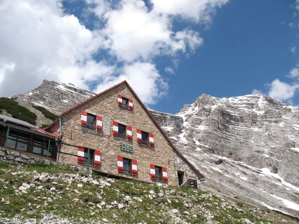
Gastronomy Bettelwurfhütte

Absam

The Bettelwurf Hut is an alpine club hut located at 2,077m with a unique view. The hut was built in 1894 and is one of the oldest and highest huts in the Karwendel. It is characterized by a very cozy and rustic atmosphere. It is particularly suitable as an overnight accommodation for long-distance hikes. The kitchen is highly recommended.

Restaurant information

Source: Hall Wattens

Description

The Bettelwurfhütte is located in the Karwendel Nature Park and is accessible via the Halltal entrance. The Halltal is not accessible by vehicle. A shuttle service is available for hikers during the summer. Relevant information regarding departure times and prices can be found on the website of the Hall-Wattens Tourism Association.

The following approaches to the hut are possible:

  • Absam (622 m), walking time: 3.5 hrs.
  • Hafelekar mountain station (2,256 m), walking time: 4.5 hrs.
  • Below the 2nd Ladhütte (1,000 m), walking time: 2.5 hrs.
  • 2nd Ladhütte (1,000 m) via Lafatscher Joch (2085 m), walking time: 5.5 hrs.

Information about the Absamer via ferrata approach:

  • Length: 3 hrs
  • Elevation difference: 600 m
  • Difficulty: some C sections, predominantly A and B exit:
  • Exit and continue to the hut: 1 hr to the Bettelwurfhütte descent, 2.5 hrs via the AV trail 222
  • Do not use the via ferrata while descending!
  • Option for backpack transport via the material cable car


Tour options around the hut:

  • Großer Bettelwurf, 2,725 m, walking time: 1 hr, 45 min.
  • Kleiner Bettelwurf, 2,649 m, walking time: 1 hr, 45 min.
  • Speckkarspitze, 2,621 m, walking time: 2 hrs, 45 min.
  • Fallbachkarspitze, 2,324 m, walking time: 2 hrs.
  • From the Little to the Big Bettelwurf, 2,725 m, walking time: 4.5 hrs.


Neighboring huts:

  • Pfeishütte (1,950 m), walking time: 3.5 hrs.
  • Hallerangerhaus (1,768 m), walking time: 2.5 hrs.
  • Hallerangeralm (1,774 m), walking time: 2.5 hrs.
  • St. Magdalena (1,287 m), walking time: 4.5 hrs.


Maps:

  • AV map No. 5/2 and 31/5
  • Österreichkarte No. 119
  • Freytag & Bernd No. 321
  • Kompass map Karwendel


Getting here

  • Parking

    The Hall-Wattens region is easily accessible by train and bus. You can quickly find the right connection using the route planner on our site https://www.hall-wattens.at/de/anreise.html.

    By train to the region at the following train stations:

    • Hall in Tirol-Thaur
    • Hall in Tirol
    • Volders-Baumkirchen
    • Fritzens-Wattens

    There are good bus connections from all train stations to the surrounding areas.

    By bus from Innsbruck, there are very good connections:

    • Line 456 and 650: Innsbruck – Hall – Volders - Wattens
    • Line 501 and 502 or 503 (weekend): Innsbruck – Thaur – Absam
    • Line 540: Innsbruck – Tulfes – Hall

    With the guest card, these trips are free of charge. This way, you can start your vacation relaxed and sustainably.

Nearby restaurants

Newsletter

The mountain is calling? So does our newsletter!

In our monthly newsletter we reveal the best holiday tips for Tyrol.
