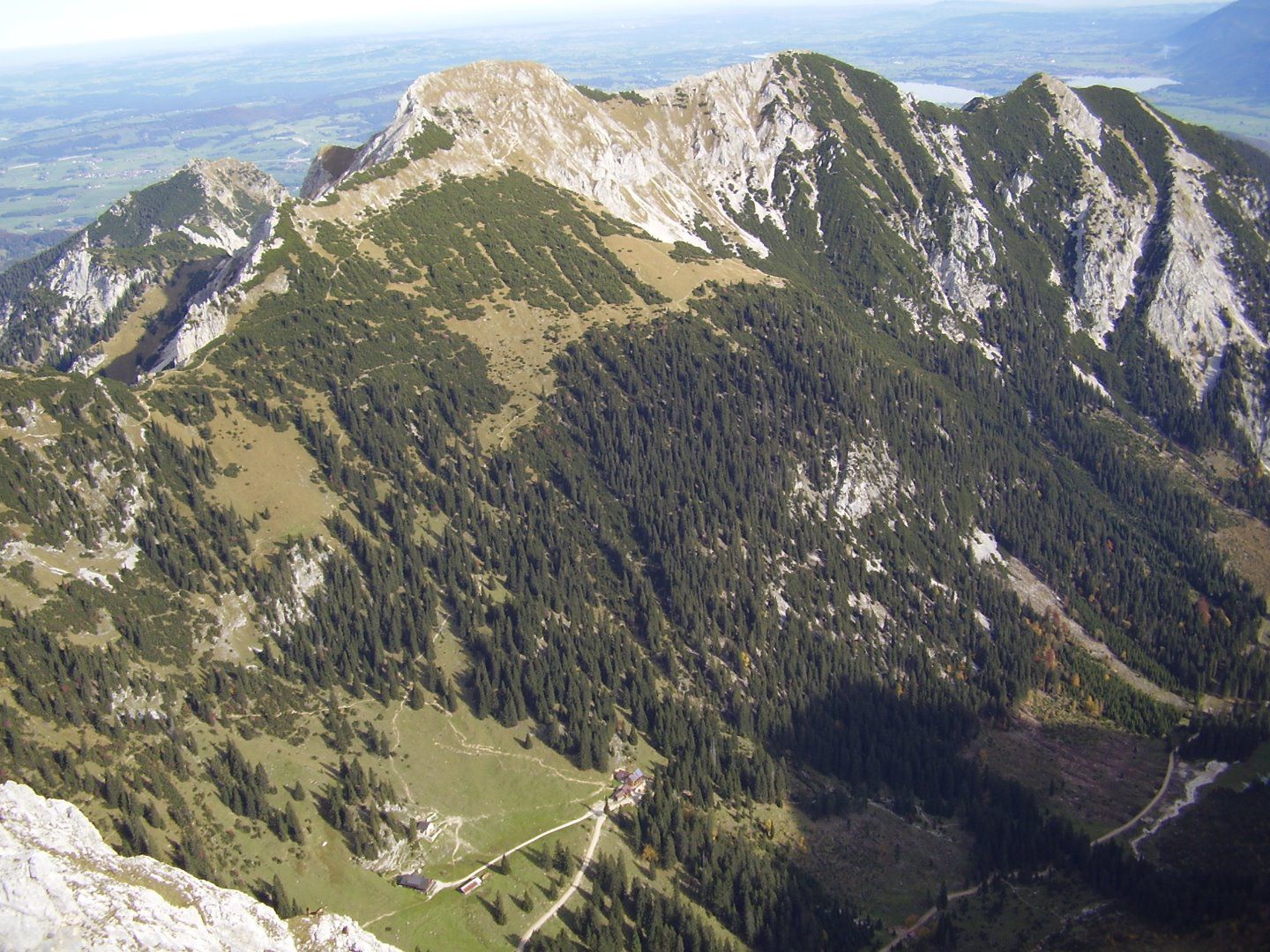
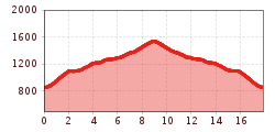
Open interactive mapOpen this POI on the interactive mapElevation profileDurch das Raintal | MTB Tour.gpx
Füssener HütteOpening hours:Open todayPlace:Musau:Alpine pasture / hut / mountain restaurantsee restaurant detailssee restaurant details: Füssener Hütte
Musauer Alm © FotostudioRene Musauer AlmOpening hours:Open todayPlace:Musau:Alpine pasture / hut / mountain restaurantsee restaurant detailssee restaurant details: Musauer Alm
Otto-Mayr-Hütte © TVB Naturparkregion Reutte Otto-Mayr-HütteOpening hours:Open todayPlace:Musau:Alpine pasture / hut / mountain restaurantsee restaurant detailssee restaurant details: Otto-Mayr-Hütte
Urisee Trail Area - D'Oachkätzla Line © Dominik Somweber Trailarea UriseeOpening hours:openLength:1.2 kmGo to biketourGo to biketour: Trailarea Urisee
Radfahrerinnen bei herbstlichem Wetter auf dem Weg zur Gaistalalm.jpg © Region Seefeld; Timo Borkowski Bikepacking Tour Tyrol - Stage 2Difficulty:difficultLength:77.0 kmDuration:6:47 hElevation uphill:1,420 mGo to biketourGo to biketour: Bikepacking Tour Tyrol - Stage 2
Give feedback for a chance to win a special holiday experience!Click here for the surveyClick here for the survey