Mountain hikes Bergdoktor circular route Söll

Söll / Kitzbüheler Alpen
Difficulty ratings: easy
Route length: 8.4 km
Duration: 3:00 h

Off the beaten track up to the Köpfing farmhouse. “Der Bergdoktor” (The Mountain Doctor) is a famous German-Austrian TV series, which is produced in the Wilder Kaiser region.

Tour information

  • Requirement: easy
  • Length: 8.4 km
  • Duration: 3:00 h
  • Elevation uphill:370 hm
  • Elevation downhill:370 hm
Highest point1,070 m

Starting point

Bergdoktor parking lot, Söll

Finishing point

Bergdoktor parking lot, Söll
  • Fitness level 2 / 6
  • Technique 2 / 6

Features

  • Circular route
  • Suitable for families

Best time of year

  • January
  • February
  • March
  • April
  • May
  • June
  • July
  • August
  • September
  • October
  • November
  • December

Trail condition

The composition of the trail varies between asphalt and gravel.

Equipment

Rucksack, sturdy hiking/mountaineering boots with anti-slip treaded soles, weather-appropriate hiking gear (breathable), a change of clothes, sun protection (sunglasses, sun cream, lip protection, headgear), waterproofs (rain jacket/poncho, pocket umbrella, rucksack protector), cold protection (hat, gloves), sufficient food and drink, hiking poles (height adjustable) if required, first aid kit incl. rescue blanket and bivouac sack, mobile phone with fully charged battery, headlamp, plastic bag for waste, hiking map, route description and information materials (GPX track), ID, insurance card, cash
Source: TVB Wilder Kaiser

Description

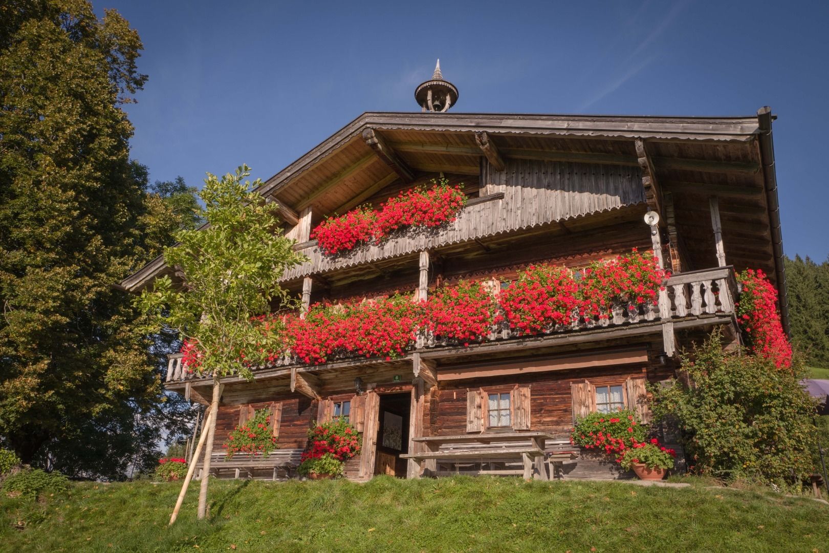
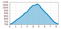
Starting from the starting point at the Bergdoktor parking lot (Stampfanger 1), hike past the valley station of the Söll mountain railways to the Stampfanger chapel. Above the chapel right there is a steadily ascending path no. 51 along the Stampfanger creek, past the Salfenau and dam bridge to the Höckenhof, where you will then get to the Bromberg street. Follow this downwards until you pass the Talern farm on the right to the Köpfinghof (mountain doctor's filming location). To get back to the starting point, follow the road down into the valley.

Tip:
Alternatively, at the Höckenhof you can also follow the Bromberg Straße right up towards the Alpengasthof Gruberhof and treat yourself a stop there. Then go the way back to the Höckenhof to reconnect with the original tour. The additional detour extends the walking time by approx. 45 minutes.

Nearby huts and mountain restaurants

  • Gruberhof

    Opening hours:Open today
    Place: Söll
    : Restaurant, Alpine pasture / hut / mountain restaurant
    see restaurant details: Gruberhof
  • Hexenalm

    Opening hours:Open today
    Place: Söll
    : Restaurant
    see restaurant details: Hexenalm

Getting here

  • Arrival by public transport

    KaiserJet stop “Söll Hotel Bergland" oder "Söll Bergbahn"
    More information at www.wilderkaiser/mobility

    Public bus stop "Söll Kreisverkehr"

  • Parking

    Bergdoktorparkplatz – € 5,- per vehicle

More tours in the surrounding area

  • Hochalm hike

    Difficulty: medium
    Length: 19.6 km Duration: 7:00 h Elevation uphill: 1,140 m
  • Hintere Goinger Halt summit tour

    Difficulty: difficult
    Length: 9.3 km Duration: 6:30 h Elevation uphill: 1,090 m
  • Panoramic circuit Brandstadl–Hartkaiser

    Difficulty: easy
    Length: 6.0 km Duration: 1:50 h Elevation uphill: 170 m
Newsletter

The mountain is calling? So does our newsletter!

In our monthly newsletter we reveal the best holiday tips for Tyrol.