
Place:
Vils
:
Alpine pasture / hut / mountain restaurant
Fantastic hike from Vils over the Lechfall to the Alatsee
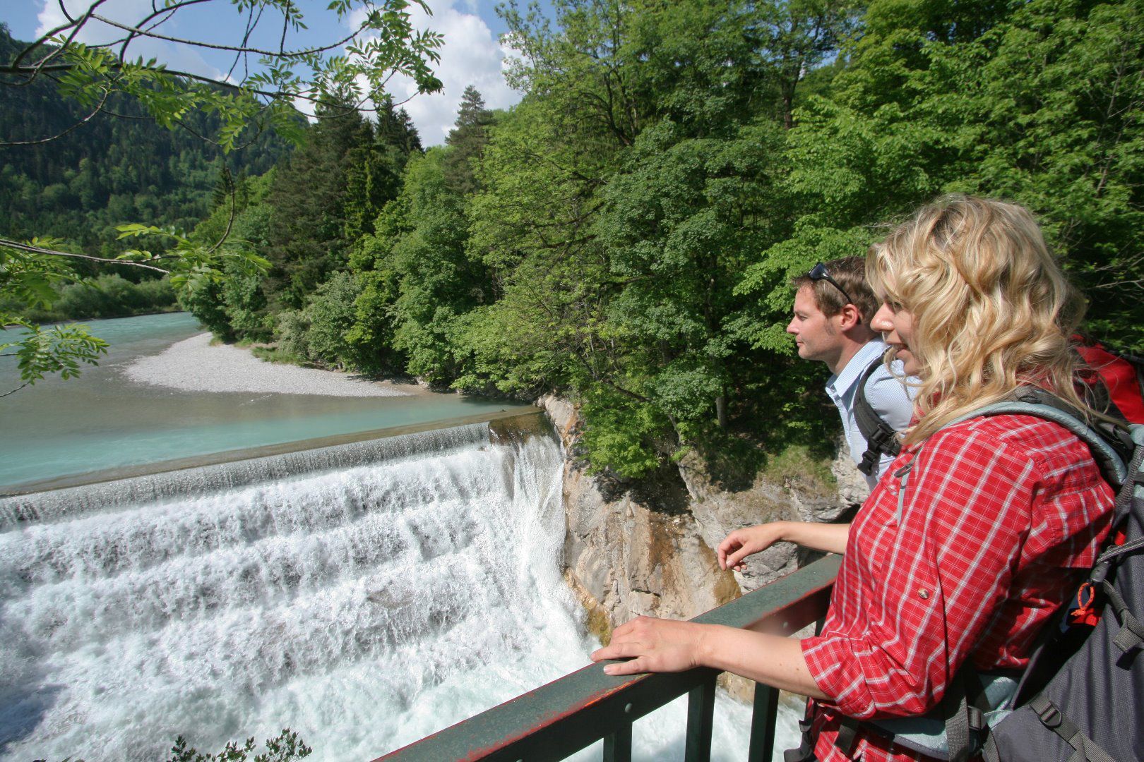
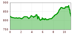
The hike starts at the Alatsee car park in Vils. The path runs parallel to the Vils in an easterly direction, past its confluence with the Lech. Finally, you cross the border into Bavaria on the Ländeweg. After about 1.6 km you will reach the majestic Lechfall.
The route continues through idyllic Bad Faulenbach. After leaving the Mittersee and the Obersee behind, the path leads you through a beautiful, quiet and secluded forest to the Alatsee. On the northern shore of the lake there is the option of climbing up to the Salober Alm (approx. 1.3 km away with an altitude difference of 200 metres).
No matter which path you choose, you will eventually hike along the foot of the extensive sunbathing lawn and climb back down to Vils via the Vilser Scharte, the starting point of your tour. Enjoy the diverse nature and the impressive landscapes on this unforgettable hiking experience.


.jpg")

