
Difficulty:
medium
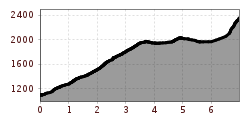
Length:
13.6 km
Duration:
5:45 h
Elevation uphill:
1,200 m
The Hochvogel more than just a mountain... The Bäumenheimerweg is closed due to danger of rockfall!
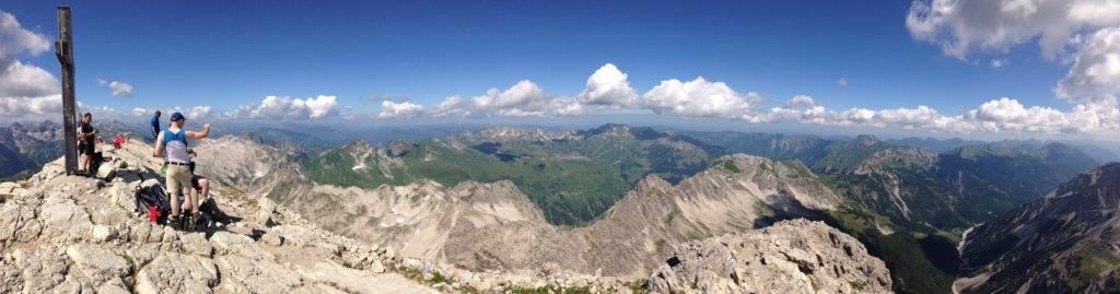
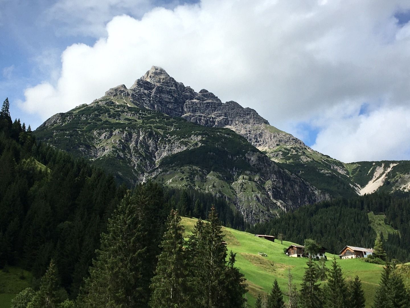
From Landgasthof Adler, the path initially climbs steeply through the forest. The steep path continues in the direction of Schwabegghütte, where the view of the uniquely beautiful Lechtal panorama opens up for the first time. In short hairpin bends, we reach a small ridge via a mountain pine slope. "König Hochvogel" towers above us, and the Fuchsensattel can already be recognised at the top right. But we still have to cross a wide, rocky cirque to get there. The Kuhkar. From the Fuchsensattel, the mighty and imposing north face of the Hochvogel inevitably comes into view and accompanies us during the descent to the Salzboden. The path winds its way upwards, first through scree, then over sparsely vegetated ground. We leave this path and head south towards the Kalten Winkel. Surefootedness is required for the steep, partly icy all-year-round snow field. Light crampons are highly recommended. Afterwards, a high mountain feeling is the order of the day. Rock towers and stony ledges dominate the scenery. A gentle scramble over rocky steps leads to the summit cross, where a breathtaking view awaits.


")


