Mountain hikes Kleiner Pölven summit from Franzlhof

Söll / Kitzbüheler Alpen
Difficulty ratings: medium
Route length: 8.5 km
Duration: 5:00 h

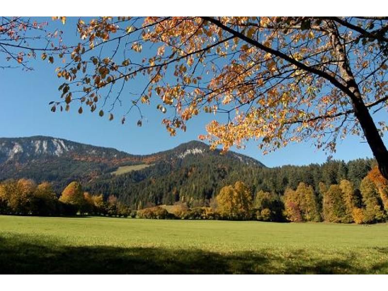
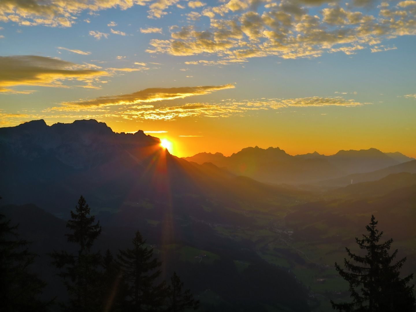
The panoramic spot of the locals, steep and fascinating.

Tour information

  • Requirement: medium
  • Length: 8.5 km
  • Duration: 5:00 h
  • Elevation uphill:880 hm
  • Elevation downhill:880 hm
Highest point1,562 m

Starting point

Hiking starting point Franzlhof, Söll (703 m)

Finishing point

Hiking starting point Franzlhof, Söll (703 m)
  • Fitness level 4 / 6
  • Technique 3 / 6

Features

  • Circular route

Best time of year

  • January
  • February
  • March
  • April
  • May
  • June
  • July
  • August
  • September
  • October
  • November
  • December

Trail condition

The composition of the trail varies between meadow path, forest trail, hiking trail, asphalt, gravel path, mountain path.

Equipment

Rucksack, sturdy hiking/mountaineering boots with anti-slip treaded soles, weather-appropriate hiking gear (breathable), a change of clothes, sun protection (sunglasses, sun cream, lip protection, headgear), waterproofs (rain jacket/poncho, pocket umbrella, rucksack protector), cold protection (hat, gloves), sufficient food and drink, hiking poles (height adjustable) if required, first aid kit incl. rescue blanket and bivouac sack, mobile phone with fully charged battery, headlamp, plastic bag for waste, hiking map, route description and information materials (GPX track), ID, insurance card, cash
Source: TVB Wilder Kaiser

Description

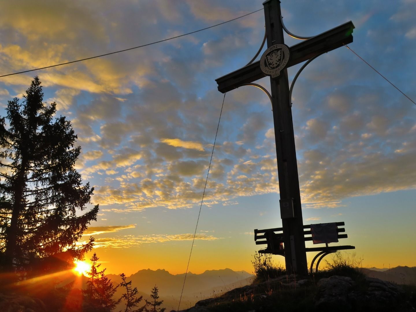
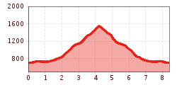
From the Franzlhof, take the Söller Sunnseitweg trail towards Hochfilzer. At the Pfötsching Bassin signpost, follow the signs towards Kleiner/Großer Pölven. Shortly after the Pfötschinghof, a steep root path branches off to the right from the forest road and leads to an alpine pasture. Continue hiking to the unmanaged Reiteralm. The trail then leads you along a winding path to the upper end of the alpine pasture and a turnstile. After a steep section of forest and two rope-secured passages, the terrain becomes flatter and you reach the Kleiner/Großer Pölven fork. Follow the path to the right through the forest until you reach the summit with the ‘Söller Kreuz’ cross. Return to the valley and the Franzlhof via the same route.

Tip: Alternatively, you can also start this tour from the Alpenschlössl hiking starting point.

Nearby huts and mountain restaurants

Getting here

  • Arrival by public transport

    KaiserJet/Postbus stop “Söll Dorf”
    followed by approx. 10-minute hike to the hiking starting point (Franzlhof leisure centre).
    More information at: www.wilderkaiser.info

  • Parking

    Franzlhof leisure centre car park, Söll (703 m) – free

More tours in the surrounding area

  • Hochalm hike

    Difficulty: medium
    Length: 19.6 km Duration: 7:00 h Elevation uphill: 1,140 m
  • Hintere Goinger Halt summit tour

    Difficulty: difficult
    Length: 9.3 km Duration: 6:30 h Elevation uphill: 1,090 m
  • Panoramic circuit Brandstadl–Hartkaiser

    Difficulty: easy
    Length: 6.0 km Duration: 1:50 h Elevation uphill: 170 m
Newsletter

The mountain is calling? So does our newsletter!

In our monthly newsletter we reveal the best holiday tips for Tyrol.