.jpg")
Difficulty:
difficult
Length:
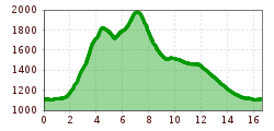
13.0 km
Duration:
7:30 h
Elevation uphill:
1,054 m
Short description:A strenuous hike that offers countless impressions. Quality of experience: ****Recommended season:MayJuneJulyAugustSeptemberOctoberProperties:LoopScenicRefreshment stops available


Description:
From Nesselwängle to the end of the Tannheimer Tal. From there it quickly goes uphill along the Enziansteig, after a stopover at the Gräner Ödenalpe continue to the Krinnenspitze. From the mountain station of the lift back via the Meranersteig to the parking lot.
Starting from the mountain station of the Krinnenalp lift (currently not in operation) ascent to the Krinnenspitze via Gamsbocksteig, about 1 1/2 hours. ATTENTION!! Sure-footedness and a head for heights required.
Descent options:
a) to the Nesselwängler Edenalpe, about 3/4 hour further towards Haldensee about 2 1/2 hours. Total 4 1/2 hours
b) to the Nesselwängler Edenalpe about 3/4 hour further on Alpenrosenweg about 2 hours. Total 4 hours.
c) to the Gräner Ödenalpe about 3/4 hour. further descent a and b. Total about 5 hours
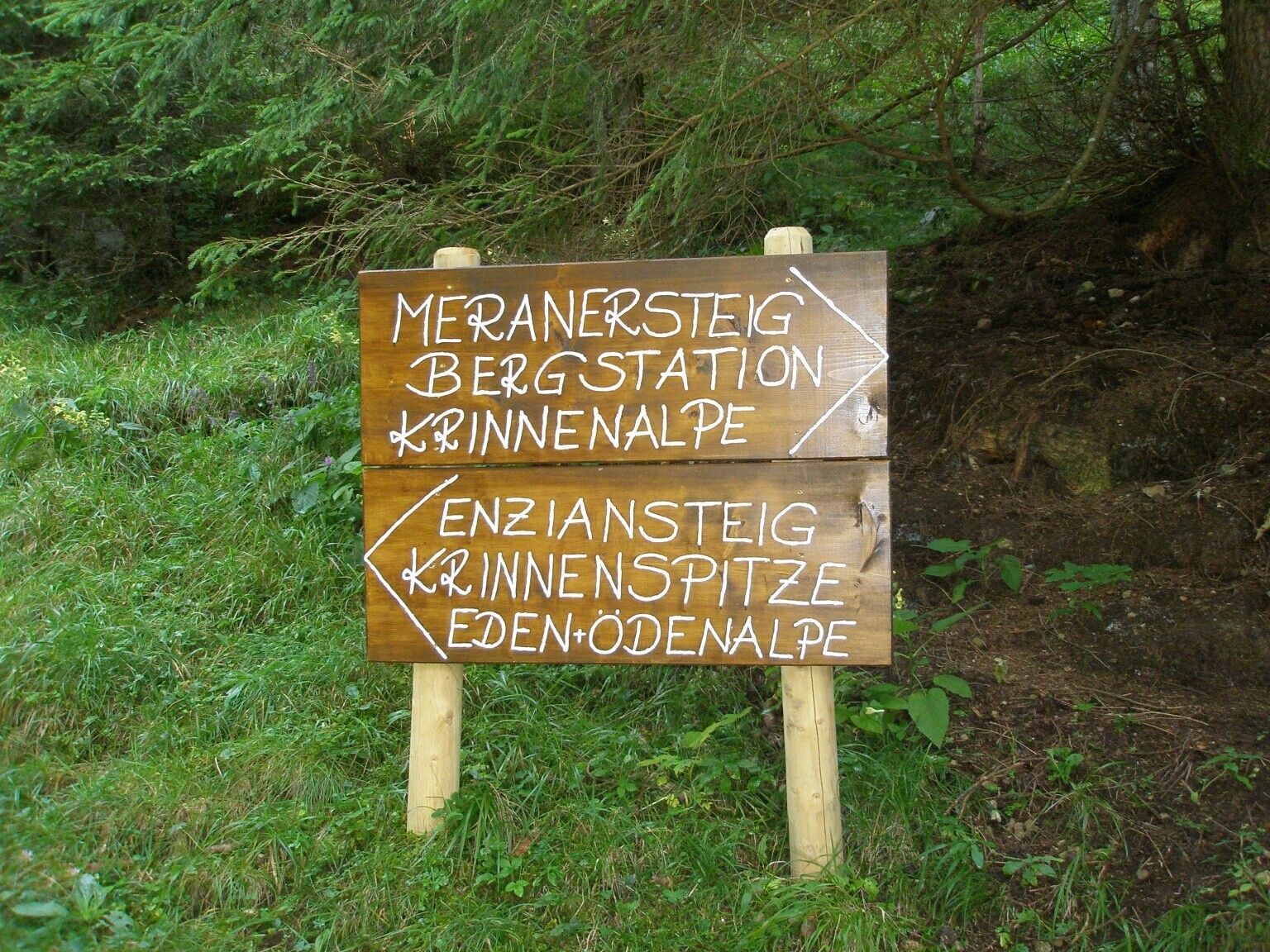
d) descend via the Enziansteig to Rauth about 2 hours and on the circular hiking trail back to the lift parking lot, about 1 hour or by hiking bus back to Nesselwängle. Total about 4 1/2 hours
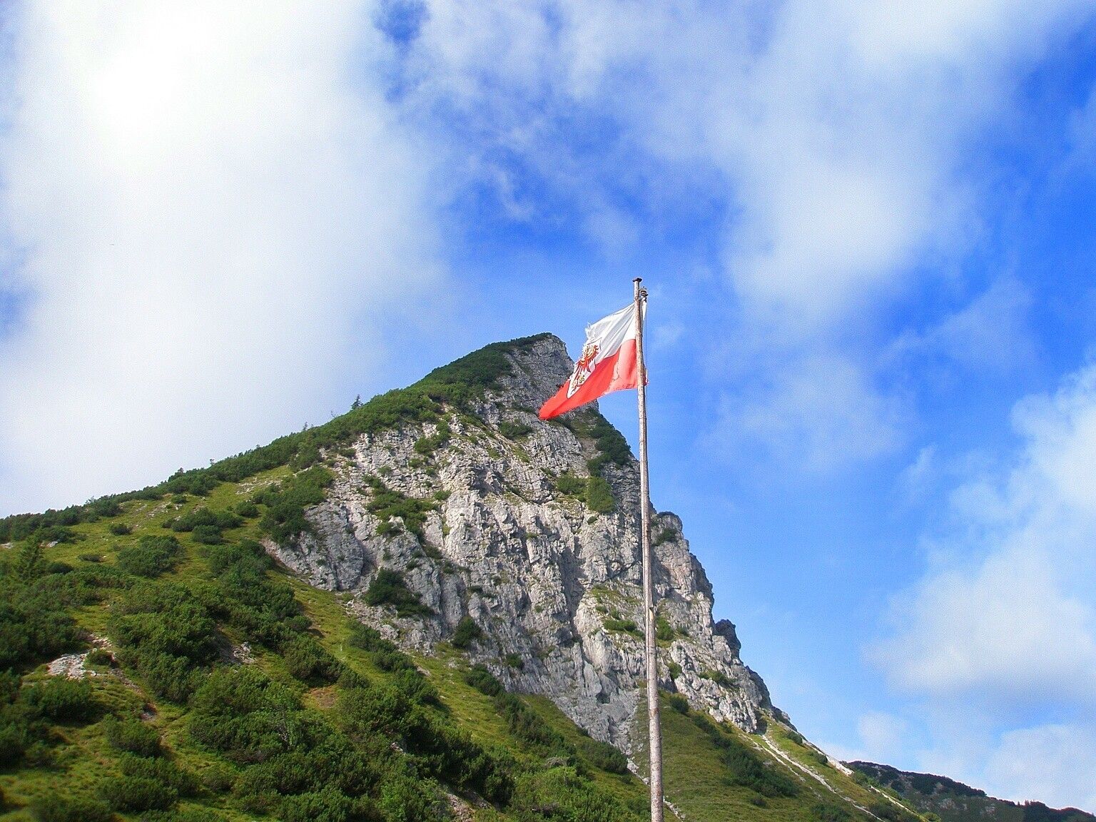
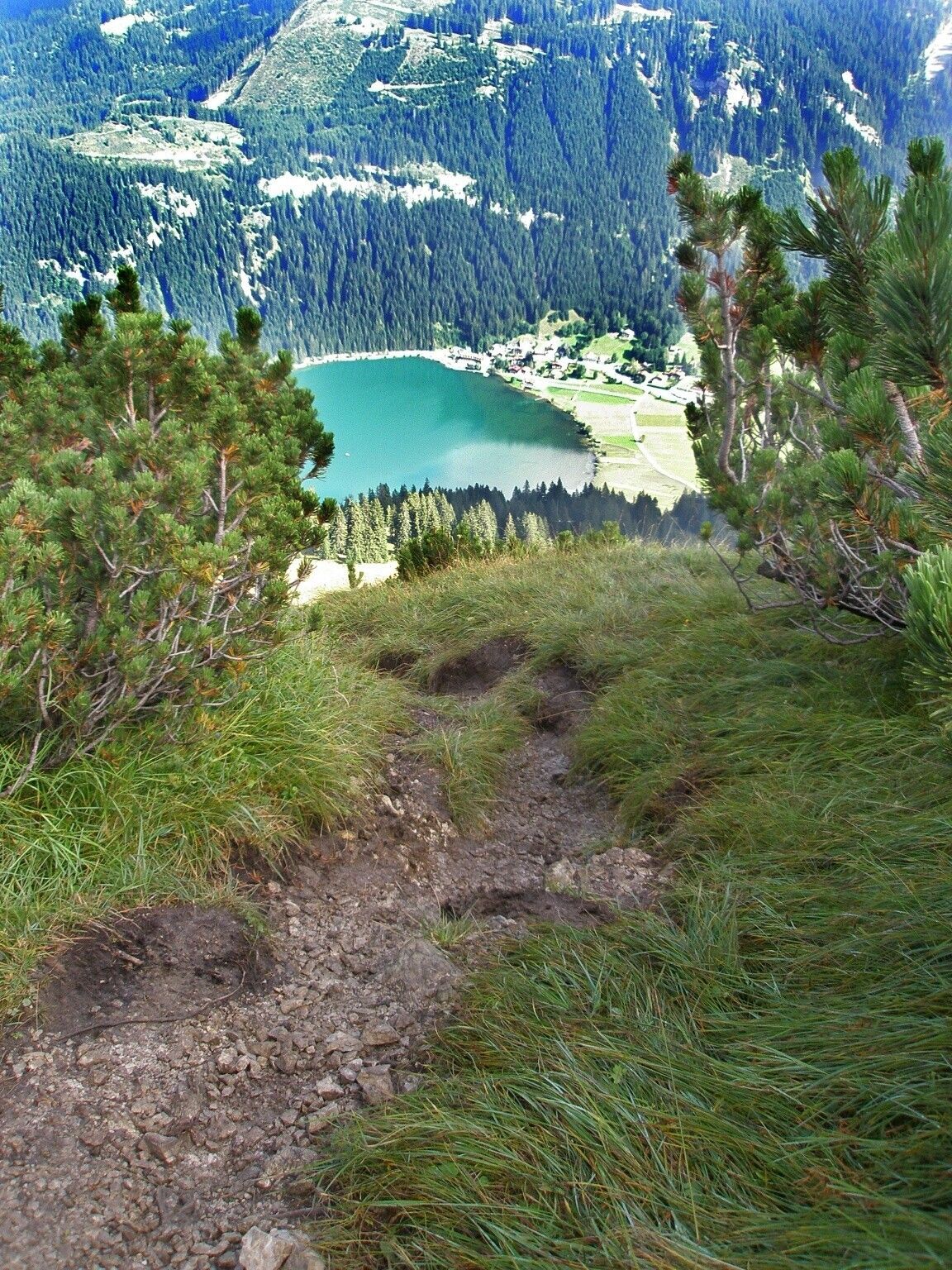
This route starts at the parking lot between Nesselwängle and Rauth. Towards Nesselwängle there is an underpass to the opposite side of the street. Once there, turn left towards Rauth. First on a gravel path, past a chapel, then on asphalt you soon reach the houses in Rauth. In the village center, the signpost to the "Enziansteig" points right and upward. Through the forest, crossing the forest road, then on the slightly steeper, grass-covered slope below the Krinnenspitze, we quickly gain altitude. On the saddle, at the junction to the Gräner Ödenalpe, turn left downward. After the detour to the hut, we hike uphill to the summit of the Krinnenspitze. The Krinnenspitze is not very high, but the view makes up for the altitude gained. Via the slightly steeper Alpenrosensteig, we reach the Alpenrosenweg and continue to the Krinnenalpe. From there, it goes to the mountain station of the Krinnenalp cable car and further right to the Meranersteig. On this trail, we reach the forest road to Rauth. Now just the asphalt road we already know downhill and the short section of gravel path, then we have reached the parking lot east of Nesselwängle again.
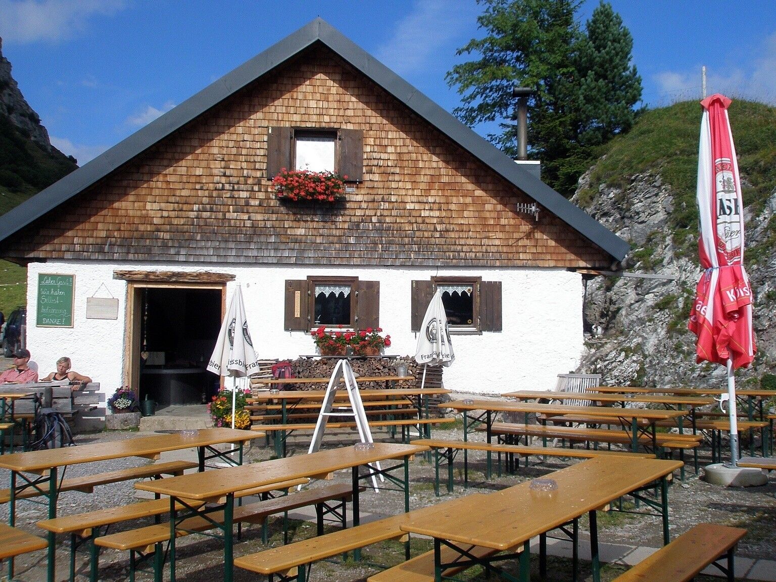
Tip:Hearty farmer's soup at the Gräner Ödenalpe.
Safety guidelines:General valid and usual rules of conduct.
Please note that there is an increased risk of accidents and injuries in mountaineering. Despite careful tour planning, there is always a basic risk. Preparation through endurance sports, appropriate technical training and further education as well as personal prudence reduce the risk of accidents and dangers. But please never forget that the weather in the mountains can change very quickly. Stay on the marked hiking trails.
Personal mountaineering equipment must be safe and functional and comply with the respective technical standard. Every hiker is recommended to inform themselves about the planned routes in alpine specialist literature or on site.
Additional information:
Tourist office Tannheimer Tal
Krinnenalpe
Gräner Ödenalpe


