Mountain hikes Rosengarten

Patsch / Tuxer Alpen
Difficulty ratings: easy
Route length: 7.8 km
Duration: 2:00 h

Rosengarten

Tour information

  • Requirement: easy
  • Length: 7.8 km
  • Duration: 2:00 h
  • Elevation uphill:178 hm
  • Elevation downhill:213 hm
Highest point1,035 m

Starting point

Igls - Kurpark

Finishing point

Igls - Kneippanlage

Features

  • Circular route
  • Suitable for families

Best time of year

  • January
  • February
  • March
  • April
  • May
  • June
  • July
  • August
  • September
  • October
  • November
  • December

Trail condition

partly forest trail, partly gravel trail, partly asphalt
Source: Innsbruck region

Description

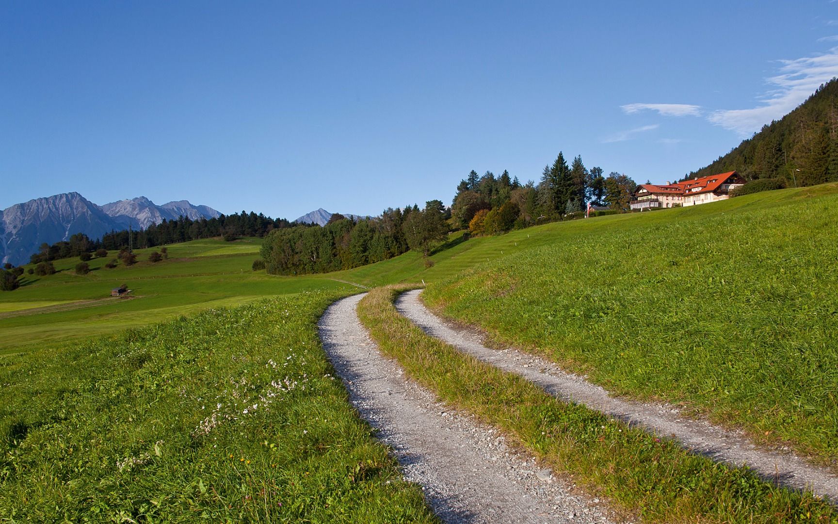
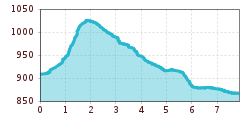
From the Igls Kurpark, the route first leads along the Patscher Straße and then continues with short and longer climbs through the Rosengarten nature reserve up to the fields below the Goldbichl. After the highest point, the route heads downhill to the Grünwalderhof farm, continuing along field paths to the Pfaffenbichl and via the sunny Fernkreuzweg trail to the Kneipp facility in the centre of Igls. The return route leads directly from the town centre back to the spa gardens. The varied route runs partly on forest paths, partly on gravel and tarmac paths.

Getting here

  • Arrival by public transport

    bus J - stop "Bilgeristraße"

More tours in the surrounding area

Newsletter

The mountain is calling? So does our newsletter!

In our monthly newsletter we reveal the best holiday tips for Tyrol.