Mountain hikes Steeg via Hager Höhenweg to Holzgau

Steeg im Lechtal / Allgäu Alps
Schwierigkeitsgrad: medium
Streckenlänge: 7.2 km
Dauer: 2:30 h

Very beautiful sunny high-altitude hike!

Toureninformation

  • Anforderung: medium
  • Länge: 7.2 km
  • Dauer: 2:30 h
  • Höhenmeter Bergauf:312 hm
  • Höhenmeter Bergab:314 hm
Höchster Punkt1,414 m

Ausgangspunkt

Steeg Aqua Nova car park

Endpunkt

Holzgau

Merkmale

  • Suitable for families

Beste Jahreszeit

  • January
  • February
  • March
  • April
  • May
  • June
  • July
  • August
  • September
  • October
  • November
  • December

Wegbeschaffenheit

Asphalt, forest path

Ausrüstung

Good equipment is essential for your hike. The following items should definitely be in your rucksack: - Food and drink - Functional clothing for rain, wind and cold - A change of clothes - Sun protection - First aid kit - Mobile phone with a full battery (Euro emergency number 112) - Hiking map or GPS - Hiking poles Nevertheless, the following applies: light luggage is also easier to carry, so you should not weigh down your rucksack with unnecessary ballast. In addition, your hiking equipment should of course also be adapted to your particular hiking tour.
Quelle: TVB Lechtal

Beschreibung

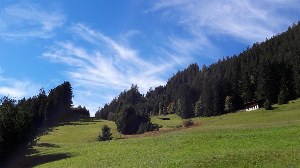
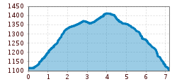
A beautiful, sunny high-altitude hike awaits you! Walk along the main road to the eastern end of the village, cross it and follow the signpost "Höhenweg Hager nach Holzgau". Your path leads you through the shady forest over sunny clearings to the Gföllberg near Holzgau. If you are brave enough, you can cross the Holzgau suspension bridge. The last section takes you along the tarmac path down to the village.

Anreise

  • Anreise mit den Öffis

    Regional bus stop Steeg-Village

  • Parken

    Steeg Aqua Nova car park

Weitere Touren in der Umgebung

Tirol Newsletter

The mountain is calling? So does our newsletter!

In our monthly newsletter we reveal the best holiday tips for Tyrol.