
Difficulty:
medium
Length:
3.2 km
Duration:
2:30 h
Elevation uphill:
390 m
Horberg Trail – Schwendau
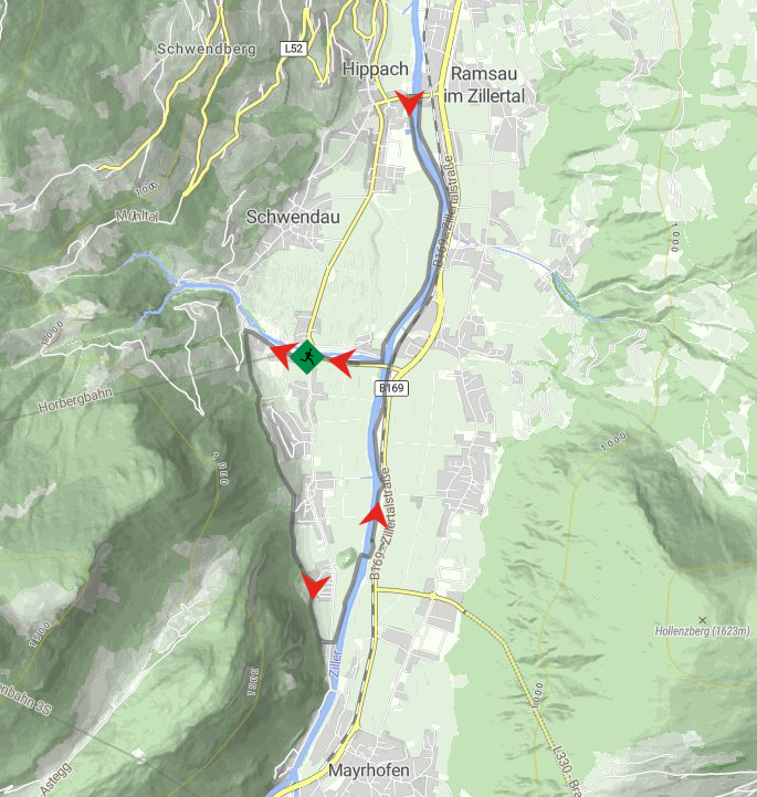
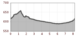
The starting point is the Horberg car park, where the route runs slightly uphill past the Horberg cable car valley station towards Kleinschwendberg. The route then heads down the valley via Burgstall to the Zimmereben. From there the route first leads west of the Ziller, then east of the river back to Schwendau.

 Berliner Hütte - Greizer Hütte")
 Greizer Hütte - Kasseler Hütte")
 Kasseler Hütte - Edelhütte")


