Steinberg Runde

Steinberg am Rofan / Brandenberger Alpen (Rofan)
Route length: 5.9 km
Duration: 0:45 h

Steinberg Runde

Tour information

  • Length: 5.9 km
  • Duration: 0:45 h
  • Elevation uphill:115 hm
  • Elevation downhill:115 hm
Highest point1,075 m

Starting point

Steinberg am Rofan, car park Rofanlifte II

Finishing point

Steinberg am Rofan, car park Rofanlifte II

Best time of year

  • January
  • February
  • March
  • April
  • May
  • June
  • July
  • August
  • September
  • October
  • November
  • December
Source: Achensee

Description

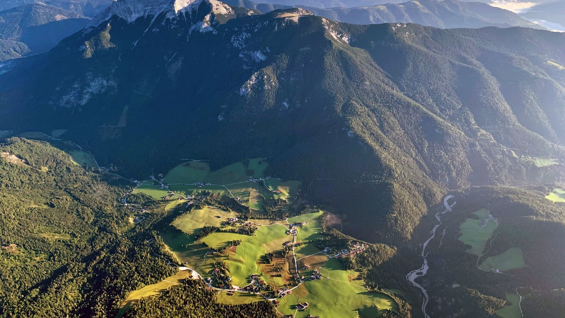
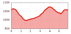
From the car park Rofan lifts II, this short, slightly hilly route leads first along a beautiful forest path and continues along a gravel path back to the starting point.

Getting here

  • Arrival by public transport

    Exit bus-stop: Steinberg a. R. Rofanlift II

  • Parking

    Car park Rofanlifte II (paid parking lot)

More tours in the surrounding area

Newsletter

The mountain is calling? So does our newsletter!

In our monthly newsletter we reveal the best holiday tips for Tyrol.