

Difficulty:difficult
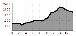
Length:10.8 kmDuration:6:30 hElevation uphill:1,200 m
Today, the Adlerweg shows its teeth with a challenging seventh stage, but is not stingy with its impressive scenery. If you like, take a dip in Lake Zirein - ice bathing is supposed to speed up recovery. The Kaiserschmarrn pancakes on the terrace of the Erfurter Hütte with a view of Lake Achensee are also said to have healing effects...
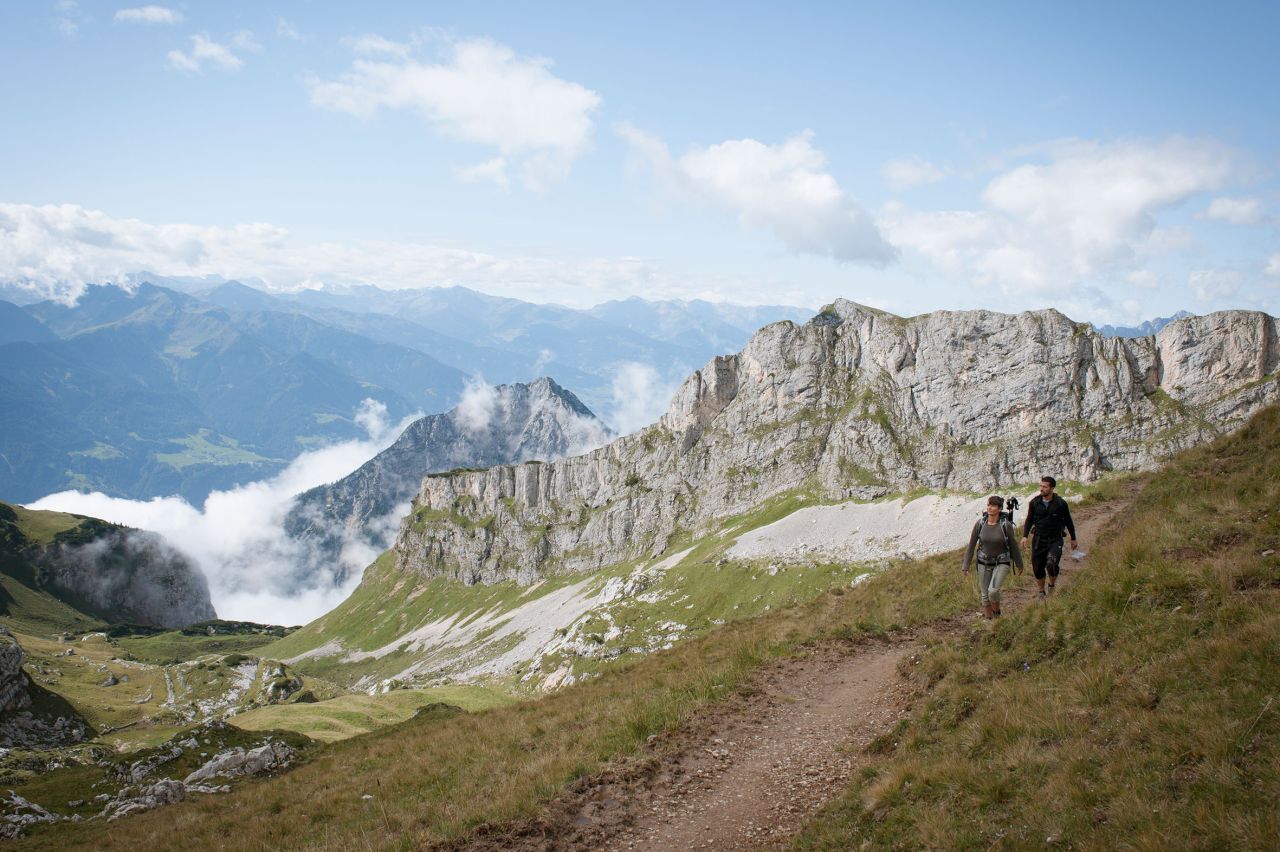
This difficult stage on black paths is demanding in terms of fitness and surefootedness. It leads over narrow, steep paths and trails that should not be underestimated, especially in wet conditions. Concentration and good walking technique are essential here.
Starting point: Gasthof Waldhäusl (Steinberg)
Starting off at thr Gasthof Waldhäusl inn in Steinberg am Rofan, take a short walk to the southeast along the village road towards St. Lambert's Parish Church and follow this road for around 500 metres. Bear left after the hay barn and continue walking until the road emerges onto a path leading into Steinberger Loch and up to the Durrahof farm. Follow E4 long-distance hiking trail to Labegg Graben. (Periods of heavy rain or snowmelt make it difficult to get through the Schauertal Valley and then cross Schafsteigsattel ridge safely. There is an alternative hike in the area that is the better option in inclement weather.*)
From Labegg Graben, follow posted signage to “Rofan” along the forest road. Keep walking gently uphill through thinning forest and along meadows and follow signage to “Zireiner See” and/or “Erfurter Hütte”. When you reach a parting of the ways right behind a farmhouse, take the trail that goes uphill, and do not walk downhill. The trail is a mere footpath now. You will soon cross a creek with a little waterfall, where the path merges with a forest road. Bear right following signage to “Bayreuther Hütte”. Then, take the left fork along the creek and keep walking uphill. Later, follow the footpath and turn right onto a broad forest road. Then turn left onto a dirt road leading uphill that will soon merge into a footpath.
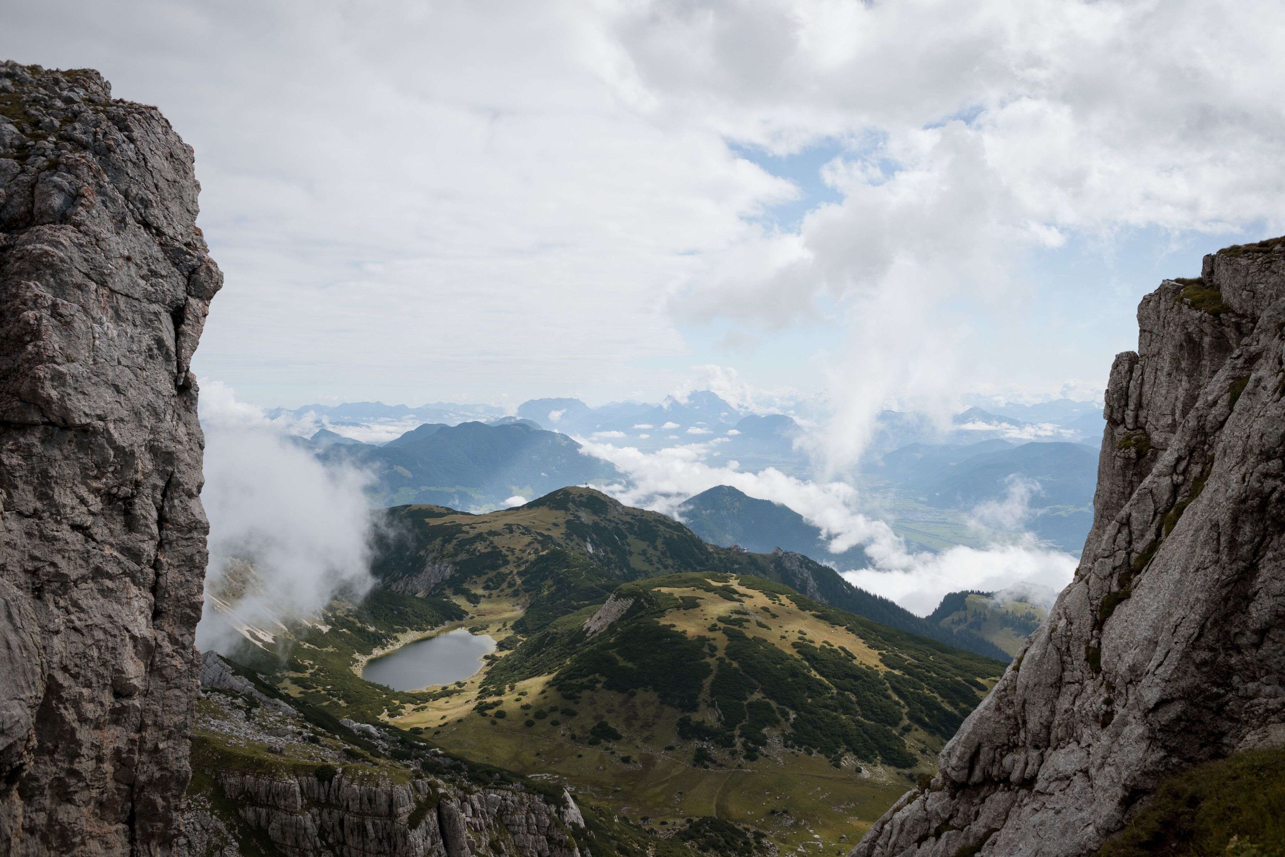
The trail takes you through thinning woodlands along the creek towards “Zireiner See”. Beyond the creek (there is no bridge), continue on the steep path that will soon take you up to the world of wide open Alpine meadows. Here you pass the idyllic Schauertalalm and follow the path uphill towards “Schauertalsattel”. Plenty of exposed roots and rocks will help keep your pace in check. The trail furiously works its way up along dwarf pines. You will soon arrive at a basin, where you follow signage to “Erfurter Hütte”. After passing the southern shore of Zireinersee Lake, follow the way-marked trail towards “Marchalm” and “Schafsteig, Rofan”. Be careful, this path is rated black and may be slippery and hazardous in wet conditions. The Schafsteig path skirts the east fast of Rofanspitz Spire, then diagonally uphill, before making a vigorous climb up to Schafsteigsattel ridge, situated northeast of the Rofanspitze mountain. From the ridge, turn left and stroll down a short passage that takes you through gentle meadows. Follow signage to “Erfurter Hütte” and/or “Rofanseilbahn” and continue on the relatively even footpath to the saddle. From here, it is a gentle downhill stroll into a lush green basin.
Food & drink: Mauritzalm
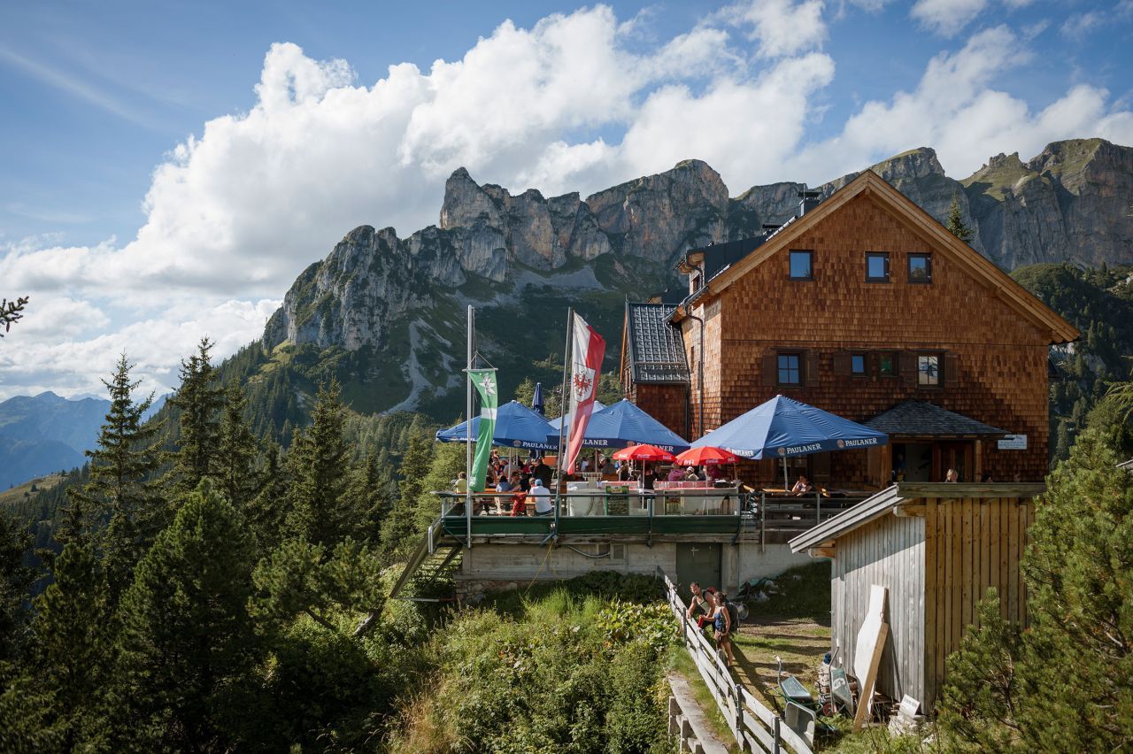
Keep walking along alpine pastures until you reach the Erfurter Hütte hut, which is located right next to the top terminal of the Rofan gondola at an elevation of 1,831 metres and is a nice place to spend the night, as is the Rofanhütte hut. You will pass the Mauritzalm hut before reaching the final destination of this stage. You can either walk downhill (1½ hours) or ride the gondola down to Maurach. Almost the entire segment of this Eagle Walk coincides with Nordalpenweg Trail 01.
Finishing point: Erfurter Hütte
*) Alternative route:
Periods of heavy rain or snowmelt make it difficult to get through the Schauertal Valley and then cross Schafsteigsattel ridge safely. There is an alternative hike in the area that is the better option in inclement weather:
From Labegg Graben, take the left fork up to the Enteralm hut (where hearty food is served) – Ameisenkogel (elev. 1,518m) – a lovely trail takes you to Labeggalm hut (strongly recommended: stop for a rest at the quaint Anderl’s Hütte, which is readily accessible within a 15-minute walk). Follow the path (do not take trail no. 411) atop Kreuzeinjoch ridge (elev. 1,702m) – continue climbing towards Rossweide and Rosskogelsattel Col (elev. 1,868m) – atop Rosskogel Peak turn right to the vantage point overlooking Zireinersee lake and descend to the beautiful mountain lake (refuel with hearty delicacies at the Sonnwendjochhaus lodge if you please). Skirt the lake westward with a vigorous climb taking you to Marchgatterl turnoff. Take the fork towards Zireiner Alm (elev. 1,698m) and Bayreuther Hütte hut (elev. 1,600m, on-mountain eatery and accommodation).
Follow trail no. 22 to Sonnwendbühelalm at an elevation of 1,645 metres – Wiesinger ski hut – climb up to Schermsteinalm hut and Schermstein Hochleger in ruins – Grubascharte Notch – from the notch, follow the Eagle Walk on trail no. 401 to Erfurter Hütte hut or to Rofan Mountain Inn (on-mountain eateries and accommodations).
The alternative route takes some 2.5 hours longer to complete. Benefits: There are no black-rated trails and the route is usually snow-free and easy to negotiate in May and June as well as in September and October. The snow on this trail melts early in the year.


