Andi Frank (247).jpg")
Difficulty:easy
Length:30.5 kmDuration:2:00 hElevation uphill:125 m
Short, diverse course with a challenging clime
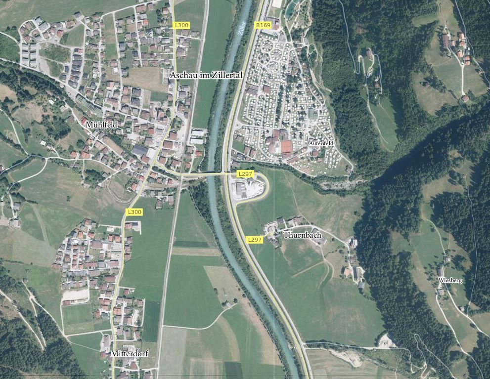
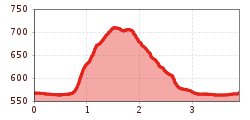
The course heads toward the east and across a bridge, which goes over the Ziller Valley main road and the Ziller Stream to reach the other side of the valley. After passing the Aufenfeld Camping Ground, the course begins to go uphill along the Thurnbach Stream. The course passes a chapel and goes across the stream. The course carries on uphill through the forest and the last part of the clime goes across a meadow. After crossing the meadow, the course goes along a road leading back down to the bottom of the valley. The trail carries on across beautiful meadows, past the camping ground and over the bridge back to the goal in Aschau.


Manfred Pfister.jpg")
.jpg")


