Route 3 - Königsleithe

closed
Serfaus / Samnaun Group
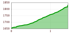
Route length: 1.4 km
Duration: 0:45 h

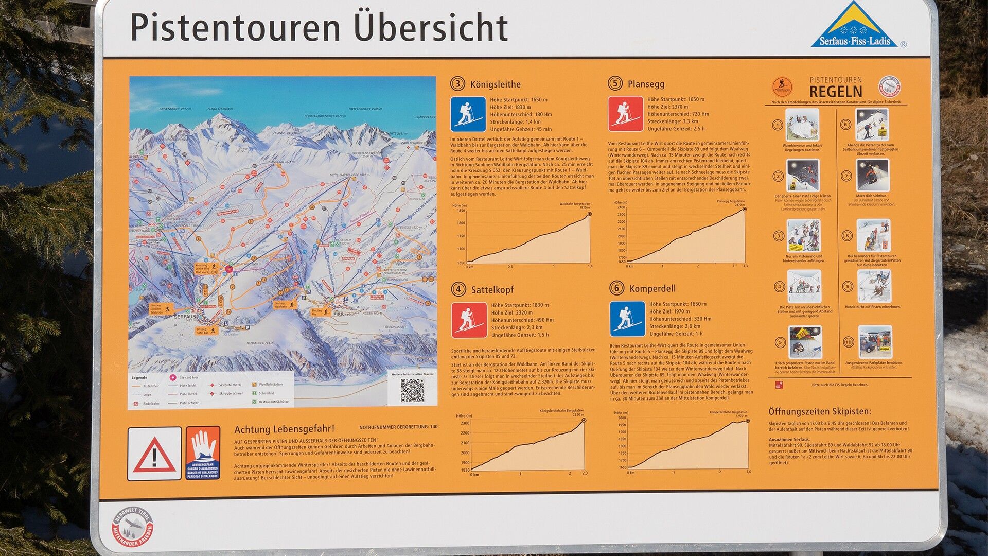
Pleasant and not too steep ascent through the forest. At the end, the route runs with “route 1 – Waldbahn” as far as the top station of the Waldbahn cable car. From there, you can continue your ascent to Sattelkopf on route 4.
Tour information

  • Length: 1.4 km
  • Duration: 0:45 h
  • Elevation uphill:180 hm
  • Elevation downhill:0 hm
Highest point1,830 m

Starting point

Leithe Wirt Restaurant

Finishing point

Waldbahn top station
Source: Serfaus-Fiss-Ladis

Description

East to Leithe Wirt restaurant, follow the Königsleitheweg towards Sunliner/Waldbahn top station. After a 25-minute walk, you reach crossing no. S052a with route 1 – Waldbahn. Both routes continue on the same trail. Keep on walking for about 20 minutes to reach Waldbahn top station. Need another challenge? Then continue with the more demanding route 4 to Sattelkopf.

Weather

Today

partly Cloudy
24°C/13°C
25%0l5 km/h

Tue

mainly clear
29°C/12°C
5%0l5 km/h

Wed

light rain showers
30°C/15°C
55%5.2l5 km/h
Go to weather forecast

More tours in the surrounding area

  • Patscherkofel Schutzhaus

    Difficulty:medium
    Length:13.3 kmDuration:2:30 hElevation uphill:1,000 m
  • Eichenhof

    Difficulty:medium
    Length:4.7 kmDuration:2:50 hElevation uphill:898 m
  • Mutterer Alm

    Difficulty:medium
    Length:3.1 kmDuration:2:00 hElevation uphill:581 m
  • Bichalm

    Difficulty:easy
    Length:2.4 kmDuration:1:30 hElevation uphill:450 m
  • Hoadl-Haus

    Difficulty:easy
    Length:7.6 kmDuration:2:25 hElevation uphill:778 m
  • Seefelder Joch

    Difficulty:medium
    Length:5.8 kmDuration:2:30 hElevation uphill:866 m
  • Breiteggspitze

    Difficulty:easy
    Length:3.4 kmDuration:2:00 hElevation uphill:700 m
Newsletter

The mountain is calling? So does our newsletter!

In our monthly newsletter we reveal the best holiday tips for Tyrol.