Trail running Gloatsteig Trail

Fulpmes / Stubai Alps
Route length: 16.3 km
Duration: 4:00 h

Tour information

  • Length: 16.3 km
  • Duration: 4:00 h
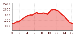
  • Elevation uphill:1,200 hm
  • Elevation downhill:1,200 hm
Highest point2,001 m

Starting point

valley station Schlick 2000

Finishing point

valley station Schlick 2000
  • Fitness level 3 / 6
  • Technique 4 / 6

Best time of year

  • January
  • February
  • March
  • April
  • May
  • June
  • July
  • August
  • September
  • October
  • November
  • December

Equipment

trail running shoes
Source: TVB Stubai

Description

From Fulpmes via Schlickerbach, Panorama Lake and Berglerbründl to Pfarrachalm.

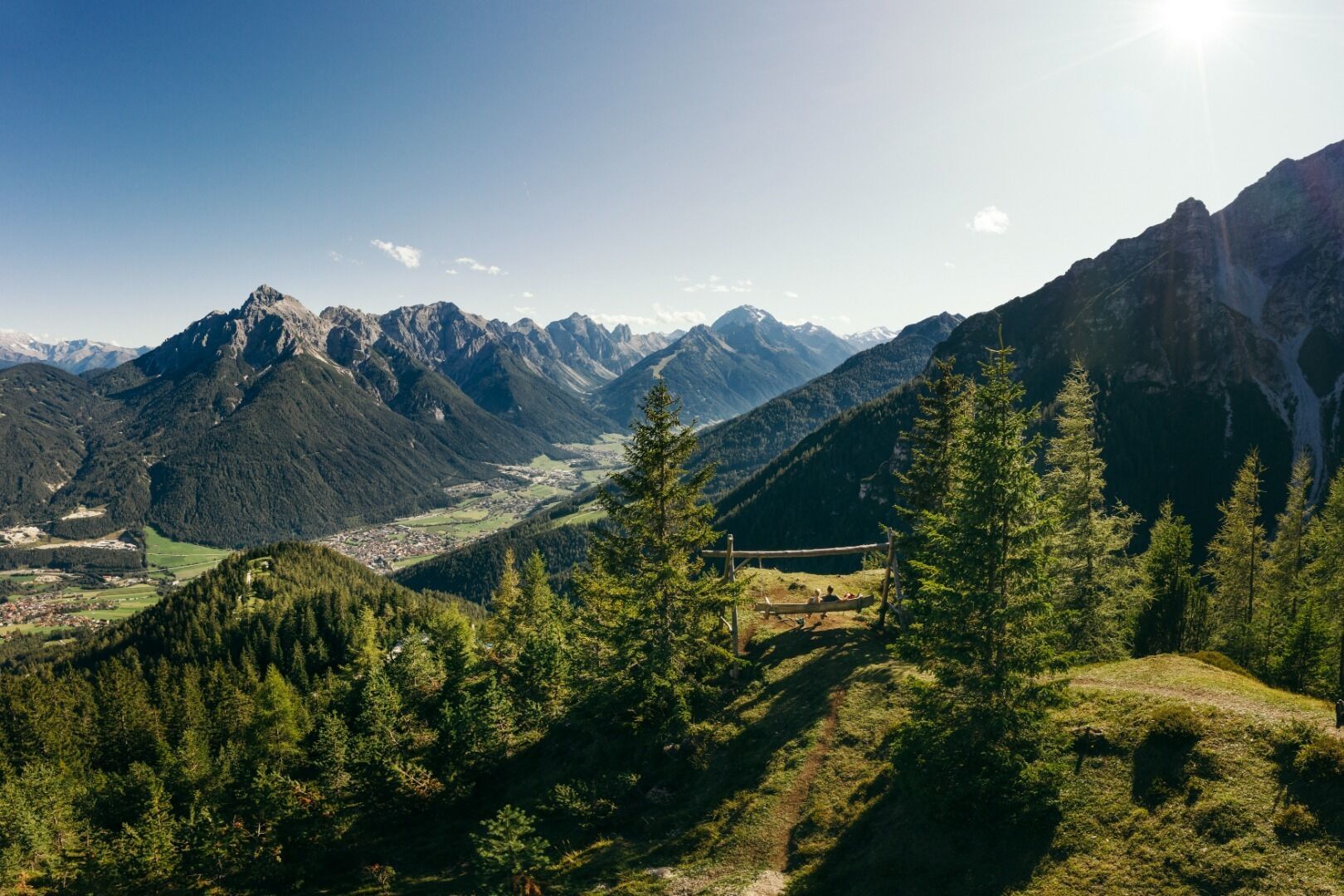
After a few metres of tarmac, the trail soon climbs quite steeply uphill; the roar of the Schlickerbach stream accompanies you all the way until just before we reach the Panorama Lake. Then over the Gloatsteig to the Berglerbründl, where you reach the highest point of the route. From there, you’ll find views aplenty in the constant ups and downs on the way to Pfarrachalm; the descent over Hirtensteig to Plöven and back to the starting point is again fantastic terrain for trailrunning.

Nearby huts and mountain restaurants

Getting here

  • Arrival by public transport

    Innsbruck main station, continue with the Stubaitalbahn or by bus to Fulpmes.

  • Parking

    From the olympic city Innsbruck the Stubai valley is accessible in 20 minutes via Brenner motorway, exit Schönberg forward to Fulpmes. The valley station Schlick2000 is well signposted in Fulpmes.
    Car park at the Schlick 2000 valley station.

Weather

Today

partly Cloudy
9°C/3°C
25%0l5 km/h

Fri

cloudy
14°C/3°C
65%4.9l10 km/h

Sat

light rain showers
6°C/0°C
50%2.3l5 km/h
Go to weather forecast

More tours in the surrounding area

  • Milderer Almentrail

    Length:20.7 kmDuration:5:12 hElevation uphill:1,564 m
Newsletter

The mountain is calling? So does our newsletter!

In our monthly newsletter we reveal the best holiday tips for Tyrol.