
Opening hours:Today closed
Place:Umhausen
:Alpine pasture / hut / mountain restaurant
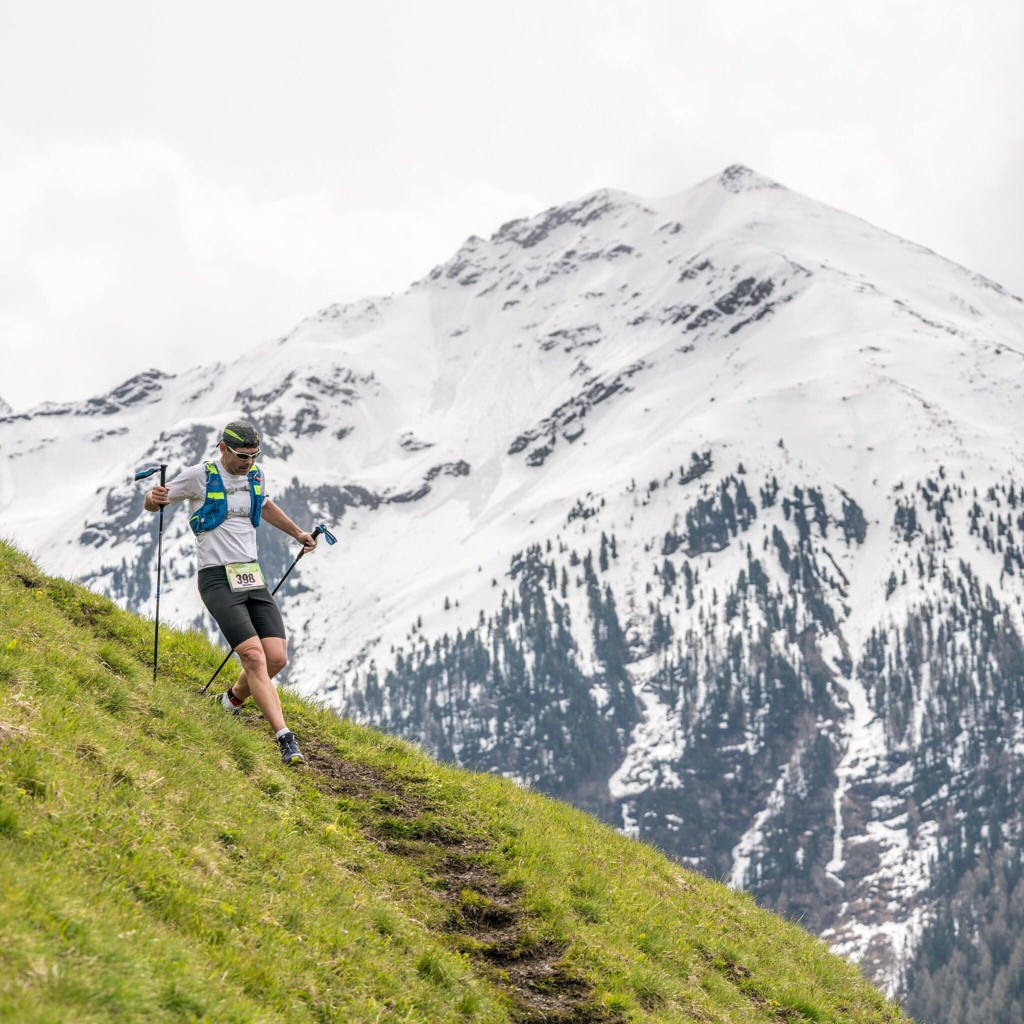
Challenging trail marathon along the highest waterfall in Tirol with a dreamy setting and beautiful panorama

In May, crossing snowfields may still be necessary. Therefore, inform yourself about the snow conditions along the route. During this period, carrying shoe spikes is recommended.
Alpine emergency number: 140
Stay safe!
Download the mountain rescue emergency app beforehand. If you need help, you can transmit your exact coordinates via the app.
EMERGENCY APP to download:
Android: https://play.google.com/store/apps/details?id=at.tirol_notfall&hl=de
iPhone: https://apps.apple.com/at/app/sos-eu-alp/id400099520
Since the Stuiben Trail 42K leads through high alpine terrain, the following equipment is recommended:
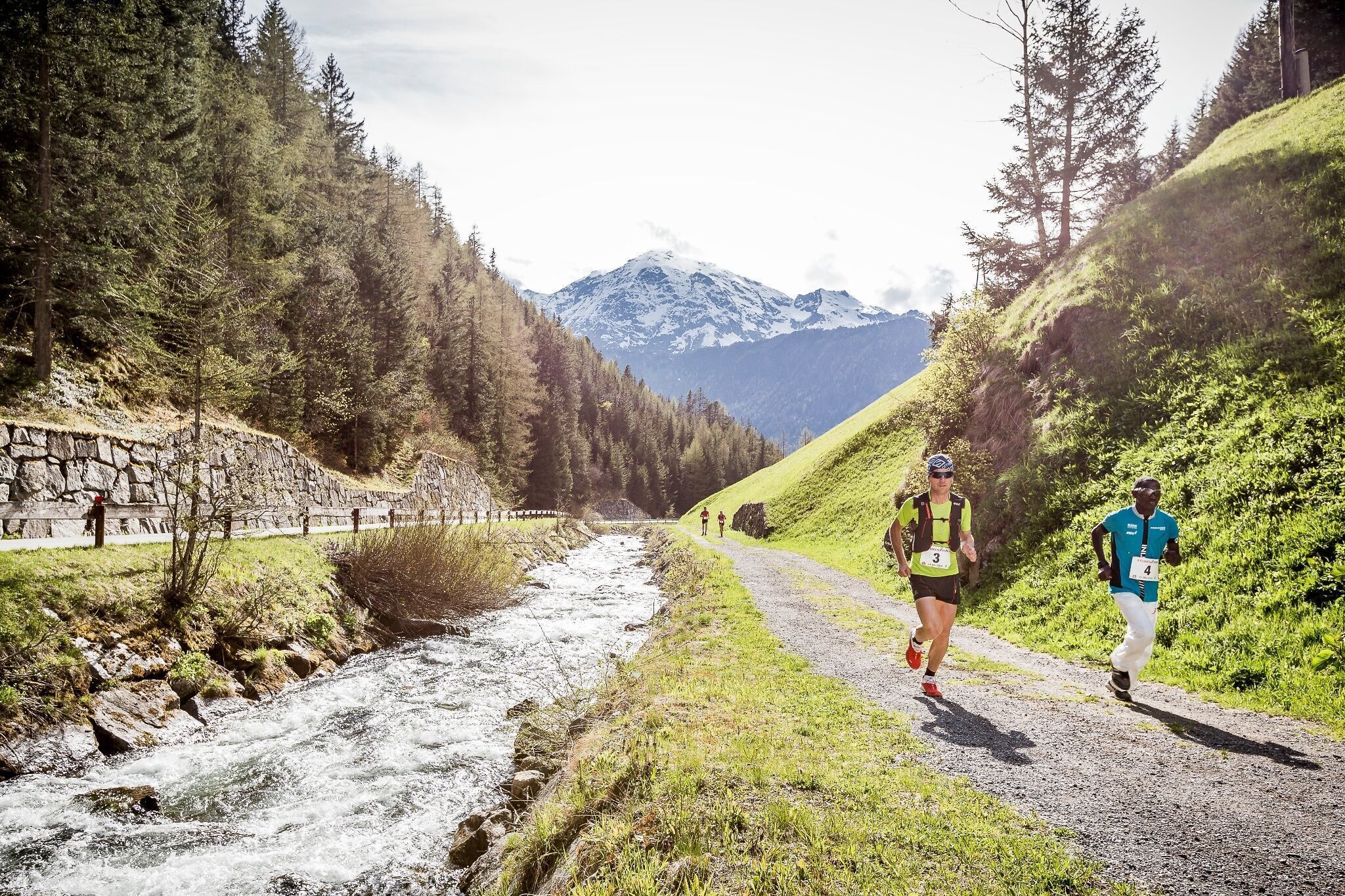
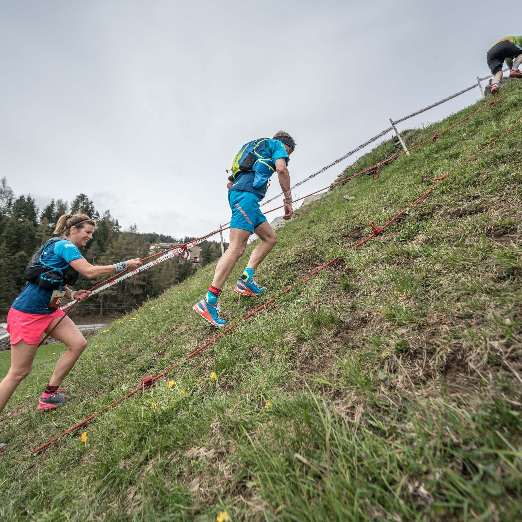
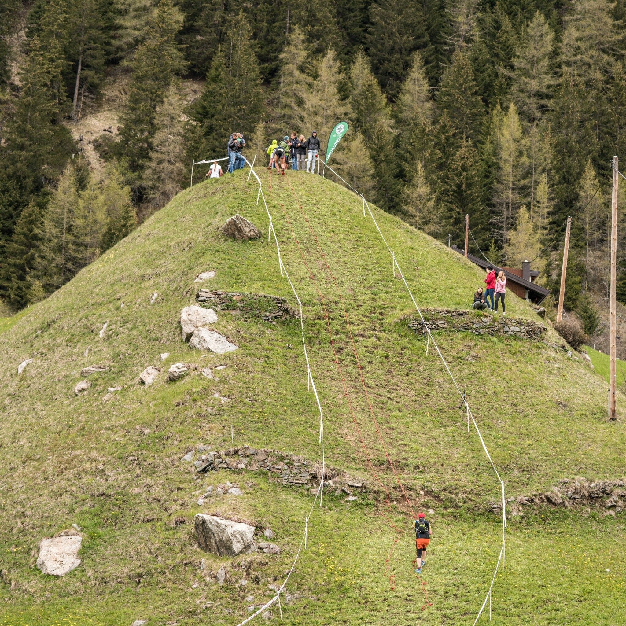
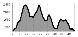
The start takes place in the center of Umhausen at an altitude of 1,036m. After one kilometer on asphalt and along the Wasserwaalweg, you reach the base of the Stuibenfall, where 728 spectacular natural and steel steps and a dreamlike backdrop await. Upon arrival in Niederthai, there is some time to rest before it steadily climbs steeply towards Narrenkogel. There, runners enjoy the panorama before a challenging single trail leads back down over the alpine meadows. A beautifully scenic trail over the Grastal leads to the Mahdebene at 2,392m, from where the route returns to Niederthai. After another ascent to the lower Hemerachalm, participants face another downhill stretch of 5km and 700m altitude difference. Upon reaching the Nösslach chapel, the route heads toward Wiesle and back to Niederthai. Here, the last reserves are required for the downhill stretch back to Umhausen. The final section of the race runs along the Steppsteig towards Stuibenfall and the village center.
Accessible by train and bus
Travel comfortably and safely by train. The final stop or exit point is ÖTZTAL train station. Afterwards, you can conveniently and quickly travel with public buses or local taxi companies to the municipality of Umhausen. From the "GH Andreas Hofer" stop, you reach the starting point at Murplatz after about 150m. The current bus schedule can be found at: fahrplan.vvt.at
Parking spaces are available directly at Murplatz Umhausen


