Strecke: Zams - Unterlochalpe - Württembergerhaus - Hinterstarkalpe - Alfutzalpe - Starkenbach
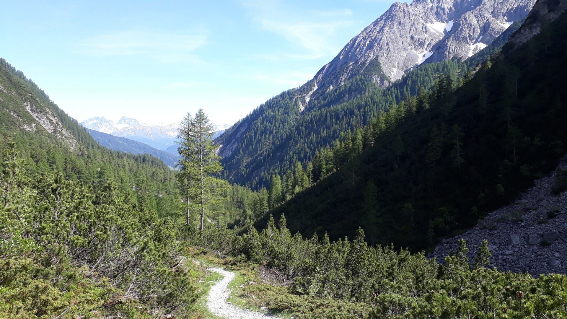
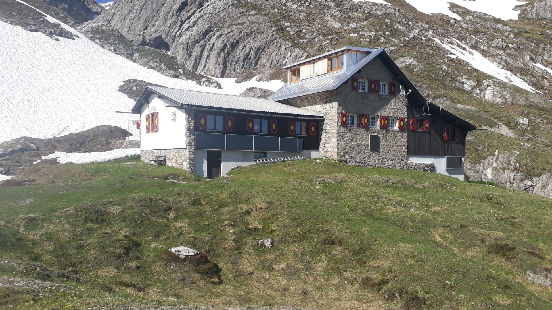
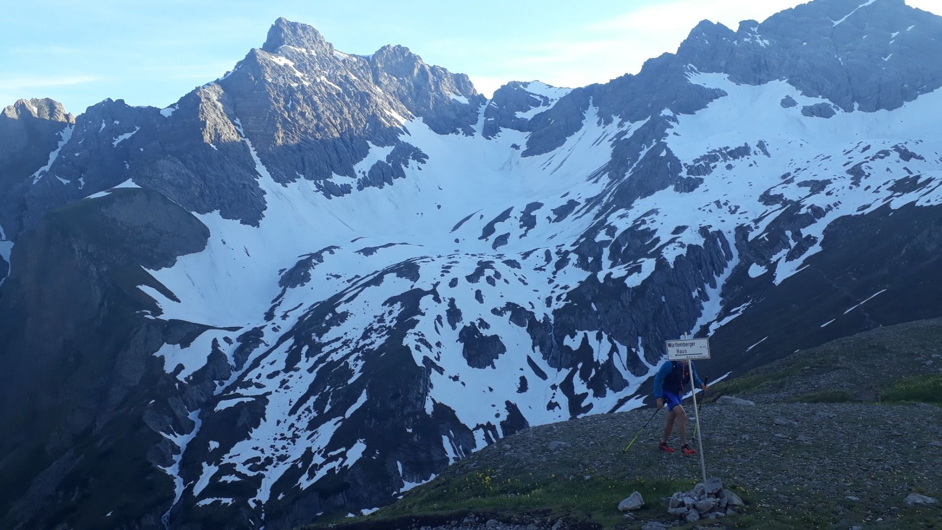
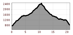
Start at the parking lot Zams/ Burschlwand the exit of the E5 long-distance trail. Follow the highway underpass for a short while and you will see the trail on the left side, direction Württembergerhaus. Follow this from now on. At the beginning steeply over the Haselwand (very nice view of Zams) into the Zammer Loch. After a few flat kilometers you arrive at the Unterlochalpe (snack station) there follow the signs to the right to the Württembergerhaus. From now on it goes steadily uphill until you reach the Württembergerhaus (2220 m). Passing the Württembergerhaus, the path forks and we follow the right side towards the Gebäudejoch. Passing the mountain lake (Auf der Lacke) we turn right again until we reach the highest point of the route, the Gebäudejoch (2452 m). From here you can throw the beautiful downhill over the Obere and Untere Gebäud. Also the Steinseehütte is glimpsed. Arrived at the Hinterstarkalpe, the path widens (= access road Steinseehütte) and you walk through the Starktal to the Alfutzalpe. From here, briefly follow the forest road before it goes again on a beautiful, fast downhill (Kopfsteig) towards Starkenbach.
