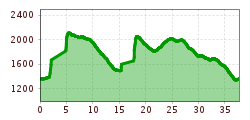
Open interactive mapOpen this POI on the interactive mapElevation profileDownload3-Länder Bike & Gondeltour.gpx
Milky Way Start.jpg © (c) Serfaus-Fiss-Ladis Marketing GmbH_Manuel Kokseder Milky WayOpening hours:openDifficulty:easyLength:2.9 kmGo to biketourGo to biketour: Milky Way
outdooractiveImport_67919192 © TVB Stubai Stubai Radroute 19Opening hours:openDifficulty:easyLength:24.0 kmElevation uphill:364 mGo to biketourGo to biketour: Stubai Radroute 19
Innsbruck to KühtaiDifficulty:difficultLength:110.0 kmDuration:4:30 hElevation uphill:1,600 mGo to biketourGo to biketour: Innsbruck to Kühtai
©-TVB-Tiroler-Oberland-Kaunertal-Daniel-Zangerl-2016-Gepatschhaus-(3).jpg © Daniel Zangerl Rolli-Wanderung GepatschhausLength:8.5 kmDuration:1:45 hElevation uphill:156 mSee trailSee trail: Rolli-Wanderung Gepatschhaus
The Chainless OneDifficulty:easyLength:7.6 kmDuration:0:10 hGo to biketourGo to biketour: The Chainless One
The First OneDifficulty:mediumLength:2.4 kmDuration:0:15 hGo to biketourGo to biketour: The First One
©-TVB-Tiroler-Oberland-Kaunertal-Michaela-Gasser-Mark-Handbikebattle-2017-8863.jpg © Michaela Gasser-Mark Handbike Route Kaunertaler GletscherDifficulty:difficultLength:27.5 kmDuration:4:00 hElevation uphill:1,500 mGo to biketourGo to biketour: Handbike Route Kaunertaler Gletscher
The Rough OneDifficulty:difficultLength:2.0 kmDuration:0:10 hGo to biketourGo to biketour: The Rough One
13 Zillertal-RadwegDifficulty:easyLength:30.5 kmDuration:2:00 hElevation uphill:125 mGo to biketourGo to biketour: 13 Zillertal-Radweg
495 - Singletrail Isskogel (495 Iss-Tough 1-2)Opening hours:openDifficulty:mediumLength:300 mDuration:0:06 hElevation uphill:9 mGo to biketourGo to biketour: 495 - Singletrail Isskogel (495 Iss-Tough 1-2)
491/492- Singletrail Isskogel (Iss-Flow 1-3)Opening hours:openDifficulty:easyLength:400 mDuration:0:08 hElevation uphill:1 mGo to biketourGo to biketour: 491/492- Singletrail Isskogel (Iss-Flow 1-3)
The Neue Magdeburger Hütte - MTB route (543)Difficulty:difficultLength:16.3 kmDuration:3:24 hElevation uphill:1,001 mGo to biketourGo to biketour: The Neue Magdeburger Hütte - MTB route (543)
Oberer Gerry TrailOpening hours:openDifficulty:mediumLength:1.2 kmGo to biketourGo to biketour: Oberer Gerry Trail
Nauders, Plamort Trail_Tirol Werbung_Schels Sebastian_Nauders (1) © Tirol Werbung | Sebastian Schels Plamort TrailOpening hours:openDifficulty:Very easyLength:2.5 kmGo to biketourGo to biketour: Plamort Trail
biken102_klammljoch_2019_(c)Erwin Haiden, bikeboard.at.jpg © Erwin Haiden, bikeboard.at Klammljoch - Defereggental No. 102Difficulty:mediumLength:22.0 kmDuration:3:30 hElevation uphill:946 mGo to biketourGo to biketour: Klammljoch - Defereggental No. 102
Dolomitenrundfahrt © Expa / Groder Around the Lienz DolomitesDifficulty:mediumLength:112.0 kmDuration:3:30 hElevation uphill:1,870 mGo to biketourGo to biketour: Around the Lienz Dolomites
Tux - Höllensteinhütte-Grieralm-RundeDifficulty:mediumLength:12.5 kmDuration:2:30 hElevation uphill:565 mGo to biketourGo to biketour: Tux - Höllensteinhütte-Grieralm-Runde
Moostal © TVB St. Anton am Arlberg Patrick Bätz Darmstädter HütteDifficulty:difficultLength:25.5 kmDuration:4:00 hElevation uphill:1,110 mGo to biketourGo to biketour: Darmstädter Hütte
web-wilder-kaiser-bergdoktorpraxis-ellmaul-sommer2022-mathaeusgartner-2©mathaeusgartner © Mathäus Gartner Wilder Kaiser cycle route no. 14Difficulty:mediumLength:38.3 kmElevation uphill:520 mGo to biketourGo to biketour: Wilder Kaiser cycle route no. 14
Kitzbüheler Horn, Tour Nr. 4Length:10.3 kmDuration:1:30 hElevation uphill:950 mGo to biketourGo to biketour: Kitzbüheler Horn, Tour Nr. 4
Supernatural Trail im Bikepark © © Serfaus-Fiss-Ladis Marketing GmbH SupernaturalOpening hours:openDifficulty:mediumLength:610 mGo to biketourGo to biketour: Supernatural
Rennrad Bike Rad © Erwin Haiden Chiemgau circuitDifficulty:mediumLength:176.1 kmElevation uphill:723 mGo to biketourGo to biketour: Chiemgau circuit
Söll_Hexenwasser_Hohe Salve_Wilder Kaiser © TVB Wilder Kaiser/Martin Raffeiner MTB Tour Söll - HochsöllDifficulty:mediumLength:5.1 kmElevation uphill:480 mGo to biketourGo to biketour: MTB Tour Söll - Hochsöll
St. Johann, Angerer Alm_Tirol Werbung_Bauer Frank_Sankt Johann in Tirol (1) © Tirol Werbung | Frank Bauer Angereralm - HarschbichlOpening hours:closedDifficulty:mediumLength:18.2 kmDuration:2:00 hElevation uphill:942 mGo to biketourGo to biketour: Angereralm - Harschbichl
Region-Hohe-Salve-Gravel-Bike-07-2025-Fotograf-Stefan-Ringler.jpg © Region Hohe Salve - Stefan Ringler Brixental cycling tour Nr. 21Difficulty:easyLength:46.7 kmDuration:3:30 hElevation uphill:450 mGo to biketourGo to biketour: Brixental cycling tour Nr. 21
Give feedback for a chance to win a special holiday experience!Click here for the surveyClick here for the survey


.jpg")


Andi Frank (247).jpg")


")
Erwin Haiden, bikeboard.at.jpg")

-min.jpg")


")

