

Place:Sölden
:Alpine pasture / hut / mountain restaurant
With views of Rettenbachferner, Schwarzsee and the three thousand meter peaks of the Stubai Alps, the Ollweite Line winds its way seemingly endlessly over berms, jumps and wooden elements - the perfect playground for experienced mountain bikers. A blocked stone field requires full concentration and provides pure adrenaline. Have your camera ready!
The Ollweite Line is one of the longest, most scenic and most fun trails in the Bike Republic Sölden - a flow experience with high standards. Block passages and the length of the route demand fitness and technique. A refreshment stop at the rustic Hühnersteign is worthwhile before the downhill fun continues seamlessly on the Ohn Line.
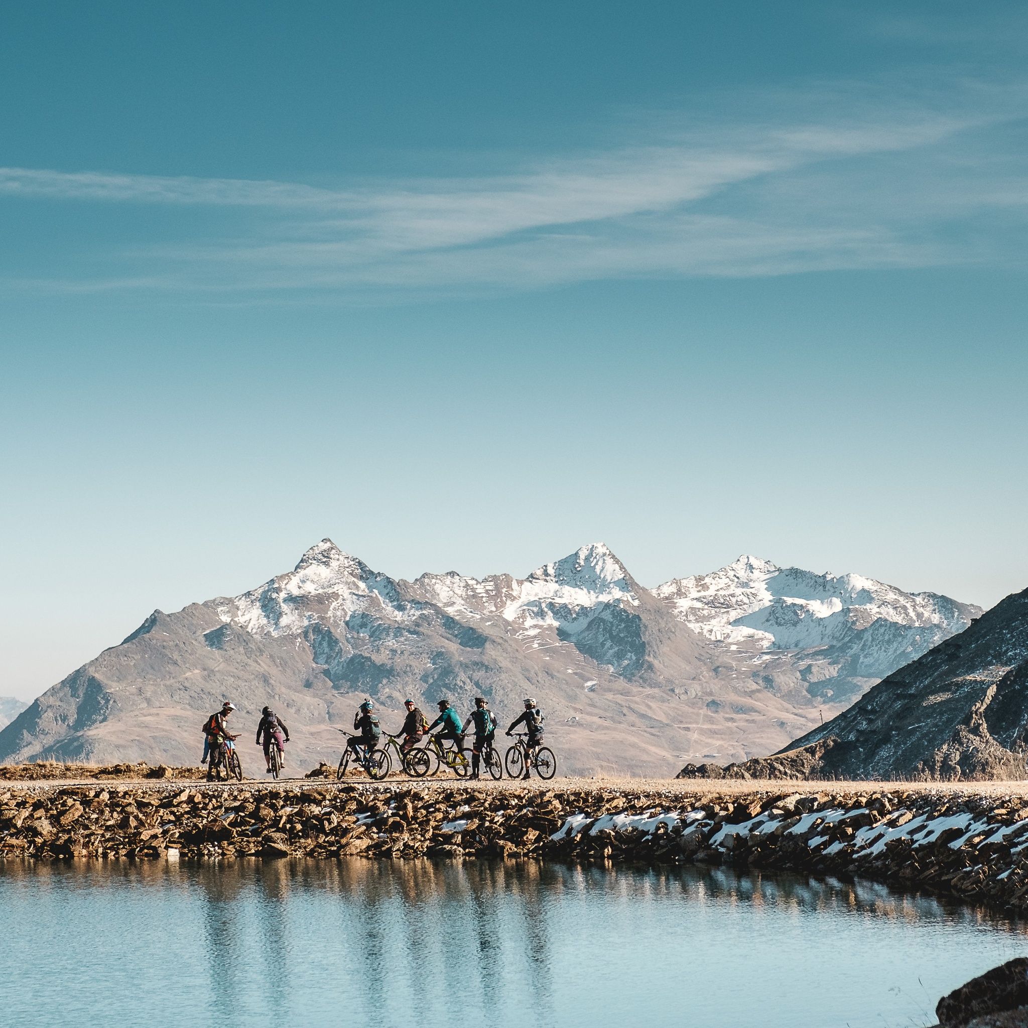


The OLLWEITE LINE is a red line that is physically and technically demanding. Take your time and use the rest areas along the way. There's plenty to see!
At BIKE REPUBLIC SÖLDEN, it's all about shared fun in bike sport - no matter your riding level. Be considerate of each other and support one another. Also, behave respectfully towards all other people on the mountain and in the valley - and towards nature.
–> Stay on the paved and signposted paths. Do not ride over open meadows!
–> Avoid locking the rear wheel and thus help preserve the paths.
–> Be considerate of animals and close the pasture gates. Cows may stand on the trails and lines from time to time. Ride carefully and keep your distance!
Well equipped rules! We recommend wearing MTB protective gear (helmet, protectors for knees, elbows, back, etc.) on all lines, trails, enduro routes, and mountain bike paths in the BIKE REPUBLIC SÖLDEN. All trails are exclusively intended for use with mountain bikes that meet today's quality standards.[ɔllvaiʔ̯ ə] “Ollweite” usually in connection with “auf”: af Ollweite. Ollweite in Ötztal dialect means outdoors, in open terrain, somewhere outside – and that's exactly what the OLLWEITE is. This varied line starts just below the Langegg mountain station and the Rotkogelhütte at 2,600 m (!) and offers a sensational view of the glacier and the world of the 3000m peaks.
The OLLWEITE winds down over 7 km to the Hühnersteign. Right at the start, the lake awaits as one of the classic photo spots. Then you go over dozens of cool berms, jumps, rocky fields (the legendary Rock Garden!), and wooden structures. OLLWEITE will challenge you both physically and technically.
The continuation leads briefly over the ski slope to the entrance of the OHN LINE, which takes you to the 12.5 km long Long Line Rotkogl. But you can also branch off earlier onto the TROALN LINE towards Giggijoch and take the 16 km (!!!) long Long Line Giggijoch.
And this is what it looks like: VIDEO OLLWEITE
Arrival by train
Travel easily by train to Ötztal train station at the valley entrance. A local bus departs directly from the station forecourt towards Obergurgl. The bus ride to Sölden takes about 1 to 1.5 hours. On the designated bike line buses, bike transport (including eMTBs) is free with a valid bus ticket.
All important information about bus schedules, connections, and taxi companies can be found here.
WHERE IS SÖLDEN?
Sölden is located in the west of Austria in the state of TIROL, in a southern side valley of the Inn valley – the ÖTZTAL.
Arrival from the west:
from Vorarlberg to Tirol via the Arlberg Pass or through the Arlberg tunnel (S 16) - Landeck - Autobahn A 12 towards Innsbruck - exit Ötztal after the Roppener Tunnel - B 186 (35km) to Sölden
from the north:
- Bad Tölz - Achen Pass - B 181 - Jenbach - A 12 Innsbruck direction Bregenz - exit Ötztal - B 186 (35km) to Sölden
- Pfronten - Reutte - Fern Pass - Imst - A 12 towards Innsbruck - exit Ötztal after Roppener Tunnel or B 171 Tiroler Straße to Ötztal (toll-free) - B 186 (35km) to Sölden
- Garmisch-Partenkirchen - Ehrwald - Lermoos - Fern Pass - Imst - A 12 towards Innsbruck - exit Ötztal after Roppener Tunnel or B 171 Tiroler Straße to Ötztal (toll-free) - B 186 (35km) to Sölden
- Garmisch-Partenkirchen - Mittenwald - Scharnitz - Seefeld in Tirol - Telfs - A 12 towards Bregenz - exit Ötztal or B 171 Tiroler Straße to Ötztal (toll-free) - B 186 (35km) to Sölden
from the east:
from Munich or Salzburg on the A 93 to Kufstein, then on the A 12 towards Bregenz, via Innsbruck to exit Ötztal, then continue on B 186 (35km) to Sölden
from the south:
coming from Bolzano towards Brenner (toll road) - Brenner Autobahn via the Schönberg toll station towards Innsbruck - from Innsbruck on A 12 towards Bregenz to Ötztal exit - continue on B 186 (35km) to Sölden
There are plenty of parking spaces available at the valley stations of the Gaislachkoglbahn and Giggijochbahn; parking garages are also available.Parking spaces are subject to a fee.
Paid overnight car parking is possible in the Gaislachkogl parking garage:
more information on overnight parking
Please respect that wild camping is prohibited!


