
Place:
Wildermieming
:
Alpine pasture / hut / mountain restaurant
:
vegetarian
Across the Steinernes Meer to the Neue Alplhütte

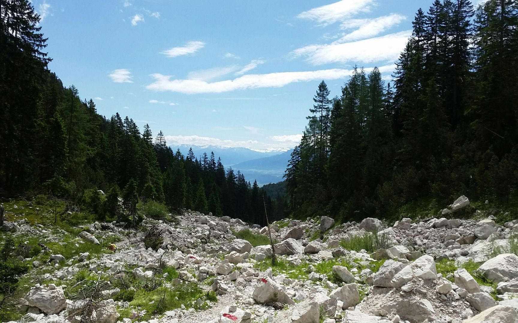
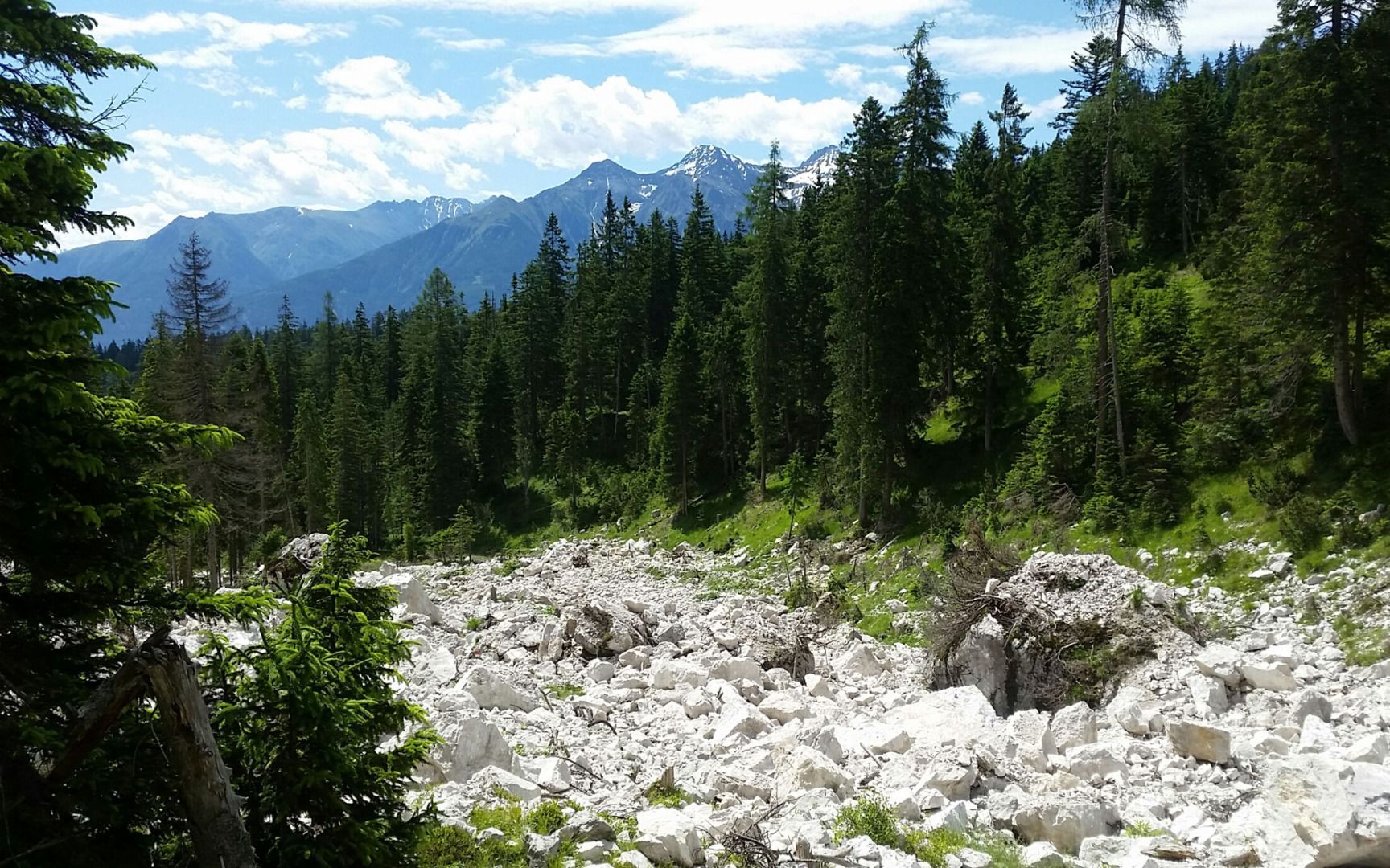
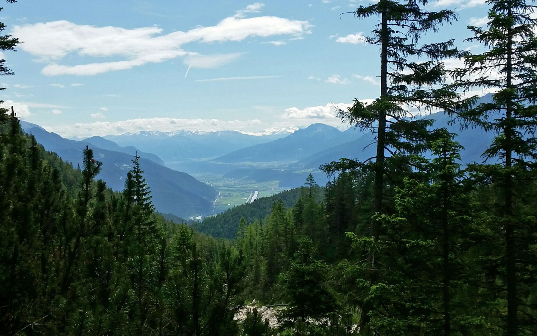
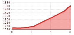
This hike starts from the car park above Telfs and initially leads past the barriers and along a relatively flat, wide forest road to the Straßberghaus mountain hut. From there, continue straight on past the hut and shortly afterwards, follow the signs for the Alplbachsteig "Steinernes Meer". Continue along the path as it follows a leisurely route along the stream and then finally snakes its way up through the forest to the Neue Alplhütte mountain hut. (For the hike back down, you can either double back along the same route or follow the forest road.)
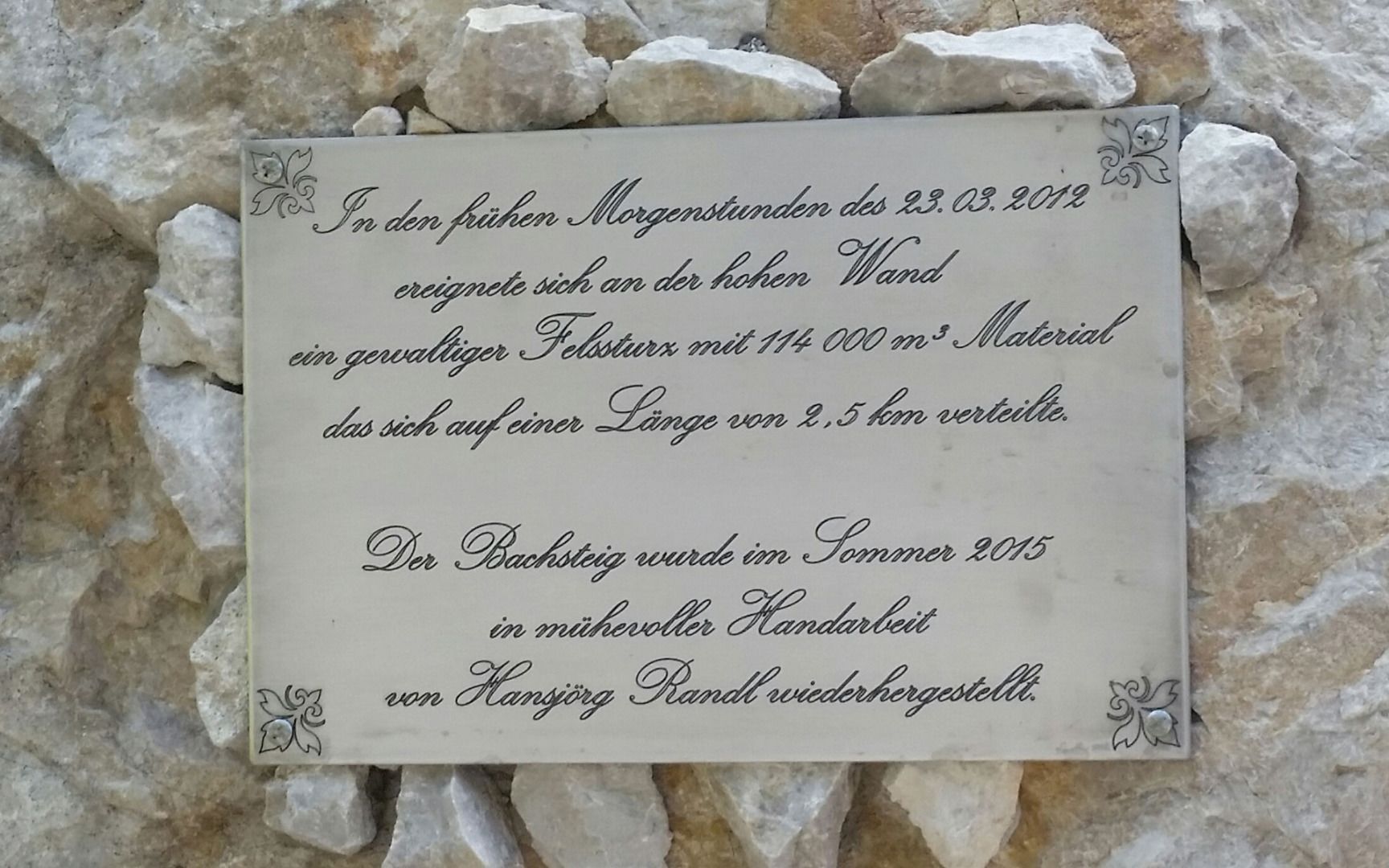
Information about the "Steinernes Meer" (Rocky Sea): The name of this area comes from a powerful rockfall that occurred on the 23 March 2012 near the so-called "Tote Wand" (Dead Wall) – the southern part of the "Hohe Wand" (2,721 m). Roughly 114,000 cubic metres of rock thundered two-and-a-half kilometres down into the Alpbach Valley. The path that leads up along the stream was lovingly restored by hand in summer 2015 by Hansjörg Randl from Telfs.


.jpg")
_WaLogo.jpg")


.jpg")

