
Opening hours:Open today
Place:Serfaus
:Alpine pasture / hut / mountain restaurant
Difficult tour on narrow trails with beautiful lakes.
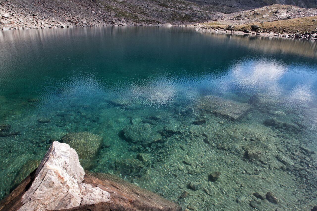
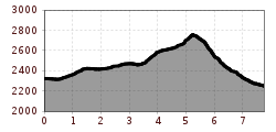
From the Lazidbahn top station (S301) on the broad trail to the Scheid (S217). At the signpost (S218) behind the cable car station turn onto the Murmeltiersteig 25a (Marmot Alpine Trail), go over the Kitzköpfl to the Furglersee lake (S211). Just behind the lake (S209) turn off in a northwesterly direction and hike over the Kanzel (trail no. 24) to the Oberer Glockhäuser lakes (S263) and via the Blankaseen lakes to the Glockscharte (S269). From here, descend northwards over some snowfields to the Ascherhütte.


 neu.jpg")


")


 (1).jpg")

.jpg")

")


