Mountain hikes Furgler (3,004 m) starting from Komperdell

closed
Serfaus / Samnaungruppe
Difficulty ratings: difficult
Route length: 5.2 km
Duration: 4:00 h

Tyroleans are actually very decisive people. But we are simply prone to ridge walks. The Furgler is more difficult via the north ridge, but also much more exciting than via the normal route.

Tour character

Beautiful high mountain tour over the Furglersee lake to the Furgler in the Samnaun group, which offers great views. From the Furglerjoch, access the blocked north ridge, which leads to the summit with moderate climbing and few rope protections. The easier descent via the normal route, which also leads back to the starting point, can also be chosen as a traverse. Basic alpine experience, surefootedness and a head for heights are essential for this alpine mountain tour. If this variant is too difficult for you, you can also choose the normal route on the ascent.

Tour information

  • Requirement: difficult
  • Length: 5.2 km
  • Duration: 4:00 h
  • Elevation uphill:1,047 hm
  • Elevation downhill:38 hm
Highest point2,869 m

Starting point

Komperdell top station

Finishing point

Furgler

Best time of year

  • January
  • February
  • March
  • April
  • May
  • June
  • July
  • August
  • September
  • October
  • November
  • December
Source: Serfaus-Fiss-Ladis

Description

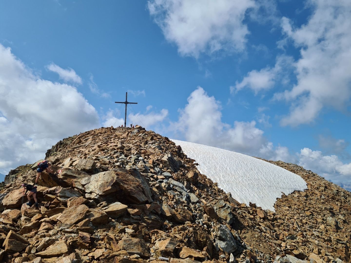
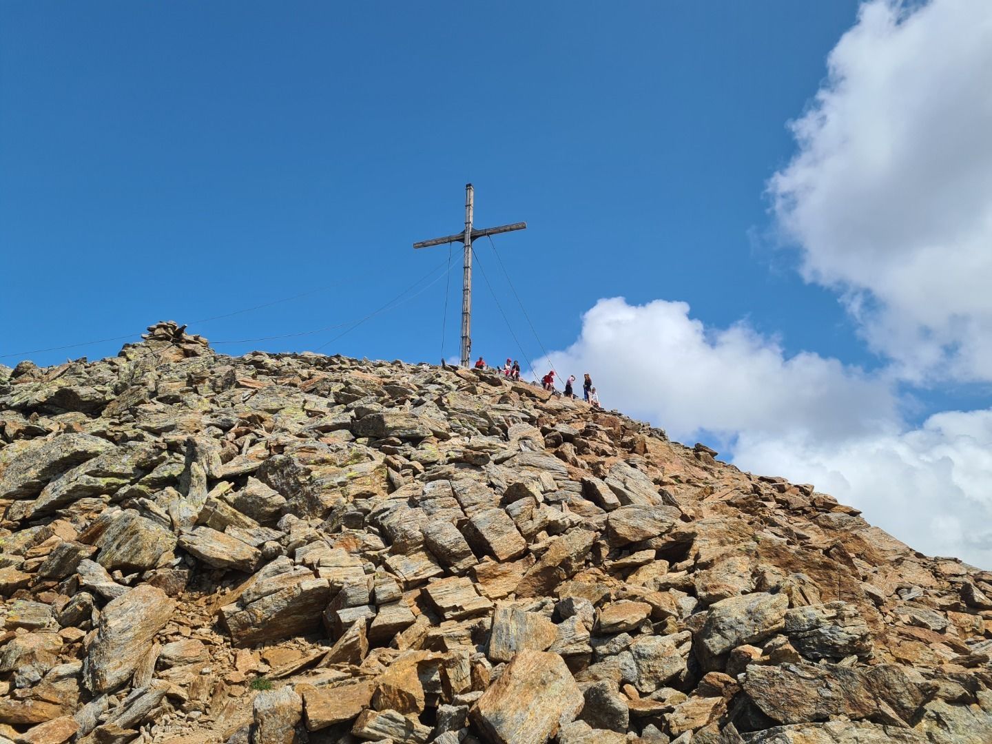
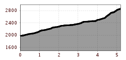
From the Komperdellbahn top station (S201) short and steep ascent northwestwards then gradually ascending in a westerly direction. Identical with Weitwanderweg trail 702 to the Furglersee lake (S211). From the Furglersee lake you ascend westwards through the usually snowy Furglertal valley between the Furgler (left) and Kleiner Furgler (right) over scree to the Furglerjoch (2,748 m, S212). From here, go over the north ridge (sometimes leaving the ridge) in an easy bit of climbing to the summit (S213).

Nearby huts and mountain restaurants

More tours in the surrounding area

  • Wild Animals Trail

    Opening hours:closed
    Difficulty:easy
  • Marmot Trail

    Opening hours:closed
    Difficulty:easy
    Length:573 mDuration:0:20 hElevation uphill:12 m
  • Fiss to the Oberen Sattelkopf

    Opening hours:closed
    Difficulty:medium
    Length:5.6 kmDuration:3:00 hElevation uphill:1,079 m
  • Forscherpfad

    Opening hours:closed
    Difficulty:easy
    Length:3.4 kmDuration:1:30 hElevation uphill:219 m
  • Murmeltiersteig (Marmot alpine trail)

    Opening hours:closed
    Difficulty:medium
    Length:6.9 kmDuration:3:00 hElevation uphill:302 m
  • Six Senses trail

    Opening hours:closed
    Difficulty:easy
    Length:6.5 kmDuration:4:00 hElevation uphill:99 m
  • Six Senses trail

    Opening hours:open
    Difficulty:easy
    Length:5.7 kmDuration:4:00 h
Newsletter

The mountain is calling? So does our newsletter!

In our monthly newsletter we reveal the best holiday tips for Tyrol.