Arrival by public transport
Dienstags mit dem Wanderbus Lienzer Dolomiten.
Circular hike - Pustertal Alpine hike
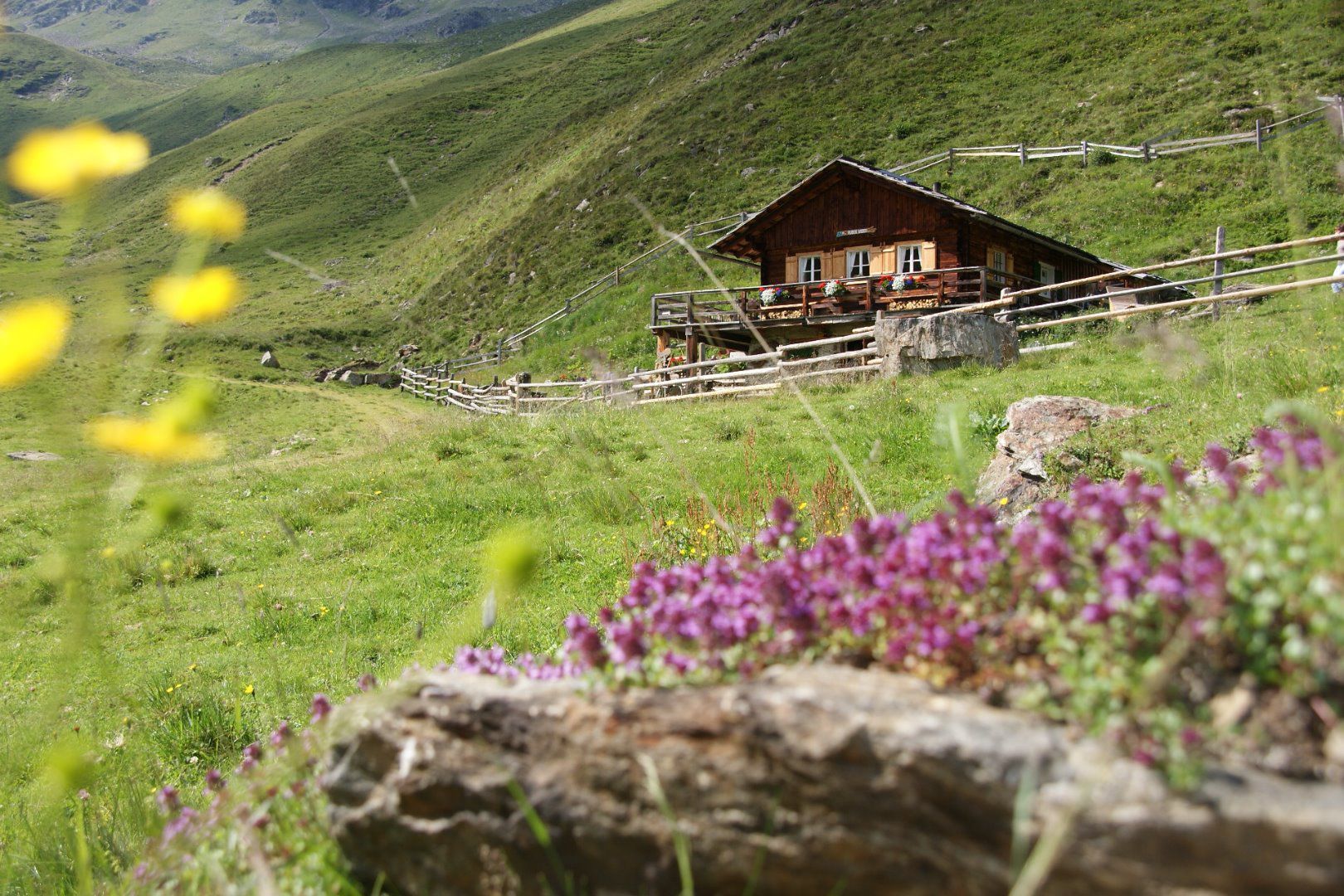
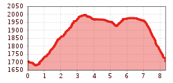
Anyone who wants to walk with their mind focussed on relaxation is best to enjoy a hike on the Pustertal Alpine path and take pleasure in coming across the rare flora and fauna of this area. The charming Alpine trail is located above Pustertal’s sun terrace and is accessible from several points. You also come across a variety of Alpine lodges here, called "Kasern" by the locals. From the car park after the gate, proceed across Gampenbach bridge, continue right, where the route alternates between standard path and steep passage sections up to the Waldhuber Kaser at 2002m.
At Waldhuber Kaser proceed left, heading in a westerly direction along the path to Huber Kaser at 1950m. The Pustertaler Höhenweg then proceeds south-west to Gampener Kaser 1963at m, from there head back down to the starting point on the steep farm route at Gampenbach.
Dienstags mit dem Wanderbus Lienzer Dolomiten.
Parkplatz Pedretscher Kaser


