
Opening hours:Open today
Place:Erl
:Alpine pasture / hut / mountain restaurant
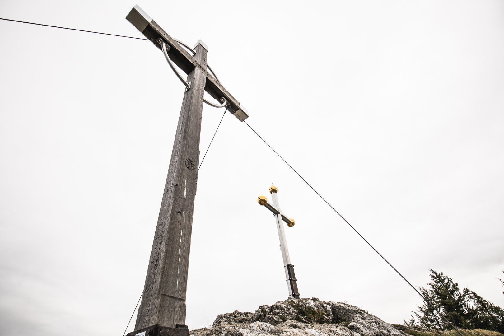
Two summit crosses have stood on the popular Kranzhorn viewing platform since 1900: the wooden one for Tyrol and the metal one for Bavaria. Border rivalry? No way! Everyone here is united by a love of beautiful mountain nature!
The easiest route leads from the Erler Bergstraße to the Kranzhorn (1,365 meters). From the signposted parking lot, you can reach the two summit crosses after just one hour via a comfortable, easy-to-walk forest path. The more athletic alternative leads from the Erler district via mountain paths to the summit in around two hours. At the top, you can meander wonderfully with a magnificent view.
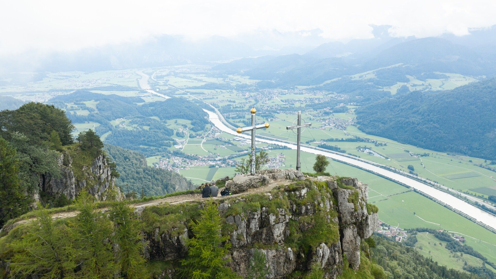
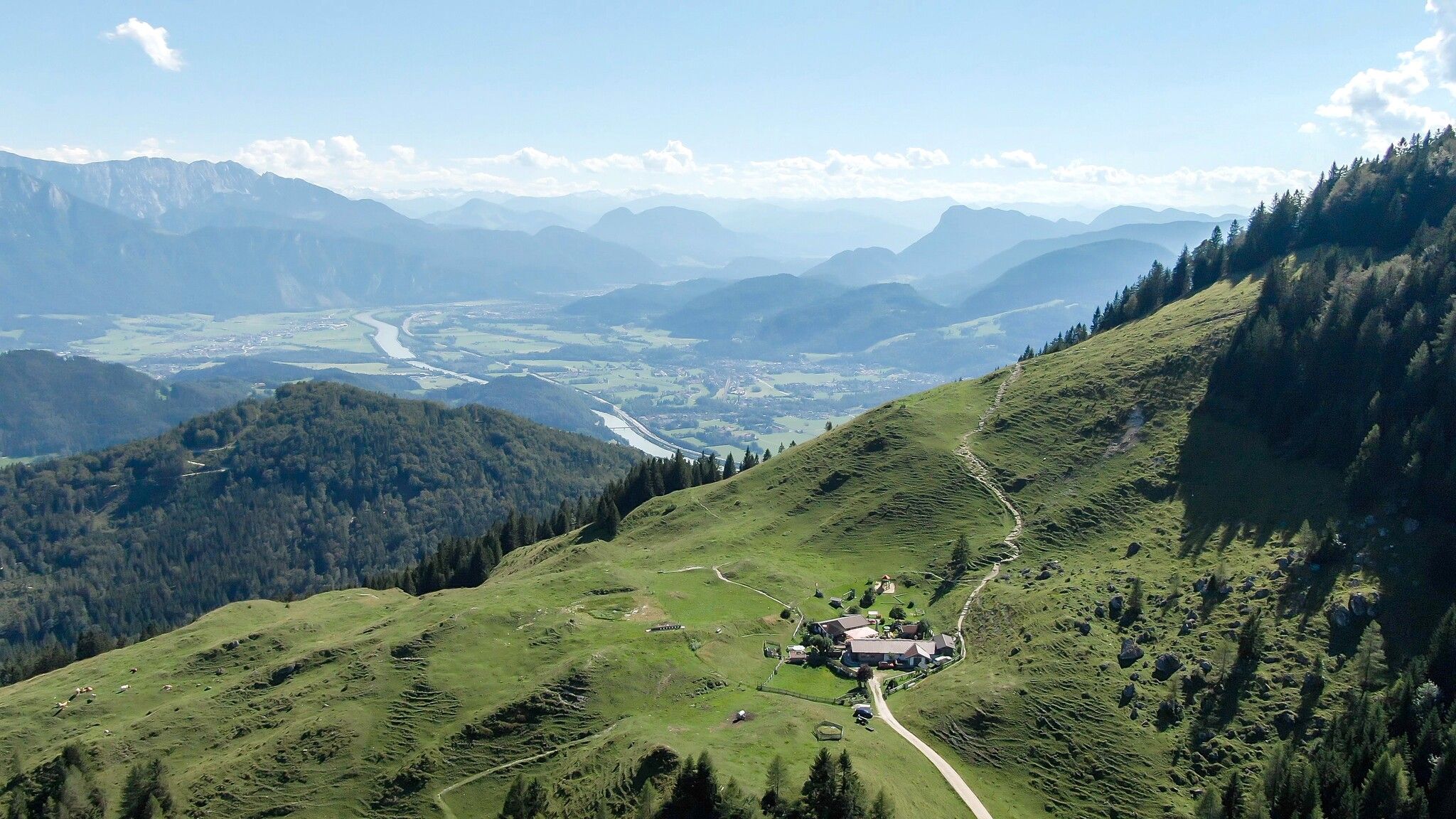
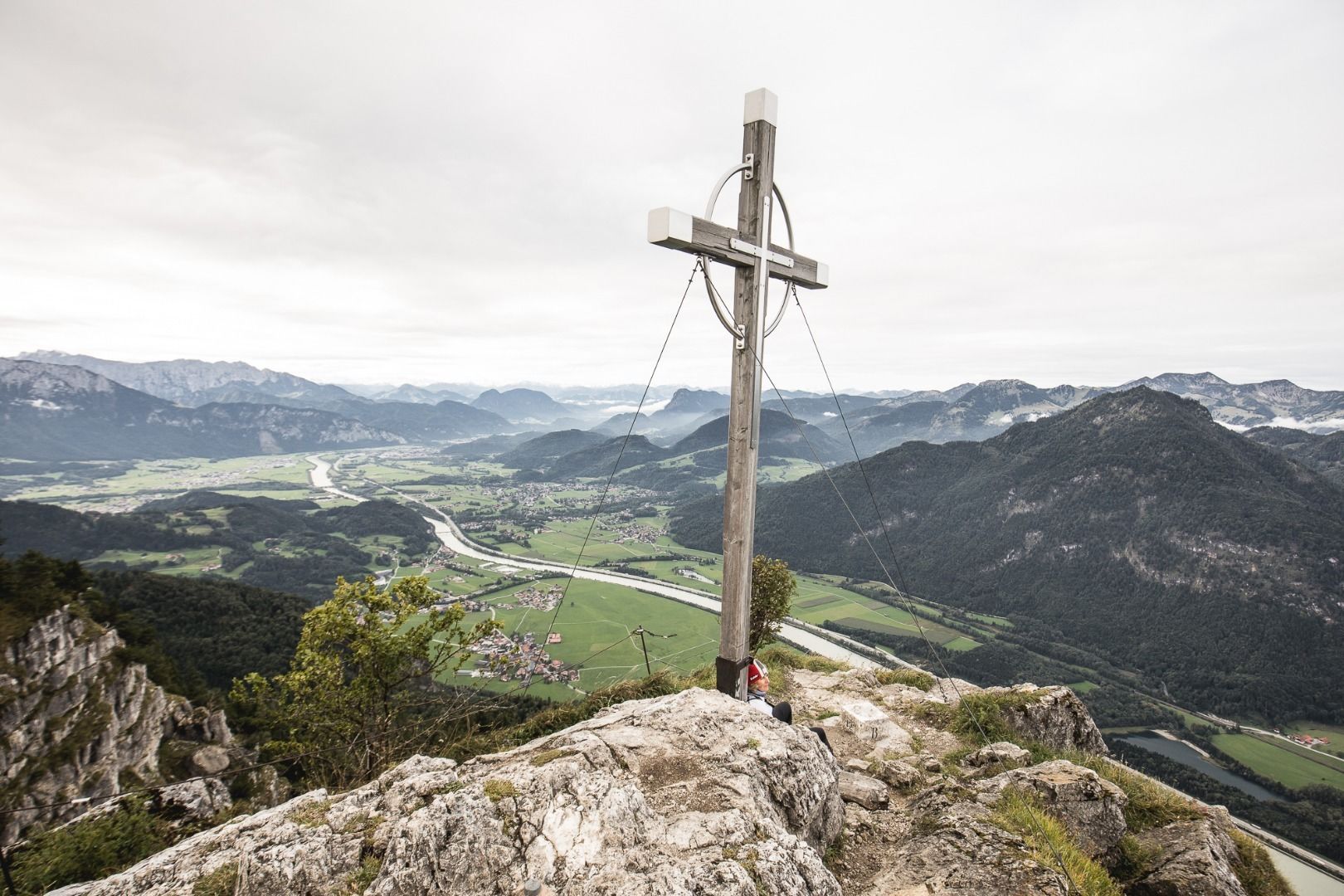
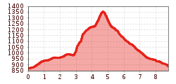
Starting from the upper Kranzhorn parking lot, the hike initially follows a gentle, ascending trail through the forest along the mountain. After nearly 3 kilometers, you reach the so-called Kranzhornsteig, where a steep and brisk climb gains significant elevation. Above the Kranzhornalm, the path continues over well-trodden trails up to the summit with its two crosses. From the top, you are rewarded with an impressive view of the rolling Bavarian foothills and the rugged Tyrolean mountains. The descent follows the same route back to the Kranzhornalm.
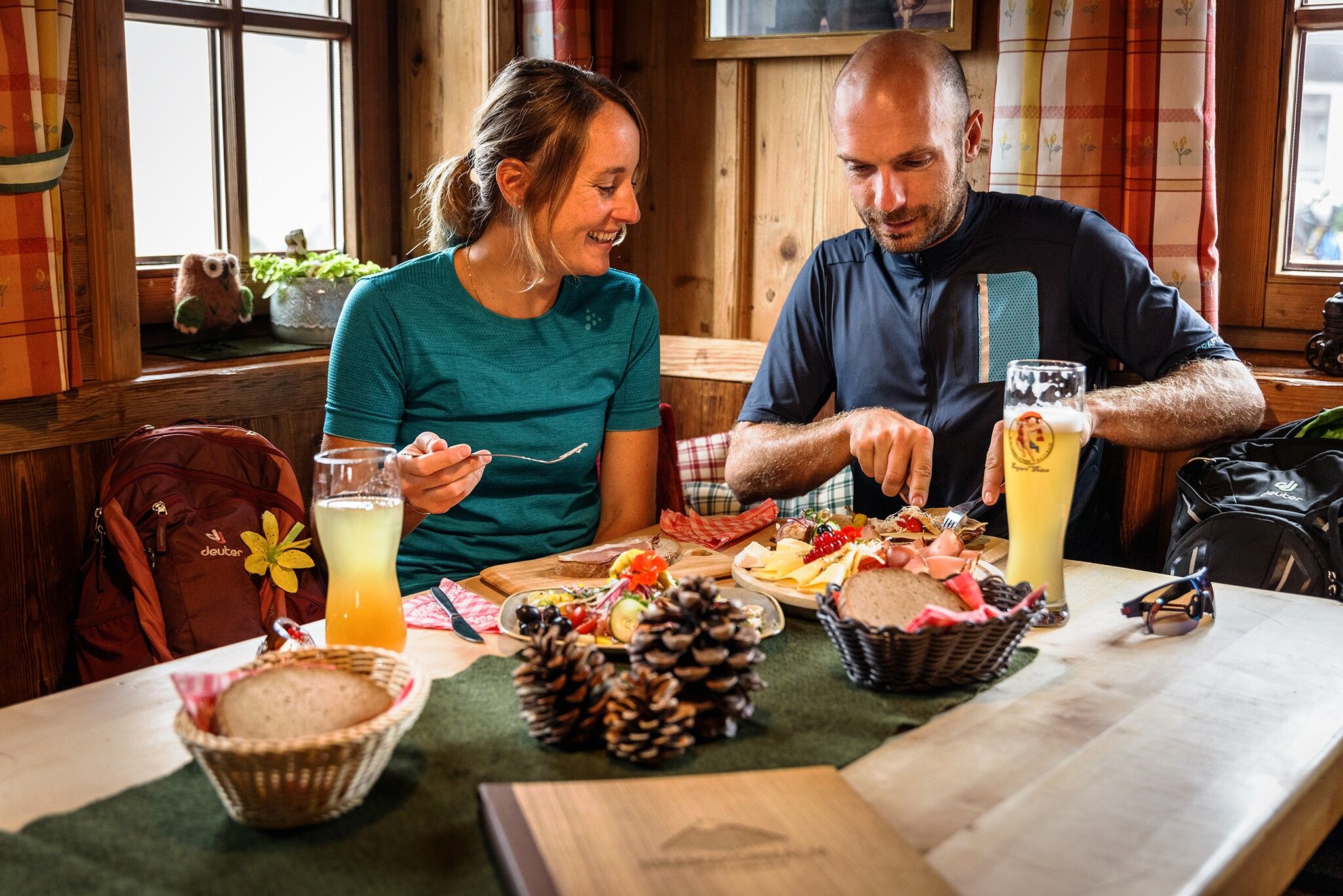
At the Kranzhorn hut, the Alm operated by Mich and Inge Anker, you’ll find traditional Tyrolean fare, as well as coffee and cake for refreshment. A petting zoo, playground, and “dog bar” ensure a great experience for young guests and four-legged friends alike.
The descent leads directly from the Alm over a gravel forestry and mountain pasture road, initially steeper, then gradually leveling out past the Hintermoar Alm back to the parking lot.
For public transportation, Bus Line 4036 takes you to the “Erl Dorf” stop, from where you will need to hike up on foot. From here, it is advisable to take the Kranzhornsteig trail all the way to the summit, with an ascent of about 900 meters. With the KufsteinerlandCard, you can ride buses for free within the region.
Wanderparkplatz Spadau, paid parking.
Wanderparkplatz Kranzhorn, paid parking.


")


.jpg")
.jpg")

