Mountain hikes Schwaigberghorn past Feldalphorn

closed
Hopfgarten im Brixental / Kitzbühel Alps
Difficulty ratings: medium
Route length: 17.8 km
Duration: 6:00 h

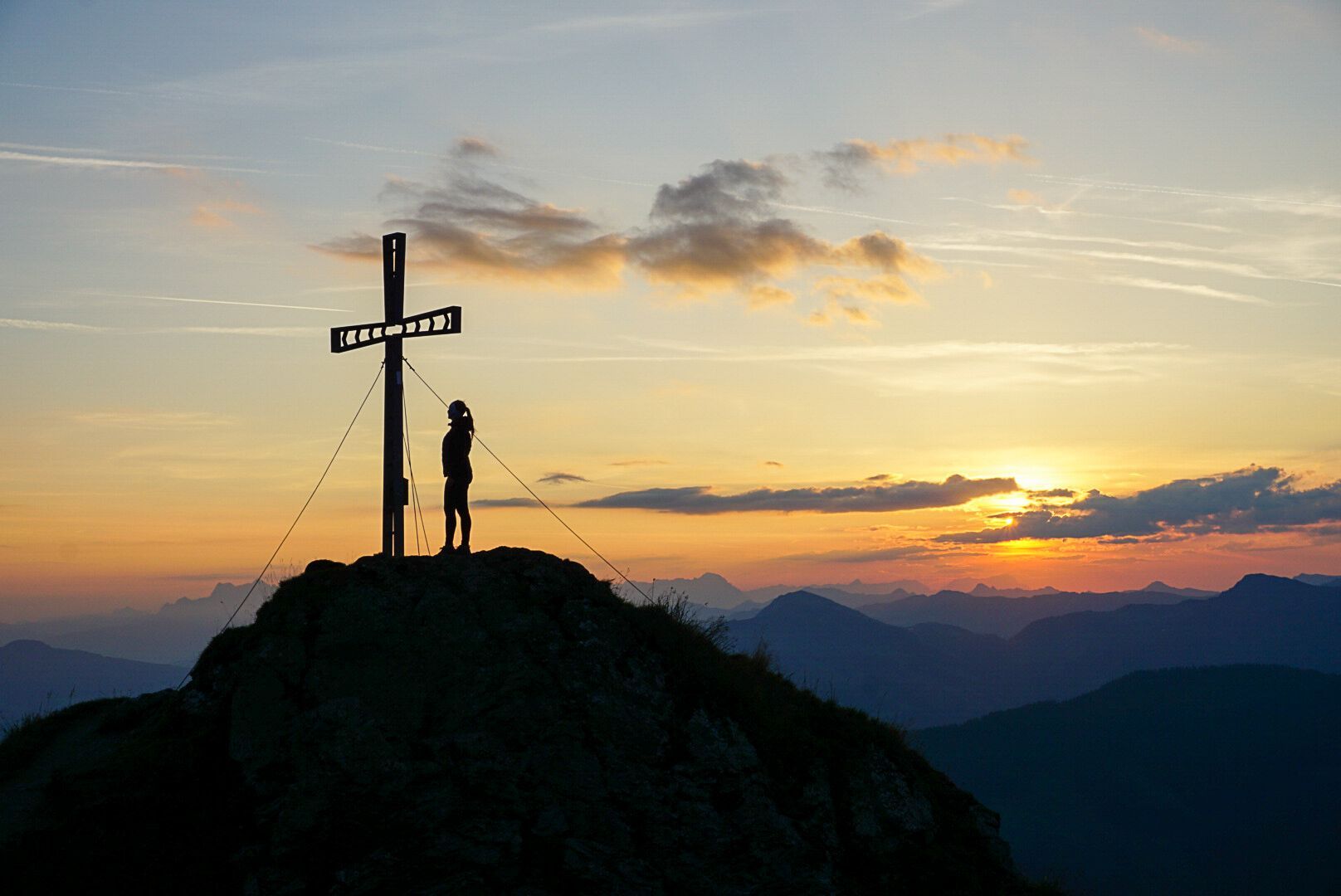
A delight in unspoilt nature - a circular tour from the Feldalphorn to the Schwaigberghorn back down into the valley

Tour information

  • Requirement: medium
  • Length: 17.8 km
  • Duration: 6:00 h
  • Elevation uphill:1,290 hm
  • Elevation downhill:1,290 hm
Highest point1,990 m

Starting point

Car park Kelchsau-Unterdorf

Finishing point

Car park Kelchsau-Unterdorf
  • Fitness level 3 / 6
  • Technique 3 / 6

Features

  • Circular route

Best time of year

  • January
  • February
  • March
  • April
  • May
  • June
  • July
  • August
  • September
  • October
  • November
  • December

Trail condition

Asphalt, forest path, hiking path

Equipment

Outdoor clothing, sturdy shoes
Sufficient food and drink
First aid kit
Mobile phone with full battery & charger Hiking map & guide literature possibly GPS device or GPS data to be loaded onto the mobile phone
Sun protection (sunglasses, sun cream & cap)
Rain protection
Cash
Source: Kitzbüheler Alpen Management GmbH

Description

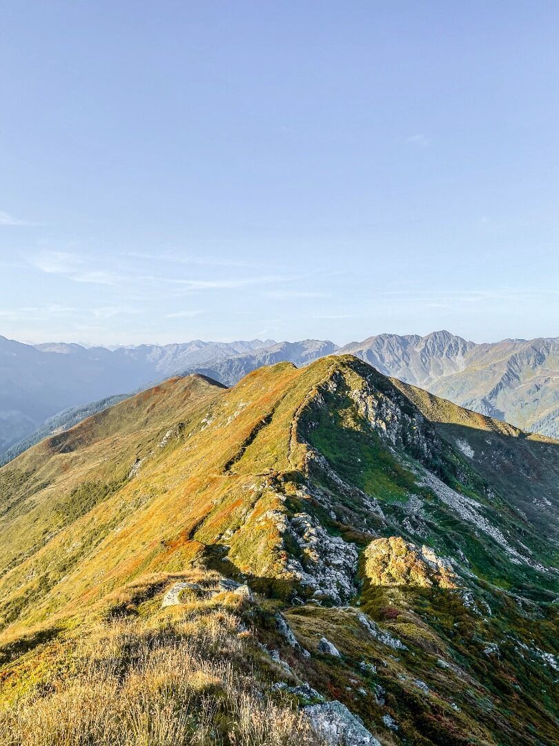
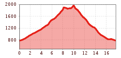
The starting point of this hike is the parking lot at the former Hofstattbahn in Kelchsau. From there you hike through the village to the Kehlbach bridge and turn right in the direction of Feldalphorn (No. 74). Along the road you hike up to the Höhenbrandalm and further to the Trockenbachalm. Then follow the signs No. 74 to the summit of the Feldalphorn (1923 m). From the Feldalphorn, follow signpost no. 75 to the next point of the tour, the Schwaigberghorn (1990 m).
Passing the Neustattalm and the Alpmessaualm, you walk along mountain paths and forest roads back to the starting point (No. 75). 

During the tour there is no possibility to stop for refreshments. We therefore recommend that you take enough food and drink with you. 

Nearby huts and mountain restaurants

  • Trockenbachalm

    Opening hours:Today closed
    Place:Hopfgarten im Brixental
    :Alpine pasture / hut / mountain restaurant

Getting here

  • Arrival by public transport

    bus: Kelchsau Hofstattbahn

    Guest card of the region = train ticket from Wörgl to Hochfilzen + bus ticket from Mariastein to Kitzbühel included

    More detailed information: www.hohe-salve.com/mobility
     

  • Parking

    Car park Kelchsau-Unterdorf

More tours in the surrounding area

  • Schafsiedel

    Difficulty:medium
    Length:15.6 kmDuration:6:45 hElevation uphill:1,280 m
  • Auenweg Niederau

    Difficulty:easy
    Length:1.0 kmDuration:0:30 hElevation uphill:31 m
  • KAT WALK FAMILY

    Difficulty:medium
    Length:52.5 kmDuration:2 daysElevation uphill:3,390 m
  • 2nd stage KAT Walk Alpine

    Difficulty:medium
    Length:18.0 kmDuration:8:00 hElevation uphill:1,140 m
  • 1st stage KAT Walk Alpine

    Difficulty:medium
    Length:20.0 kmDuration:6:00 hElevation uphill:800 m
  • KAT WALK ALPINE

    Difficulty:medium
    Length:113.0 kmDuration:6 daysElevation uphill:6,300 m
  • KAT WALK COMPACT

    Difficulty:medium
    Length:83.0 kmDuration:5 daysElevation uphill:5,462 m
  • 1st stage KAT Walk Kompakt

    Difficulty:medium
    Length:14.2 kmDuration:7:15 hElevation uphill:1,212 m
Newsletter

The mountain is calling? So does our newsletter!

In our monthly newsletter we reveal the best holiday tips for Tyrol.