Mountain hikes The Speckbacherweg trail

Tulfes / Tuxer Alpen
Difficulty ratings: easy
Route length: 16.4 km
Duration: 4:30 h

The Speckbacherweg trail

Tour information

  • Requirement: easy
  • Length: 16.4 km
  • Duration: 4:30 h
  • Elevation uphill:816 hm
  • Elevation downhill:633 hm
Highest point1,333 m

Starting point

Tulfes

Finishing point

Ellbögen/St. Peter

Best time of year

  • January
  • February
  • March
  • April
  • May
  • June
  • July
  • August
  • September
  • October
  • November
  • December

Trail condition

mostly meadow trails, forest trails and gravel trails, partly asphalt
Source: Region Hall - Wattens

Description

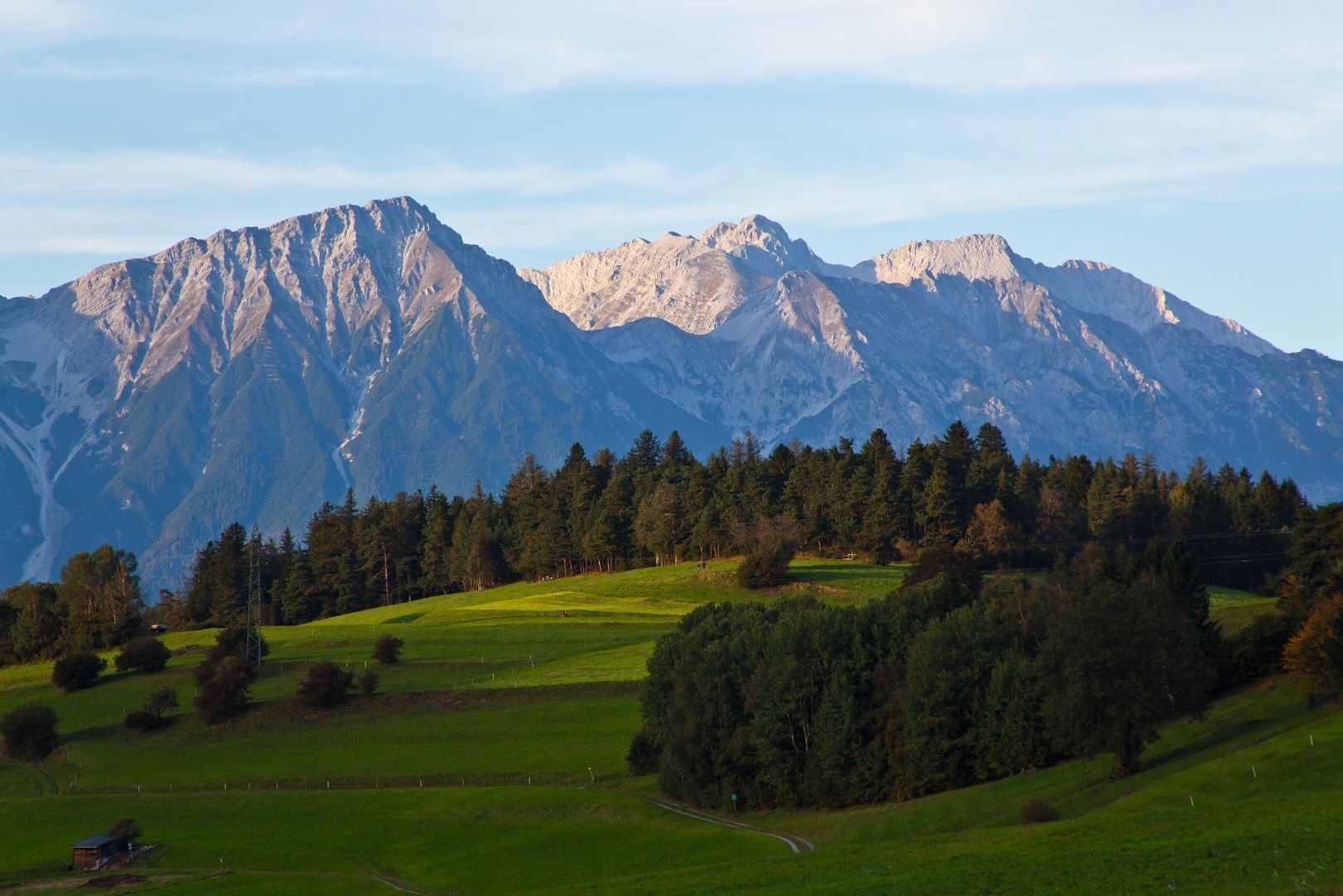
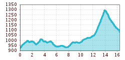
The Speckbacherweg is a path that begins in the village of Tulfes and stays near the lower edge of the forest. It leads past the golf course in Rinn, through alpine meadows and fields to the village of Sistrans, on to the Olympic bobsleigh and luge track in Igls and towards the Goldbichl archaeology trail. The last stretch leads along the edge of the forest above the village of Patsch to St. Peter, where this beautiful and varied hiking trail comes to an end. The Speckbacherweg covers the entire length of the southeastern alpine plateau. It can of course also be walked in the opposite direction, starting in St. Peter/Ellbögen.

Nearby huts and mountain restaurants

More tours in the surrounding area

Newsletter

The mountain is calling? So does our newsletter!

In our monthly newsletter we reveal the best holiday tips for Tyrol.