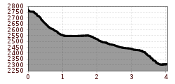
Mountain hikes Valluga - Kapall (Teilstrecke Lechtaler Höhenweg)

St. Christoph am Arlberg / Lechtaler Alpen
Difficulty ratings: difficult
Route length: 4.0 km
Duration: 2:00 h

Valluga - Kapall (Teilstrecke Lechtaler Höhenweg)

Tour information

  • Requirement: difficult
  • Length: 4.0 km
  • Duration: 2:00 h
  • Elevation uphill:30 hm
Highest point2,771 m

Starting point

Vallugagrat

Finishing point

Kapall

Best time of year

  • January
  • February
  • March
  • April
  • May
  • June
  • July
  • August
  • September
  • October
  • November
  • December

Trail condition

Panoramic hike

Equipment

Good walking boots, poles and drinks/snacks, rain jacket, sun protection
Source: St. Anton am Arlberg (Region)

Description

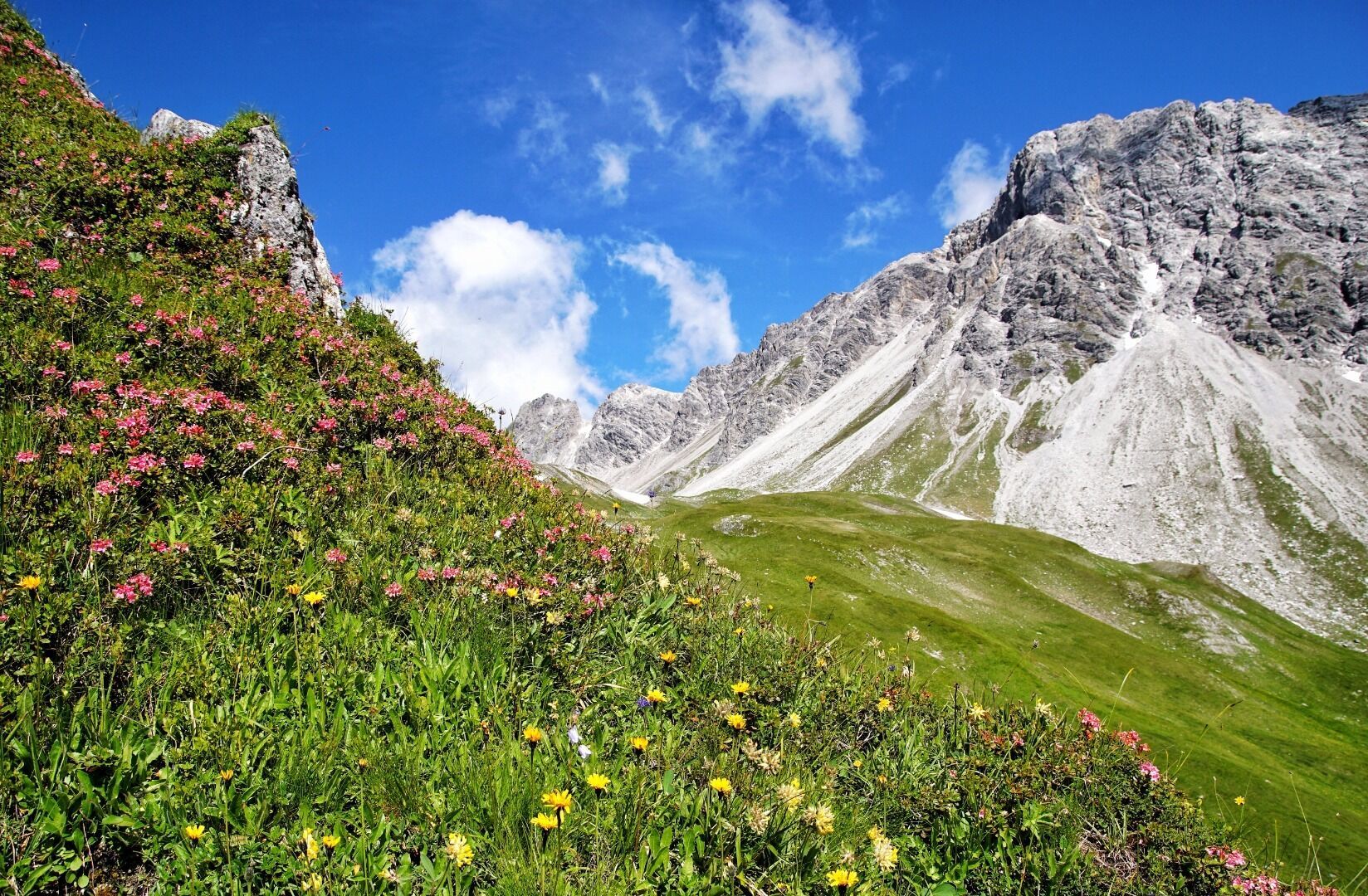
From the Vallugagratbahn mountain station, head down the snow field along the switchbacks to the Valfagehrjoch. From there, continue east on Trail 601 via the Mattunjoch. Next, climb down over a few boulders and follow Trail 601 until you reach the area under the Weißschrofenspitze peak. From there, follow the winding trail down to Kapall. 

More tours in the surrounding area

Newsletter

The mountain is calling? So does our newsletter!

In our monthly newsletter we reveal the best holiday tips for Tyrol.