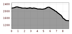
Open interactive mapOpen this POI on the interactive mapElevation profileWöffi Tour 13 / Tag 2: Über sieben Schneiden musst du gehen.gpx
GenießerRundWeg am Ahorn © Christian Lorenz Circular & themed hike: "GenießerRundWeg" at Mount AhornDifficulty:easyLength:2.0 kmDuration:0:45 hElevation uphill:70 mSee trailSee trail: Circular & themed hike: "GenießerRundWeg" at Mount Ahorn
valentinkapelle-1.jpg © Archiv TVB Mayrhofen Mountain hike: Zillergrund - Valentins KapelleDifficulty:mediumLength:3.2 kmDuration:2:30 hElevation uphill:390 mSee trailSee trail: Mountain hike: Zillergrund - Valentins Kapelle
Hut hike: Ginzling Nature Park House - Greizer HütteDifficulty:mediumLength:22.4 kmDuration:8:30 hElevation uphill:1,250 mSee trailSee trail: Hut hike: Ginzling Nature Park House - Greizer Hütte
Sommerfrische im Gunggltal © Archiv TVB Mayrhofen Hut hike: Ginzling Nature Park House - MaxhütteDifficulty:mediumLength:5.8 kmDuration:3:00 hElevation uphill:460 mSee trailSee trail: Hut hike: Ginzling Nature Park House - Maxhütte
Kolmhaus mit Brandberger Kolm © Archiv TVB Mayrhofen Brandberger KolmDifficulty:difficultLength:13.7 kmDuration:7:30 hElevation uphill:1,600 mSee trailSee trail: Brandberger Kolm
Hut hike: Zillergrund Bärenbadalm - PlauenerhütteDifficulty:mediumLength:14.0 kmDuration:6:00 hElevation uphill:980 mSee trailSee trail: Hut hike: Zillergrund Bärenbadalm - Plauenerhütte
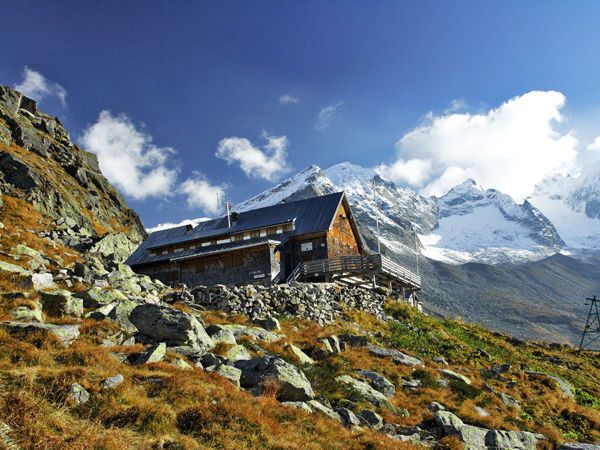
Kasseler Hütte © Reinhard Weber Stage Berliner Höhenweg (Zillertal Runde): Kasseler Hütte - EdelhütteDifficulty:difficultLength:13.0 kmDuration:9:00 hElevation uphill:800 mSee trailSee trail: Stage Berliner Höhenweg (Zillertal Runde): Kasseler Hütte - Edelhütte
sommer-steinbockmarsch-foto-dominic-ebenbichler © Archiv TVB Mayrhofen Stage of the Berliner Höhenweg (Zillertal Runde): Berliner Hütte - Greizer HütteDifficulty:difficultLength:10.2 kmDuration:6:30 hElevation uphill:1,200 mSee trailSee trail: Stage of the Berliner Höhenweg (Zillertal Runde): Berliner Hütte - Greizer Hütte
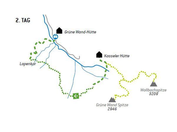
Stage of the Berliner Höhenweg (Zillertal Runde): Greizer Hütte - Kasseler HütteDifficulty:difficultLength:9.8 kmDuration:6:00 hElevation uphill:650 mSee trailSee trail: Stage of the Berliner Höhenweg (Zillertal Runde): Greizer Hütte - Kasseler Hütte
neuer-wanderweg-im-stilluptal-foto-stefan-absenger © Archiv TVB Mayrhofen Themed hike: Stilluptal "Wasserfallweg"Difficulty:easyLength:15.3 kmDuration:5:00 hElevation uphill:325 mSee trailSee trail: Themed hike: Stilluptal "Wasserfallweg"
Filzenkogel winter walk in MayrhofenDifficulty:mediumLength:3.6 kmDuration:1:30 hElevation uphill:250 mGo to winter hikeGo to winter hike: Filzenkogel winter walk in Mayrhofen
Give feedback for a chance to win a special holiday experience!Click here for the surveyClick here for the survey