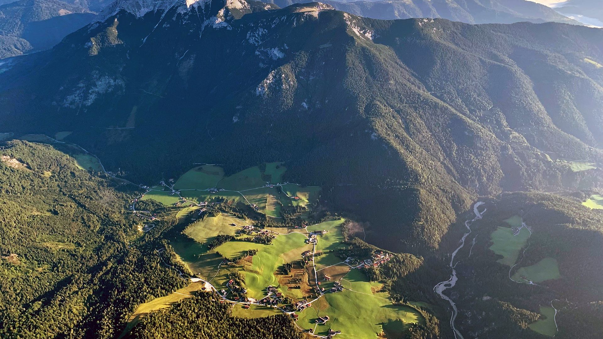
HikingHiking in Steinberg am RofanThe most beautiful end of the world – that's how the 300-inhabitant community of Steinberg am Rofan likes to describe itself. It is indeed remote, but all the more beautiful for it.
Situated on a sunny and secluded high plateau above Lake AchenseeSurrounded by three different mountain rangesRemote village with only 300 inhabitants
Gipfelkreuz am 2.195 Meter hohen Guffert - es wurde 2021 in die Höhe getragen, dort aufgestellt und feierlich geweiht © Achensee Tourismus Guffert Difficulty:difficultLength:10.3 kmDuration:6:30 hElevation uphill:1,195 mSee trailSee trail: Guffert
die Grundache - erfrischend an heißen Sommertagen © Achensee Tourismus Steinberg - Gaismoosstollen - SteinbergDifficulty:mediumLength:5.5 kmDuration:2:00 hElevation uphill:210 mSee trailSee trail: Steinberg - Gaismoosstollen - Steinberg
etwas oberhalb von Steinberg - unterwegs in Richtung Bärenwaldrunde und Panoramarunde © Achensee Tourismus Bärenwald circuitDifficulty:easyLength:4.9 kmDuration:1:30 hElevation uphill:170 mSee trailSee trail: Bärenwald circuit
Blick zur Gufferthütte © Achensee Tourismus Steinberg - Schneidalm - Raetische Inschriften - Gufferthütte - SteinbergDifficulty:mediumLength:18.1 kmDuration:8:00 hElevation uphill:1,060 mSee trailSee trail: Steinberg - Schneidalm - Raetische Inschriften - Gufferthütte - Steinberg
Aussicht vom Weg über den Gfasssattel zur Kotalm © Achensee Tourismus Steinberg - Gfaßsattel - Kotalm - Vorderunnutz - Kögljoch - Schönjochalm - SteinbergDifficulty:difficultLength:18.2 kmDuration:7:30 hElevation uphill:1,030 mSee trailSee trail: Steinberg - Gfaßsattel - Kotalm - Vorderunnutz - Kögljoch - Schönjochalm - Steinberg
Give feedback for a chance to win a special holiday experience!Click here for the surveyClick here for the survey