Hut Langtalereckhütte

Obergurgl

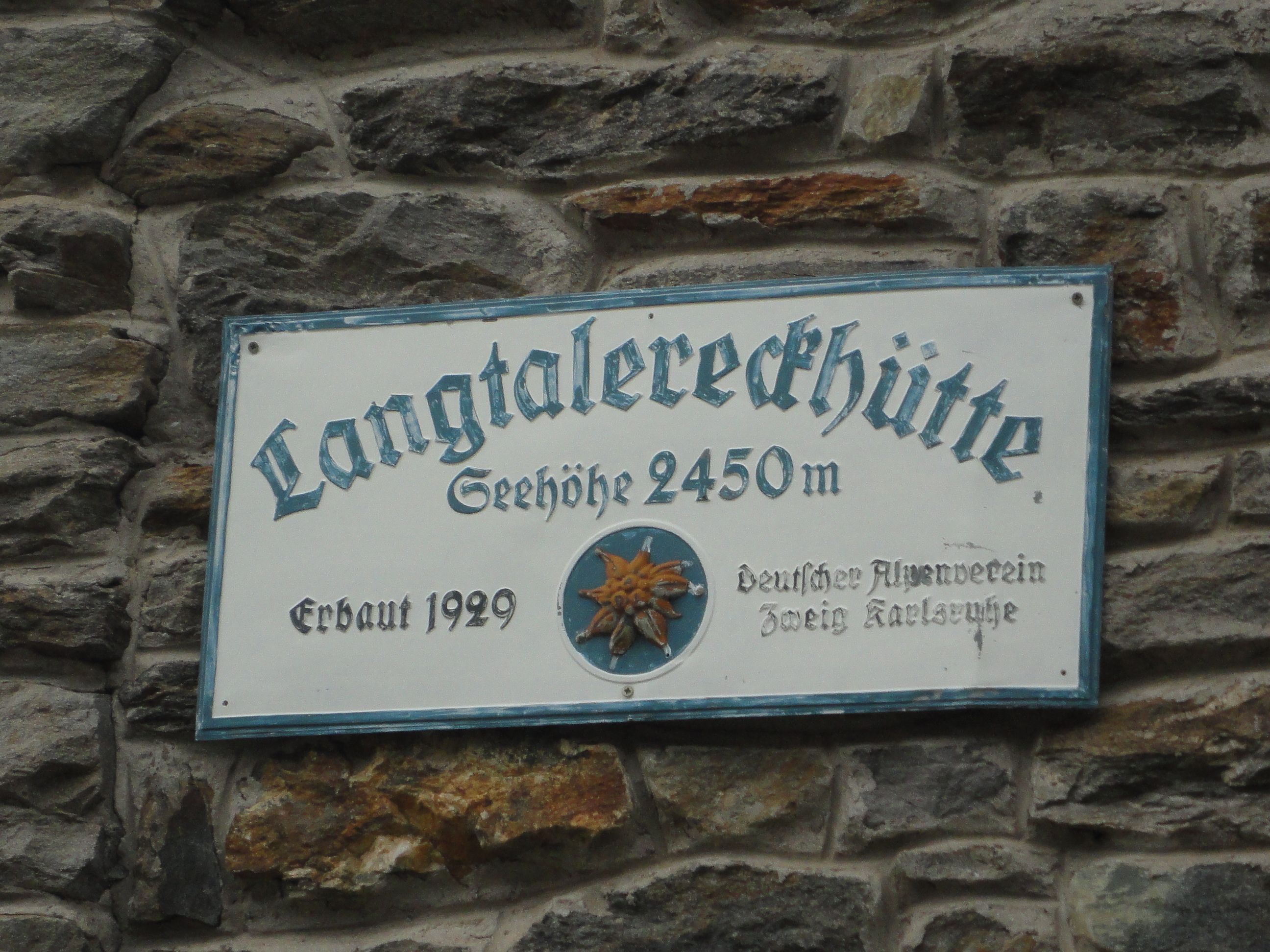
The Langtalereckhütte (2,450 metres) in the Ötztal Alps is an excellent base for walks and hikes, including glacier adventures.

Information

Altitude

2,450 m

Mountain range

Ötztal Alps

Sleeps (number of guests)

  • Dormitory/beds:37
  • Dormitory with mattresses:19

Facilities

  • Showers
  • Mobile phone reception

Suitable for:

  • mountain hiking
  • High-altitude hikes
  • cross country skiing
  • Ski touring

Coordinates

  • Geographic length:10.991944444444
  • Geographic width:46.828611111111
  • UTM (east):5188048
  • UTM (east):651917
  • Reference Meridian:
Source: Alpenverein

Description

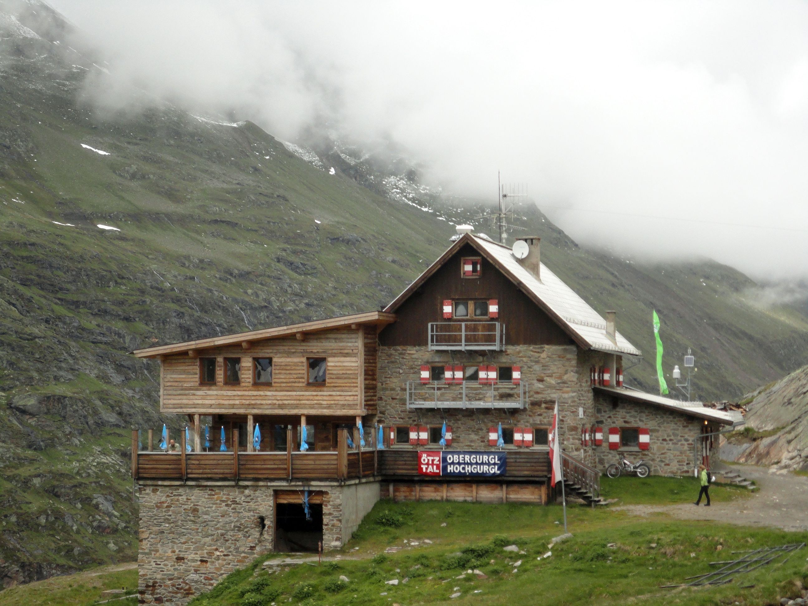
Hut close to the Gurgler Ferner glacier
German Alpine Club, Karlsruhe Division

The Langtalereckhütte is the final stop on the way to the Gurgler Ferner glacier, at the end of the Gurgltal Valley. It is a good base camp for walkers and hikers keen to explore some of the easier-to-climb 3,000m peaks in the area with no glacier crossing needed. The hut is just one of several mountain refuges erected by alpine enthusiasts from Karlsruhe, Germany, since the end of the 19th century. Ambitious hikers and climbers will also find plenty to keep them busy. The hut is a good place for a daytrip from Obergurgl.

How to get to the Langtalereckhütte

From Obergurgl in 2.5 hours

Walks and hikes in the area (walking time to summit)

Hangerer (3,020 metres), 3.75 hours, intermediate
Eiskögele (3,228 metres), 3 hours, difficult
Hinterer Seelenkogel (3,472 metres), 3.5 hours, difficult (glacier equipment required)
Hochwilde (3,482 metres), 7 hours, difficult (glacier equipment required)
 

Further huts in the area, long-distance hiking trails

Fidelitashütte (self-catering hut), 2 hours
Ramolhaus, 3 hours

The Langtalereckhütte is located on the Ötztal Trek (Stage 10).

Nearby huts

  • Hildesheimer Hütte

    Place:Stubai Alps
    :2,899 m
    :Suitable formountain hikingHigh-altitude hikesRock climbingSki touring
  • Hochstubaihütte

    Place:Stubai Alps
    :3,173 m
    :Suitable forHigh-altitude hikesRock climbingSki touring
  • Brandenburger Haus

    Place:Ötztal Alps
    :3,277 m
    :Suitable forHigh-altitude hikesSki touring
  • Erlanger Hütte

    Place:Ötztal Alps
    :2,550 m
    :Suitable formountain hikingHigh-altitude hikesSki touring
  • Hochjoch-Hospiz

    Place:Ötztal Alps
    :2,413 m
    :Suitable forHigh-altitude hikesSki touring
  • Neue Bielefelder Hütte

    Place:Stubai Alps
    :2,112 m
    :Suitable foralpine skiingmountain hikingHigh-altitude hikesRock climbingSki touring
  • Amberger Hütte

    Place:Stubai Alps
    :2,135 m
    :Suitable formountain hikingHigh-altitude hikesRock climbingMountain bikeSki touring
  • Hochwildehaus

    Place:Ötztal Alps
    :2,885 m
    :Suitable forHigh-altitude hikesSki touring
  • Siegerlandhütte

    Place:Stubai Alps
    :2,710 m
    :Suitable formountain hikingHigh-altitude hikesRock climbingSki touring
  • Vernagthütte

    Place:Ötztal Alps
    :2,755 m
    :Suitable formountain hikingHigh-altitude hikesRock climbingSki touring
  • Winnebachseehütte

    Place:Stubai Alps
    :2,372 m
    :Suitable formountain hikingRock climbingSki touring
  • Martin-Busch-Hütte

    Place:Ötztal Alps
    :2,501 m
    :Suitable formountain hikingHigh-altitude hikesMountain bikeSki touring
  • Ramolhaus

    Place:Ötztal Alps
    :3,006 m
    :Suitable forHigh-altitude hikes
  • Schweinfurter Hütte

    Place:Stubai Alps
    :2,028 m
    :Suitable formountain hikingHigh-altitude hikesRock climbingMountain bikeSki touring
Newsletter

The mountain is calling? So does our newsletter!

In our monthly newsletter we reveal the best holiday tips for Tyrol.