
Opening hours:closed
Difficulty:medium
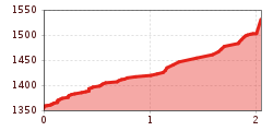
Length:6.5 kmDuration:1:00 hElevation uphill:140 m:Style: Skating, Classic
Tip: detour to the Moosenalm
To get to the Moosenalm (not serviced), turn right about 700 metres before the Gföllalm and after another two kilometres and 200 metres in altitude you reach the Moosenalm.

.jpg")


