
Opening hours:Open today
Place:
Maurach am Achensee
:
Alpine pasture / hut / mountain restaurant
Get in the gondola! The magnificent summit hike is shortened by around 800 meters in altitude if you take the Rofan cable car from Maurach am Achensee up to the Erfurter Hütte.
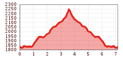
The Rofan cable car takes you from Maurach am Achensee up to the Erfurter Hütte on the Mauritzköpfl. You then follow a good mountain trail over the easily accessible western side of the Rofanspitze to the popular vantage point at the summit, which can be reached in around two hours on foot. From the Rofanspitze, the view opens up to a spectacular mountain panorama and the Erfurter Hütte, which is a cozy place to stop for refreshments after the tour.

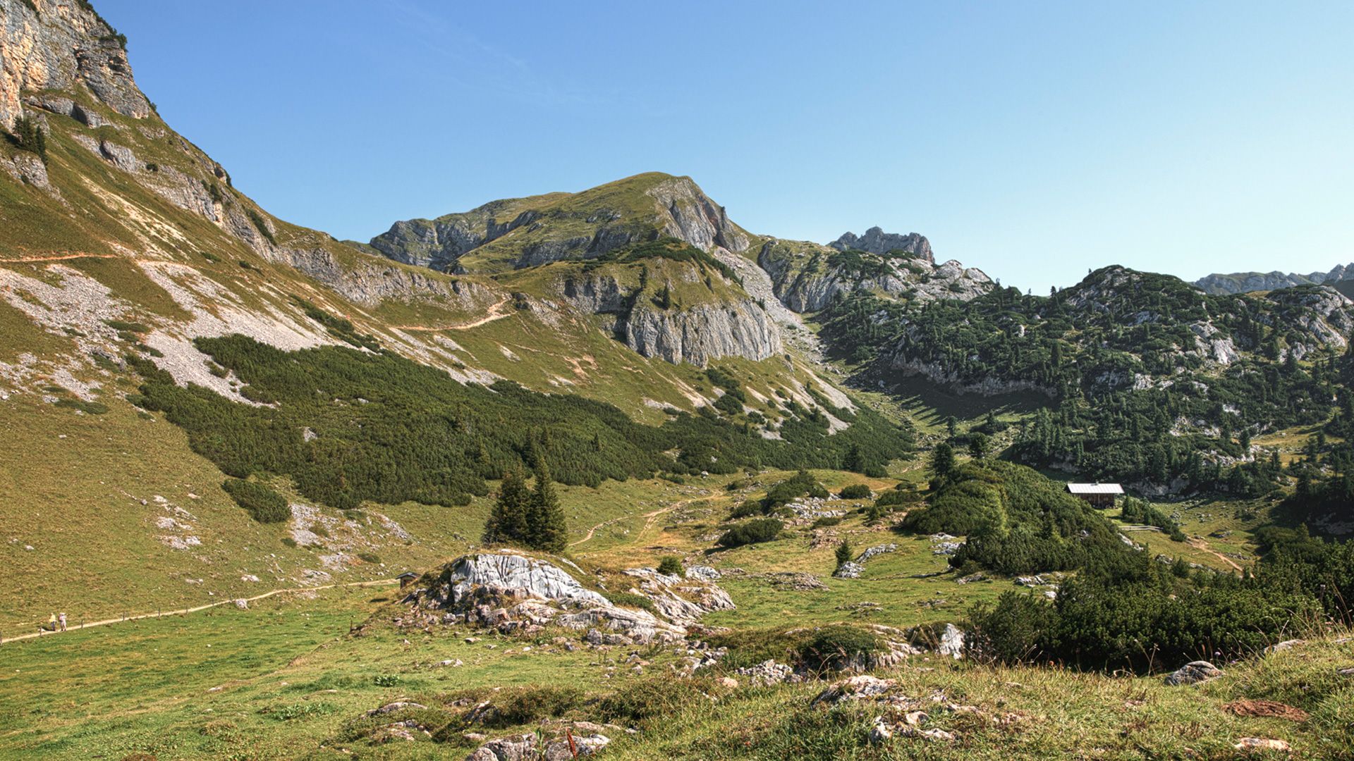
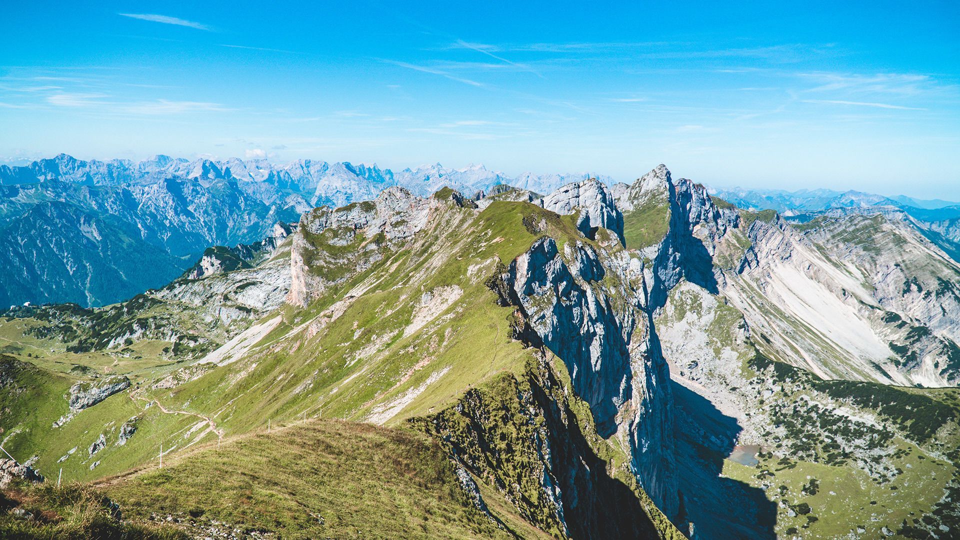
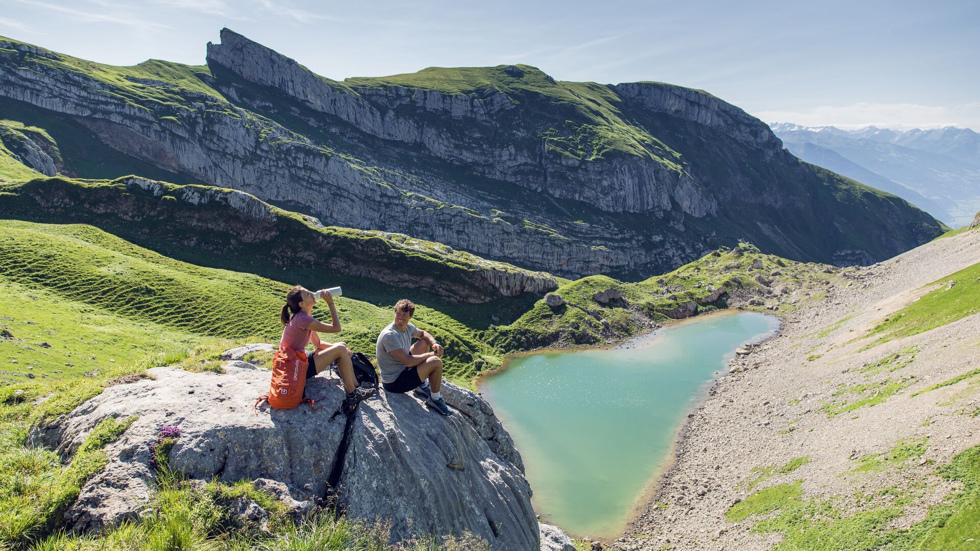
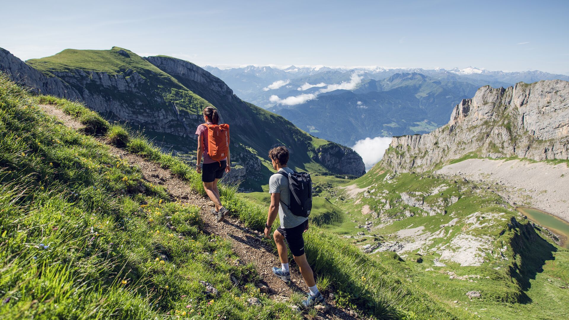
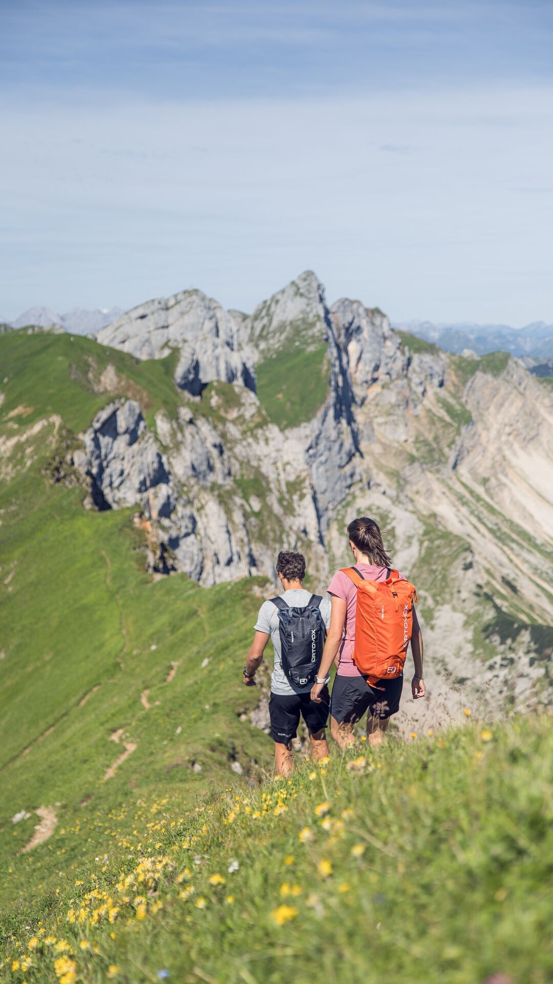
From the top station of the Rofan cable car, walk past the Mauritzalm mountain hut (signposted). The trail descends a little, then flattens and descends via two steep steps to the Grubastiege. Walk downhill past a commemorative plaque and to the Grubalacke and on to the Krahnsattel. To the south below the saddle, on open terrain, lies the striking Hexenfels (Witch's Rock). Continue along alpine meadows until you reach a junction (signpost) and turn right to the Grubascharte, below lies the Grubersee. The trail is almost level until you reach the junction before it leads to the ridge and to the grassy summit of the Rofanspitze which affords gorgeous views. The return is via the same route.
Take the regional bus to Maurach (line 8332, 4080 or 390) and get off at the "Maurach a. A. Rofan Seilbahn" stop.
Car park Rofan Seilbahn 1 or 2 (paid parking; Rofan cable car passengers receive a refund at the ticket office).


