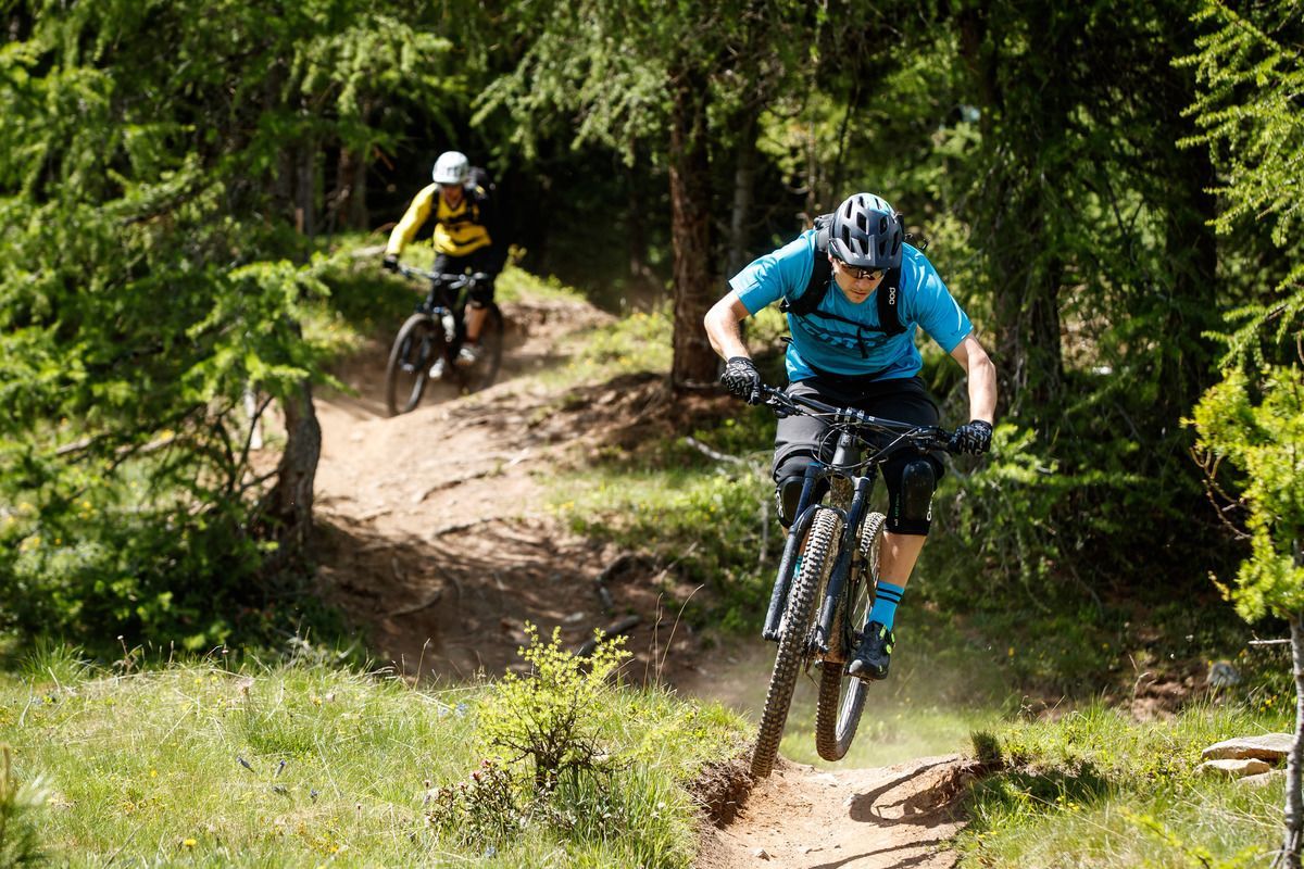
Lienz, Peter Sagan Trail crop (1) © Tirol Werbung | Sebastian Schels Peter Sagan Trail No. 141Difficulty:mediumLength:5.0 kmDuration:0:30 hElevation uphill:90 mGo to biketourGo to biketour: Peter Sagan Trail No. 141
26955746.jpg © TVB Wipptal 530 mountainbike SattelalmDifficulty:mediumLength:4.0 kmDuration:1:00 hElevation uphill:423 mGo to biketourGo to biketour: 530 mountainbike Sattelalm
2031 | Sonnenrast TrailDifficulty:easyLength:1.7 kmGo to biketourGo to biketour: 2031 | Sonnenrast Trail
Trailarea Urisee - D'Oachkätzla Line © Dominik Somweber Trailarea UriseeOpening hours:openLength:1.2 kmGo to biketourGo to biketour: Trailarea Urisee
Singletrail Leithetrail.jpg © © Serfaus-Fiss-Ladis Marketing GmbH Leithetrail 7128Opening hours:openDifficulty:easyLength:4.3 kmGo to biketourGo to biketour: Leithetrail 7128
Miesberg - SeerundeDifficulty:easyLength:13.2 kmDuration:1:30 hElevation uphill:130 mGo to biketourGo to biketour: Miesberg - Seerunde
Labalm KirchbergDifficulty:mediumLength:26.0 kmDuration:3:00 hElevation uphill:450 mGo to biketourGo to biketour: Labalm Kirchberg
Lisi Osl TrailOpening hours:openDifficulty:mediumLength:2.3 kmDuration:0:20 hGo to biketourGo to biketour: Lisi Osl Trail
Mountainbike training parcoursOpening hours:openDifficulty:easyLength:500 mDuration:0:07 hElevation uphill:12 mGo to biketourGo to biketour: Mountainbike training parcours
Ehenbichler Alm mit Blick auf Abendspitze © LIGHTHOUSE | Stefan Mayr Fotografie Berwang - To the Sennalpe RaazDifficulty:mediumLength:16.6 kmDuration:3:30 hElevation uphill:768 mGo to biketourGo to biketour: Berwang - To the Sennalpe Raaz
Högtrail zum Högsee © © Serfaus-Fiss-Ladis Marketing GmbH Högtrail 7081Opening hours:openDifficulty:easyLength:3.8 kmGo to biketourGo to biketour: Högtrail 7081
TVB bike 43.jpg © KLAUS LISTL Lichte Trail 882Opening hours:openDifficulty:difficultLength:3.4 kmDuration:0:15 hElevation uphill:5 mGo to biketourGo to biketour: Lichte Trail 882
Gravelbike-Tour KössenDifficulty:mediumLength:32.3 kmDuration:3:00 hElevation uphill:765 mGo to biketourGo to biketour: Gravelbike-Tour Kössen
am Gipfel des Feilkopfes © Achensee Tourismus 435 FeilkopfDifficulty:mediumLength:8.3 kmDuration:2:00 hElevation uphill:580 mGo to biketourGo to biketour: 435 Feilkopf
Pillersee (3) © TVB Kitzbüheler Alpen St. Johann in Tirol Pillerseetal-Runde GravelDifficulty:mediumGo to biketourGo to biketour: Pillerseetal-Runde Gravel
Mountainbiken - am Beginn der Karwendeltäler in Pertisau © Achensee Tourismus Buchau - GramaialmDifficulty:easyLength:32.9 kmDuration:3:00 hElevation uphill:540 mGo to biketourGo to biketour: Buchau - Gramaialm
Singletrail Kals © Miriam Raneburger Gornerwald Trail No. 139Difficulty:difficultLength:2.3 kmDuration:0:30 hGo to biketourGo to biketour: Gornerwald Trail No. 139
Komperdell Tour © © Serfaus-Fiss-Ladis Marketing GmbH Komperdell Tour 761Difficulty:mediumLength:17.4 kmDuration:1:30 hElevation uphill:650 mGo to biketourGo to biketour: Komperdell Tour 761
Adlertrail © bikeboard/Roland Kachelhauser Adlertrail No. 138Difficulty:mediumLength:3.7 kmDuration:0:20 hGo to biketourGo to biketour: Adlertrail No. 138
Lakata Trail © bikeboard/Roland Kachelhauser Alban Lakata Trail No. 142Difficulty:mediumLength:2.0 kmDuration:0:20 hElevation uphill:10 mGo to biketourGo to biketour: Alban Lakata Trail No. 142
Frommestrail (1).jpg © (c) Serfaus-Fiss-Ladis Marketing GmbH_Raphael Pöham Frommestrail 7077Opening hours:openDifficulty:mediumLength:9.6 kmElevation uphill:12 mGo to biketourGo to biketour: Frommestrail 7077
BergkasteltrailOpening hours:openDifficulty:mediumLength:5.5 kmGo to biketourGo to biketour: Bergkasteltrail
Radstrecke Bike Everest Tirol © © Serfaus-Fiss-Ladis Marketing GmbH Bike Everest TirolDifficulty:difficultLength:285.0 kmElevation uphill:8,848 mGo to biketourGo to biketour: Bike Everest Tirol
Kitzbüheler Horn, Tour Nr. 4Length:10.3 kmDuration:1:30 hElevation uphill:950 mGo to biketourGo to biketour: Kitzbüheler Horn, Tour Nr. 4
Supernatural Trail im Bikepark © © Serfaus-Fiss-Ladis Marketing GmbH SupernaturalOpening hours:openDifficulty:mediumLength:610 mGo to biketourGo to biketour: Supernatural
Give feedback for a chance to win a special holiday experience!Click here for the surveyClick here for the survey
")


_FULL110.jpg")


")


.jpg")
.jpg")


