
Mountainbike-Tour Lucknerhütte N. 152

Kals am Großglockner / Glockner Group
Difficulty ratings: difficult
Route length: 5.5 km
Duration: 1:15 h

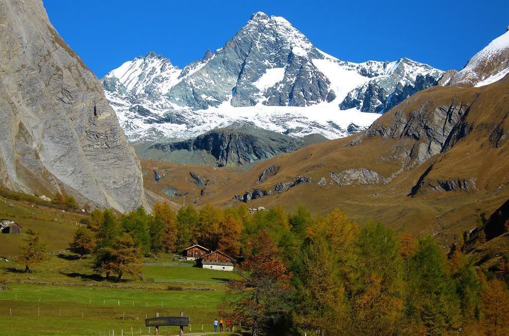
Mountainbiking to the "foot" of the Großglockner
Tour information

  • Requirement: difficult
  • Length: 5.5 km
  • Duration: 1:15 h
  • Elevation uphill:327 hm
  • Elevation downhill:326 hm
Highest point2,240 m

Starting point

Parkplatz Lucknerhaus

Finishing point

Lucknerhütte
  • Fitness level 4 / 6
  • Technique 5 / 6

Best time of year

  • January
  • February
  • March
  • April
  • May
  • June
  • July
  • August
  • September
  • October
  • November
  • December

Trail condition

Schotter

Equipment

Basic cyclingequipmentincludes a well-fitting helmet and functionalclothingadaptedtotheweather and temperature. Essential itemsare rain, sun, and wind protection, a repair kit, a first-aid kit, a charged mobile phone, aswellassufficientfluids and provisions. Gloves and eyewearprotecthands and eyes, while lightsimprovevisibility.  A mapor a GPS deviceassistwithorientation. 
 
This informationservesas a guide and does not claimtobe exhaustive. Equipment mustalwaysbeadaptedtothe tour destination, weatherconditions, season, naturalhazards, environmental influences, and personal needs. 
Source: TVB Osttirol

Description

The difficult mountainbike-route "Lucknerhütte" starts at Alpengasthof Lucknerhaus. It leads after about 200 m on the right hand side along the Ködnitzbach (river) with many places to rest and to listen to the background noise of the river. Take the next 1,5 km wide graveled path in a moderate ascent to the bridge and then further on along a very narrow path steep uphill. Please be very careful along this section! After another 2,5 km you're at the Lucknerhütte. Please take care on the way back, too, and never forget to pay attantion to other hikers or bikers!

Nearby huts and mountain restaurants

Getting here

  • Arrival by public transport

    Kals a.G. Lucknerhaus

  • Parking

    Parkplatz Glocknerwinkel

More tours in the surrounding area

  • Adlertrail No. 138

    Difficulty:medium
    Length:3.7 kmDuration:0:20 h
  • Alban Lakata Trail No. 142

    Difficulty:medium
    Length:2.0 kmDuration:0:20 hElevation uphill:10 m
  • Karlsbaderhütte No. 154

    Difficulty:difficult
    Length:26.2 kmDuration:4:00 hElevation uphill:1,590 m
  • Flow Family Trail Nr. 155

    Difficulty:easy
    Length:4.0 kmDuration:0:30 hElevation uphill:60 m
  • Peter Sagan Trail No. 141

    Difficulty:medium
    Length:5.0 kmDuration:0:30 hElevation uphill:90 m
  • Iseltal cycle trail No. 22

    Difficulty:easy
    Length:53.0 kmDuration:3:00 hElevation uphill:300 m
Newsletter

The mountain is calling? So does our newsletter!

In our monthly newsletter we reveal the best holiday tips for Tyrol.
