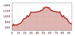
Cycle tour Ötztal Cycle Trail (11)

closed
Haiming / Ötztaler Alpen
Difficulty ratings: medium
Route length: 60.2 km
Duration: 6:00 h

It's a good thing that the Ötztal doesn't hide its natural treasures very well: countless waterfalls, the wild Ötztaler Ache river and one or two three-thousand-meter peaks can be seen from the saddle on the Ötztal Cycle Trail.

Tour character

The Ötztal Cycle Trail stretches for almost 50 kilometers, connecting Haiming (663 meters) at the head of the valley with Sölden (1,360 meters), surrounded by the imposing three-thousand-meter peaks of the Ötztal Alps. Highlights along the route: Area 47 adventure park, Habicher See lake, Stuibenfall waterfall, Aqua Dome thermal spa and impressive cycle bridges over the mountain rivers. The cycle path leads far away from the main road through nature, small side roads and villages where delicacies invite you to take a break. It is ideal for families thanks to the good road conditions and moderate gradients. Divided into four short stages, it can also be completed in one day by fit cyclists.

Tour information

  • Requirement: medium
  • Length: 60.2 km
  • Duration: 6:00 h
  • Elevation uphill:915 hm
  • Elevation downhill:224 hm
Highest point1,349 m

Starting point

Haiming

Finishing point

Sölden (1,377 m)
  • Fitness level 3 / 6
  • Technique 4 / 6

Best time of year

  • January
  • February
  • March
  • April
  • May
  • June
  • July
  • August
  • September
  • October
  • November
  • December

Equipment

The Ötztal cycle route has some climbs and should not be underestimated in this respect.

The cycle path crosses the Ötztaler Bundesstraße several times.

BIKE BEHAVIOR RULES

  1. Always cycle on the right, at a controlled speed, and use half sight if necessary, especially in narrow sections and tight corners, as oncoming traffic or obstacles (e.g., bollards, barriers, stones, branches, cattle grids, other vehicles) can occur at any time.
  2. Note that the used roads and paths often have mixed uses and therefore obstructions may occur at any time (e.g., agricultural and forestry vehicles, authorized vehicles, stored wood, grazing cattle).
  3. Be considerate particularly of pedestrians and other cyclists and overtake only at walking pace.
  4. Consider the technical and physical difficulty of your cycling tour and accurately assess your experience and ability as a cyclist (for bike or e-bike beginners, a safety training course is recommended).
  5. Protect your head with a helmet and check your equipment before starting each ride (brakes, bell, light, reflectors, etc.).
  6. Adhere to driving bans and closures. Close the pasture gates.
  7. Be considerate of animals and nature and avoid riding off the roads and paths open to cycle traffic.
  8. Do not leave any waste behind.
  9. According to the traffic regulations, only e-bikes/pedelecs with a maximum speed of 25 km/h are allowed on cycle paths.

Gear up rules! We recommend wearing special bike protection equipment on all cycling and mountain biking routes in the Ötztal region. We recommend bringing enough water, especially on long routes like the Ötztal cycle path.

Source: Ötztal

Description

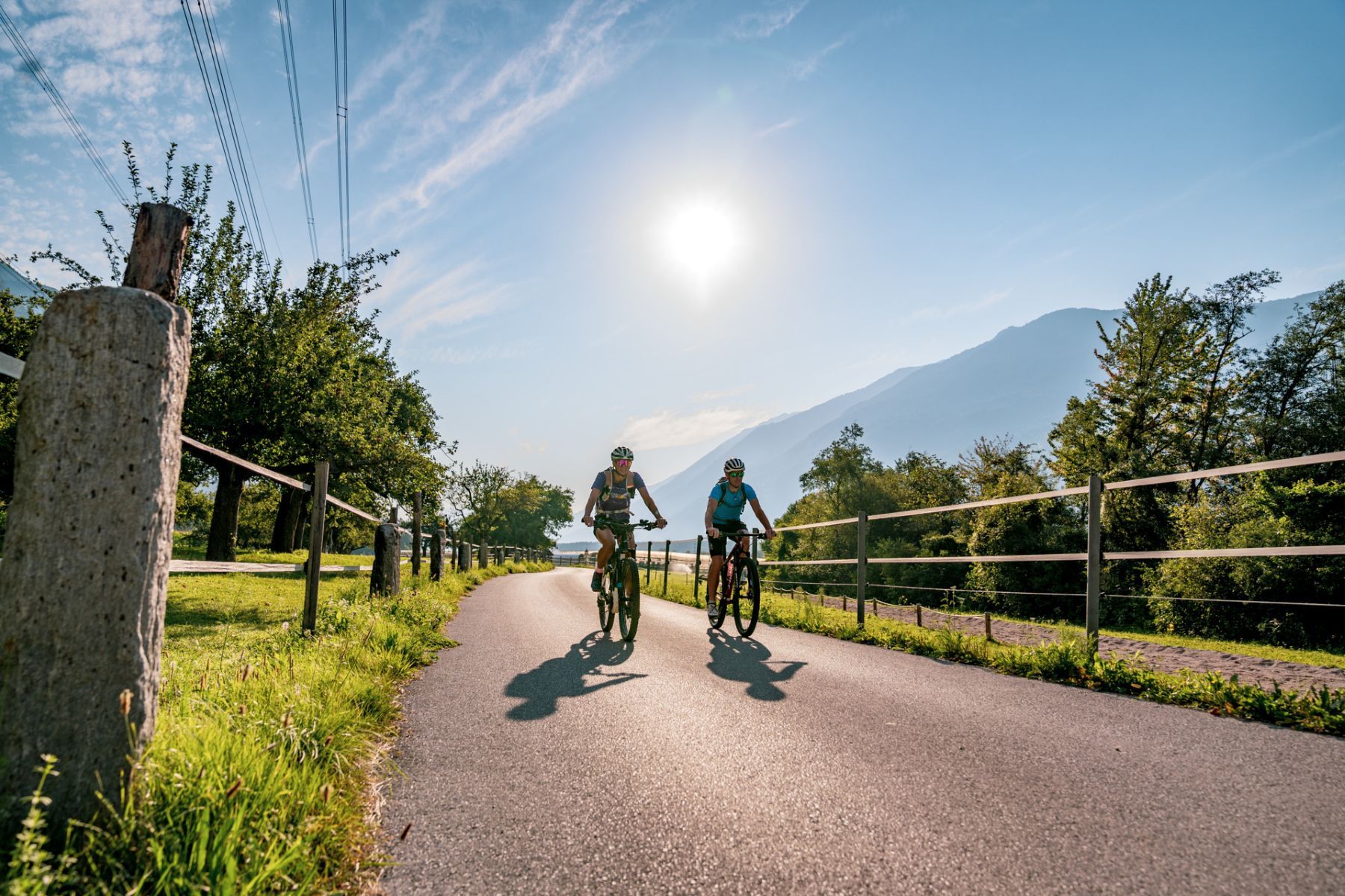
The cycle path starts in the town center of Haiming. Protected by mountain ranges all around, the entrance to the Ötztal valley offers a wonderful climate with little precipitation and lots of sunshine. The mild temperatures make it the heart of Tyrolean apple growing. The cycle path passes the hamlets of Magerbach and Schlierenzau and leads to Ötztal-Bahnhof. Then it continues through a forest for several hundred meters parallel to the railway tracks to AREA 47, Austria’s largest outdoor adventure park. From here, it heads south, away from the federal road, through Brunau and along the Ötztaler Ache to Oetz.

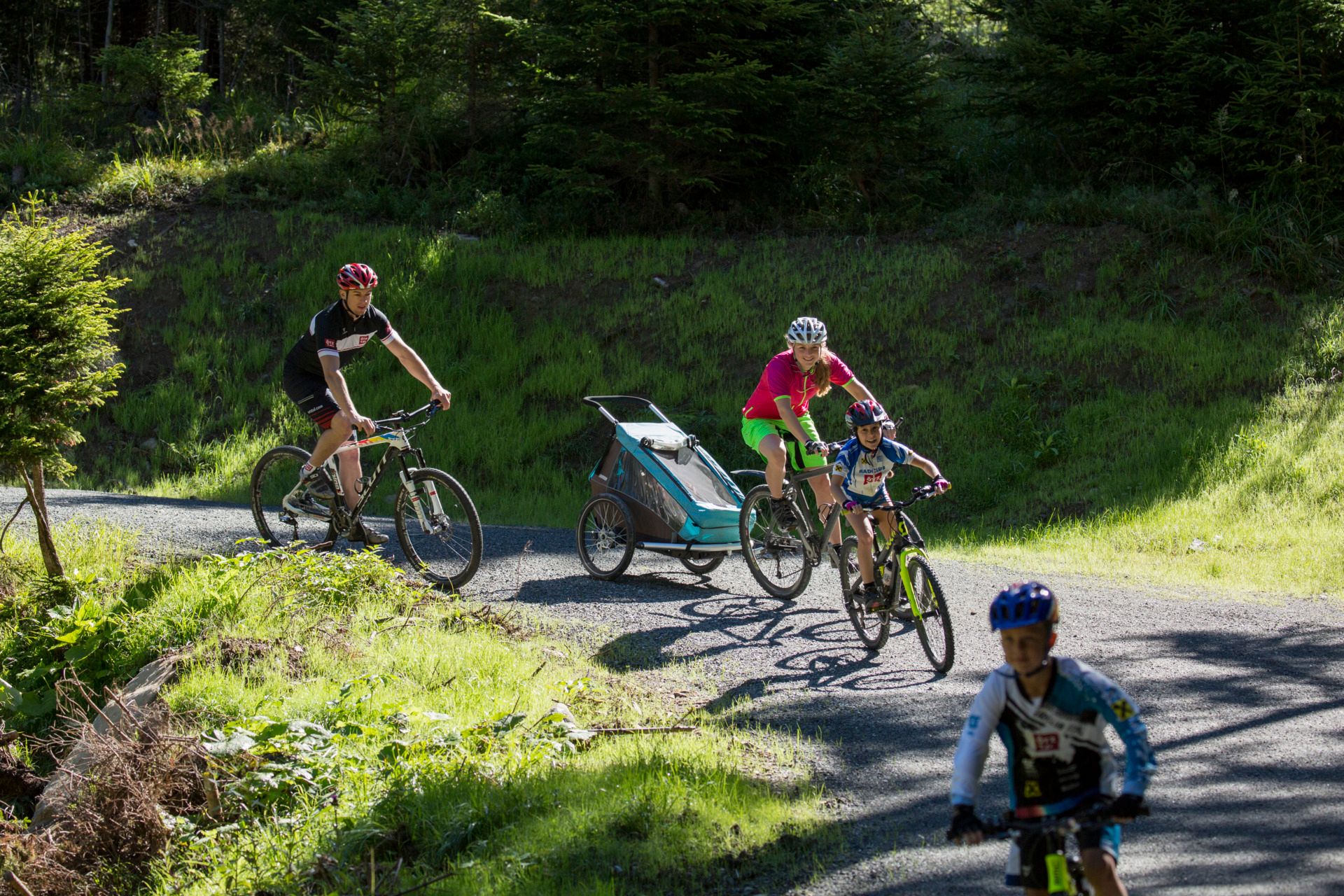
At the end of Oetz, cycle parallel to the Ötztaler Bundesstraße to Habichen. An underpass at Habichen invites a detour to Habicher See, or take on the challenging climb “Tumpener Gstoag”. The path leads through a small forest section (Seestall/Grube) to Tumpen. Here, it goes past the school towards the Ötztaler Bundesstraße, which you cross, as well as the Ötztaler Ache afterwards. Relaxed, continue towards Umhausen, past Engelswand, the hamlet Lehn-Platzl, and the chapel Maria Schnee. A small climb takes you directly into the center of Umhausen. Passing the parish church, follow the ground markings through the hamlet Neudurf until you cross the Ache again at Fundus bridge in the valley floor.

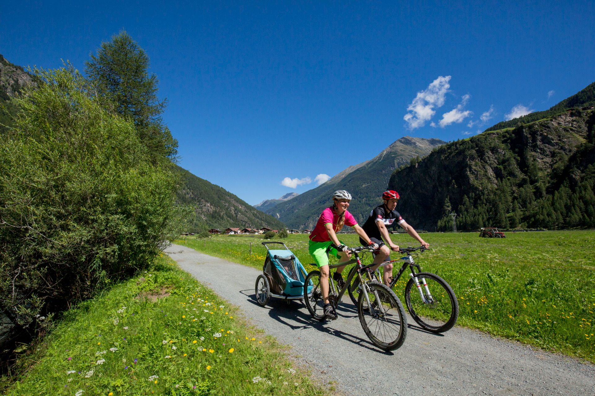
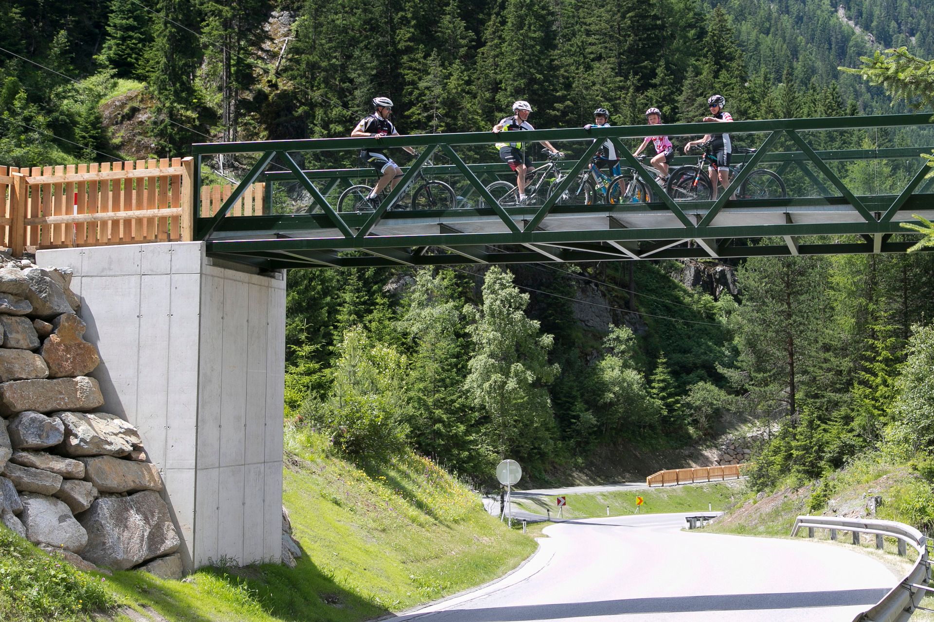
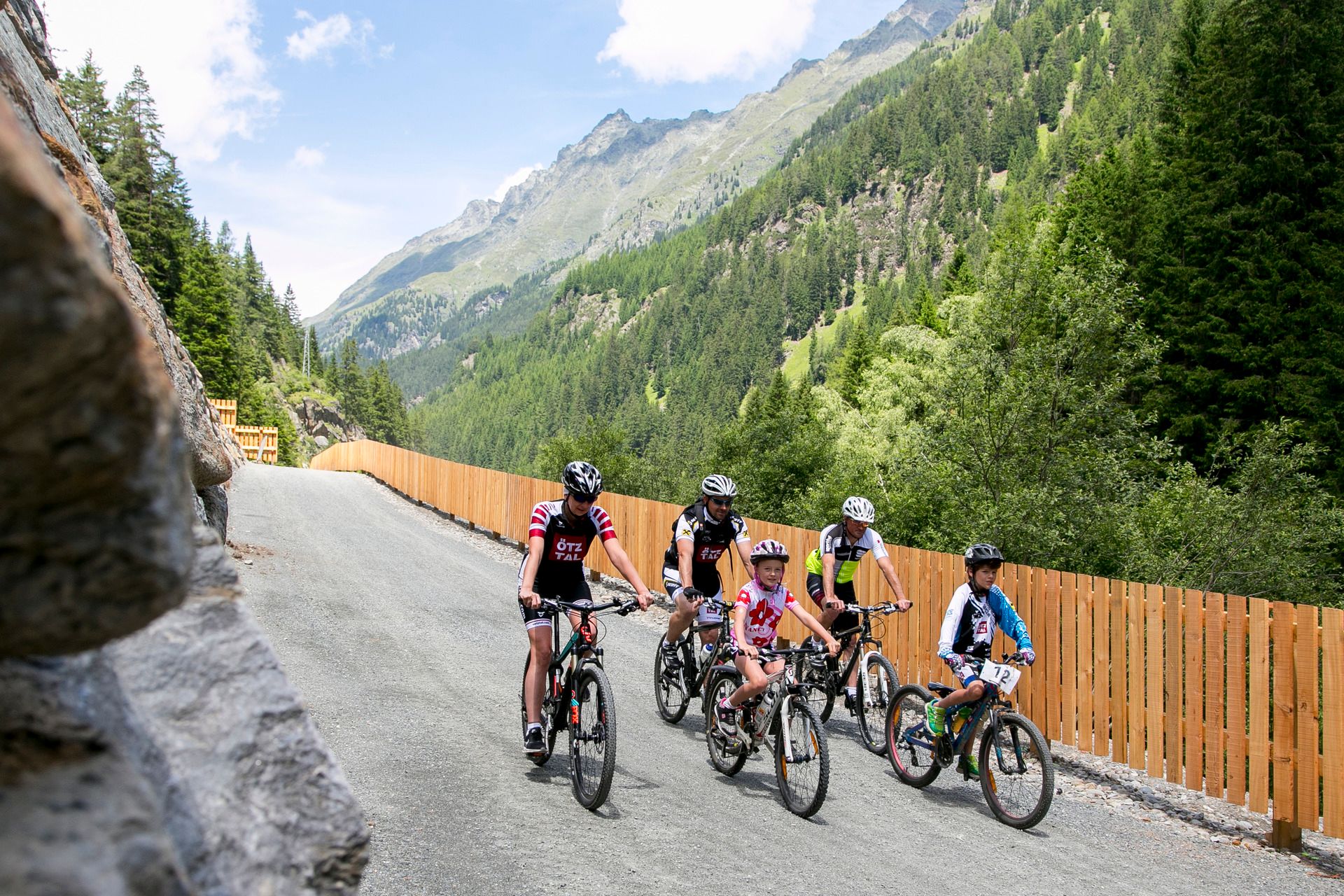
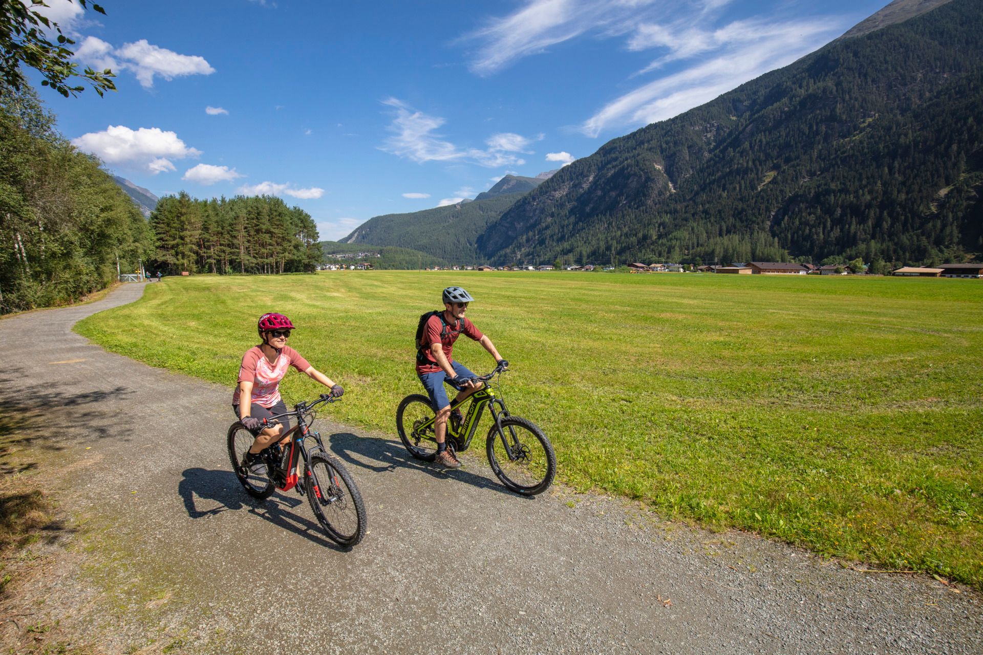
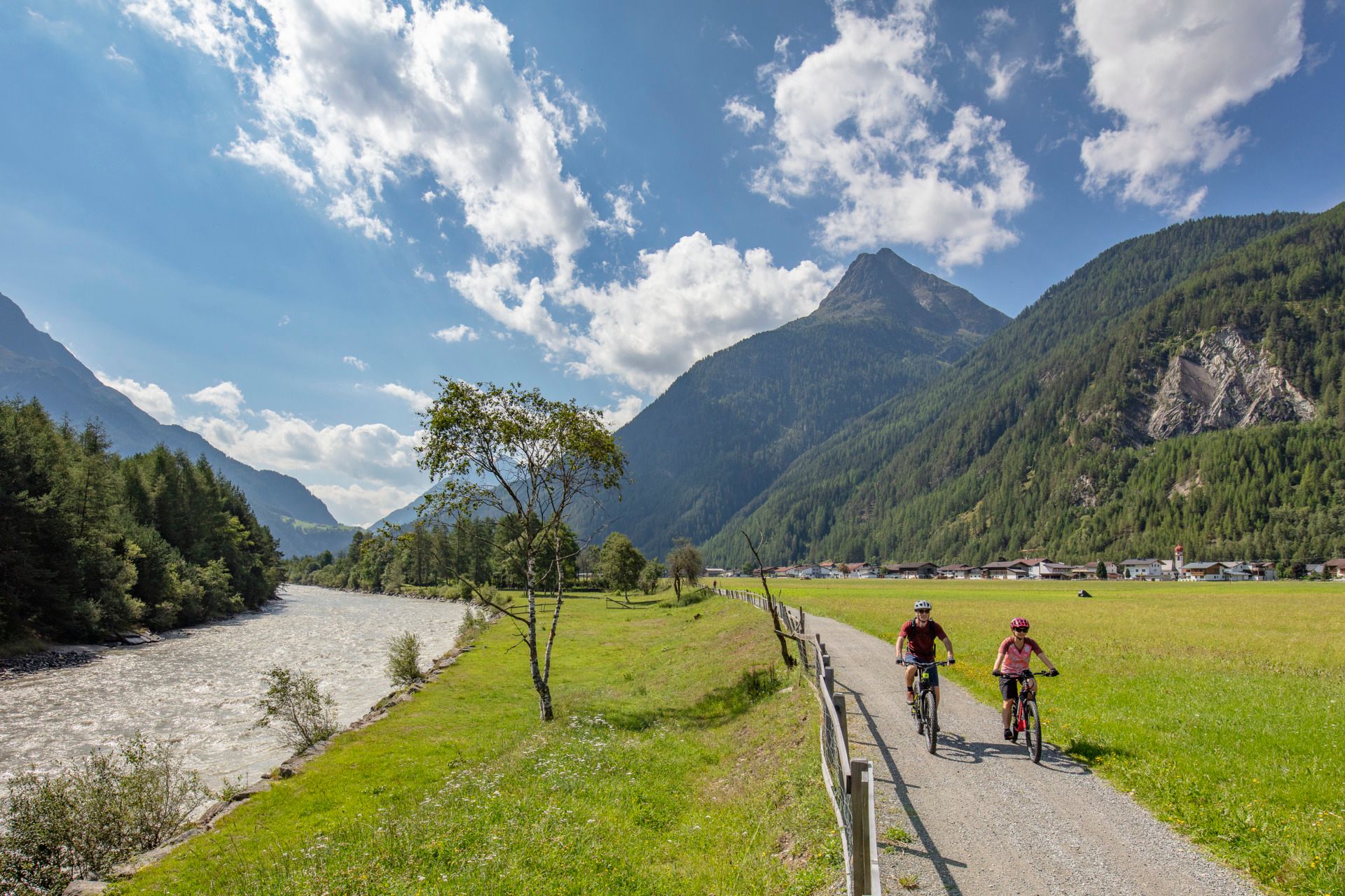
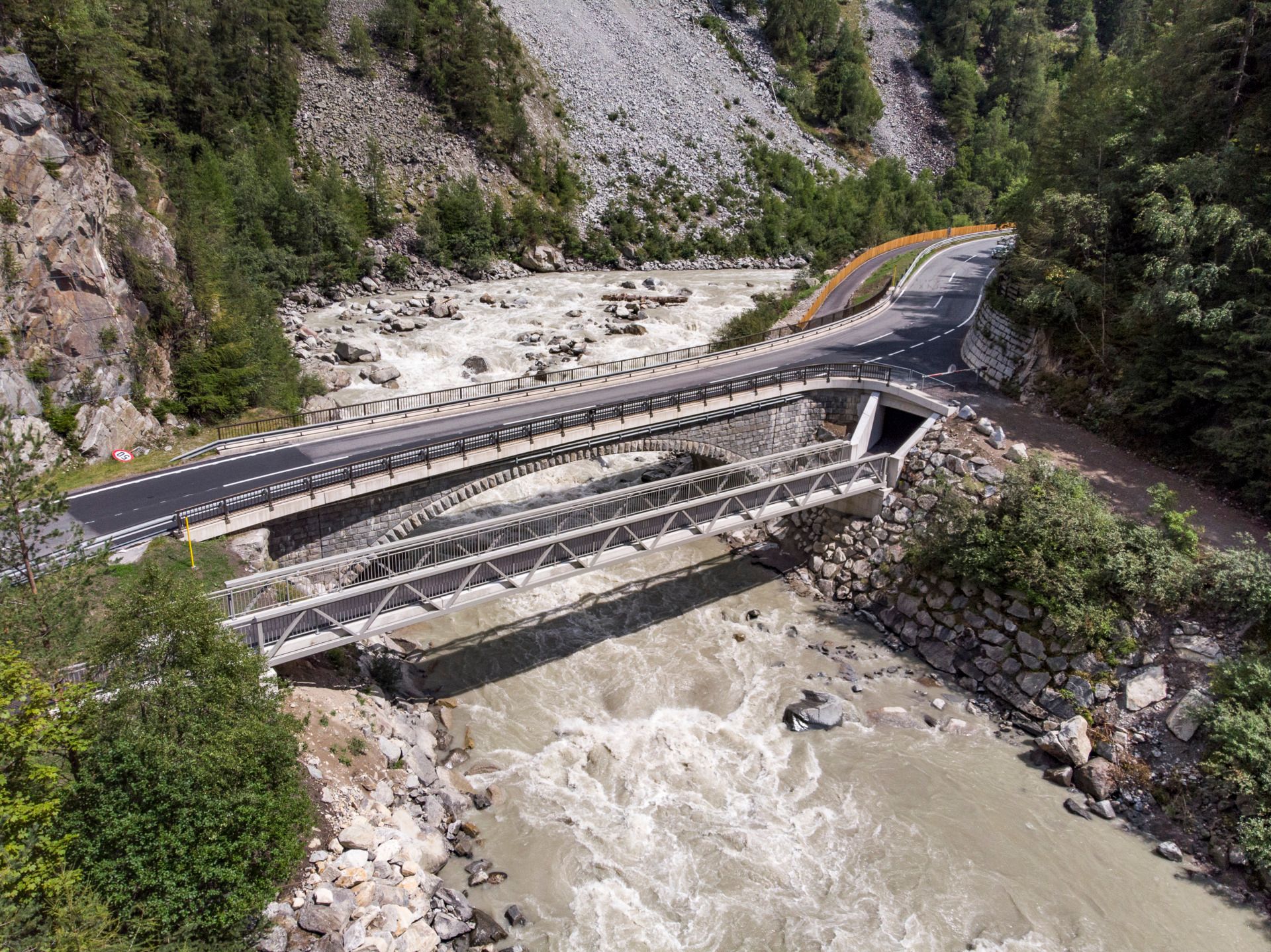
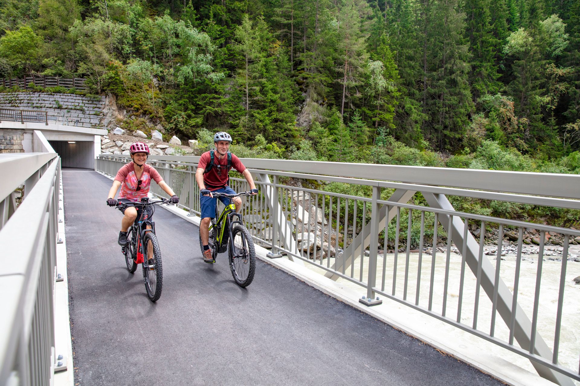
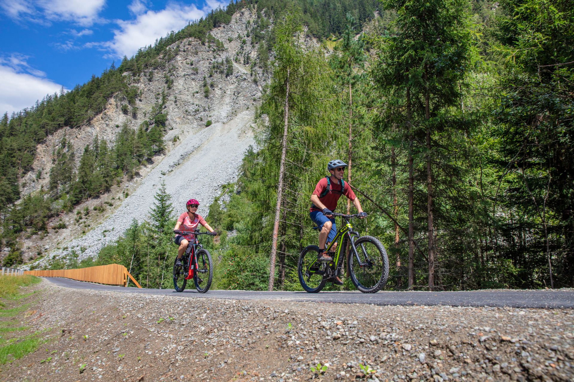
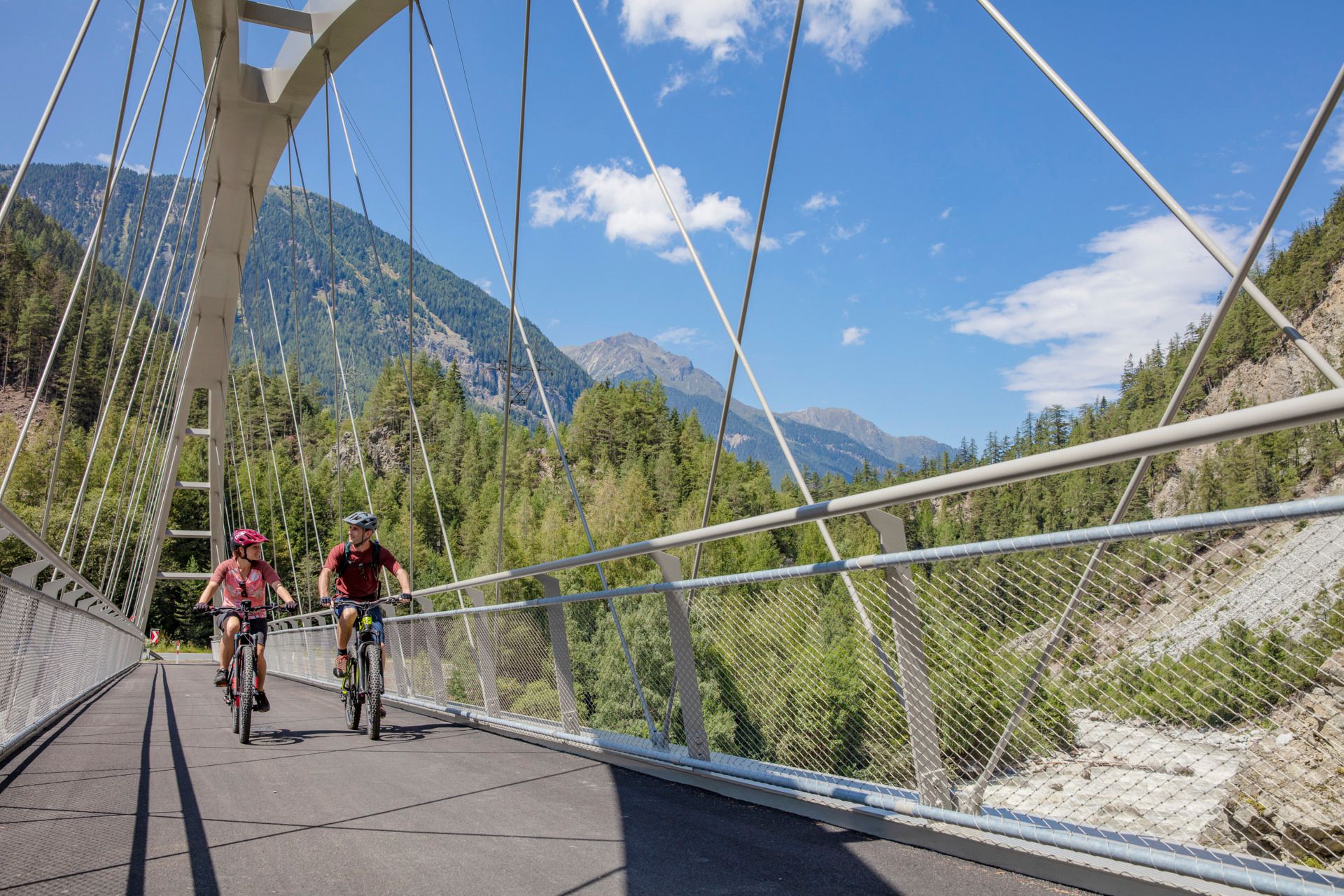
The cycle path continues along the Ache to the turnoff Köfels and on a gravel path to Au. At the end, an asphalted path above the roaring Ötztaler Ache crosses two newly built spectacular cycle bridges. After the second bridge, turn left into a somewhat steeper forest section. At the end of this forest section, an underpass leads to the other side of the road. At the next intersection, turn right to Winklen, then at the next fork turn right along the Ache towards Unterried. At the next intersection, turn right to Winklen again, pass the hamlets Oberried, Lehn, and Unterried west of Längenfeld, and finally reach Längenfeld. From here, cycle past the famous Aqua Dome spa and follow the path through the wide meadows of Astlehn and Runhof to reach Huben. The impressive mountain world in the rear Ötztal draws closer and closer.

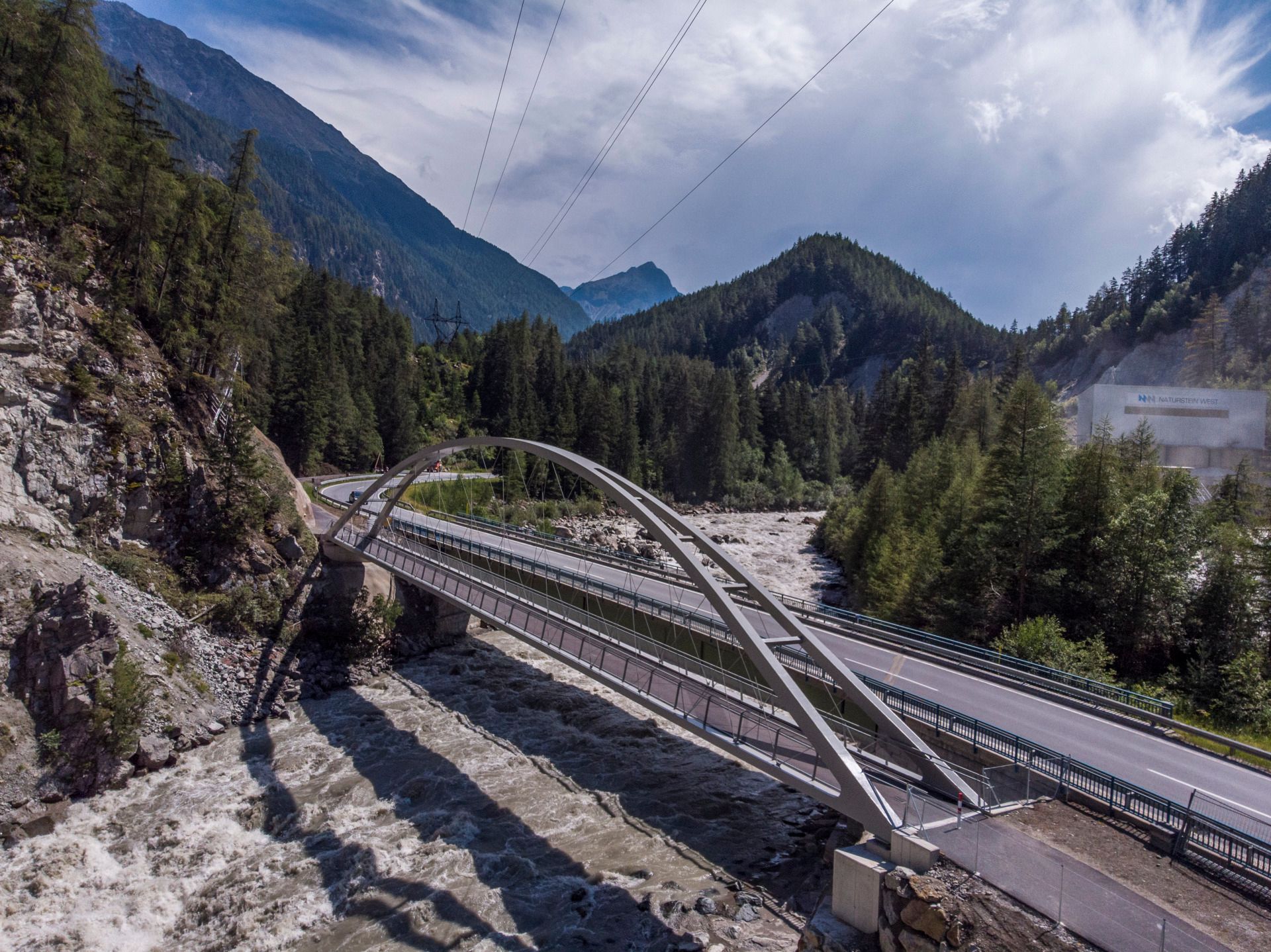
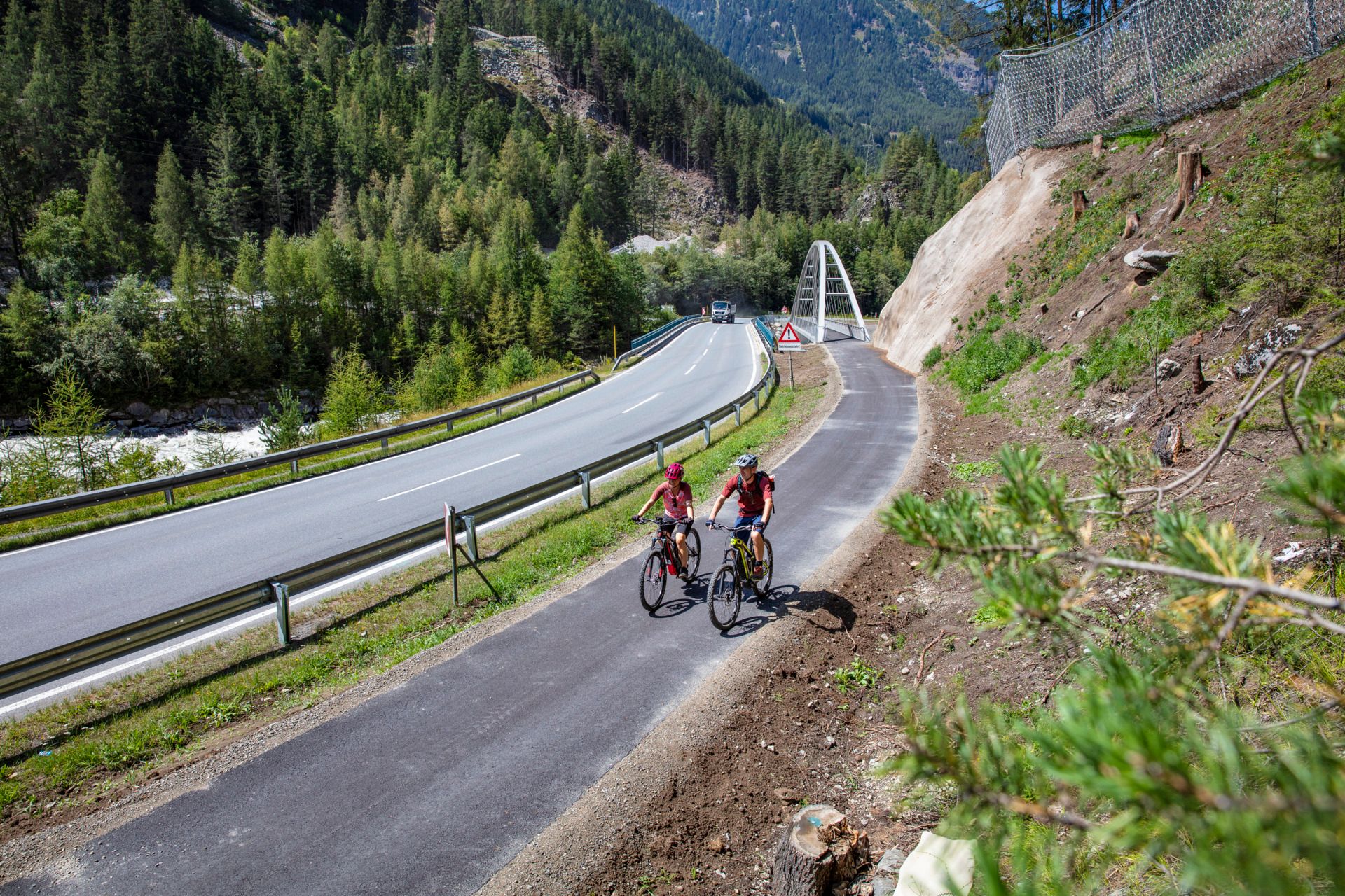
At the end of Huben, cross the Ötztaler Ache again and follow a gravel path parallel to the federal road. Through an underpass, you safely reach the other side of the road and cycle on gravel to Bruggen. After another underpass, a cycle bridge crosses the Ache at Aschbach, followed by a short uphill and slight downhill. Soon you come to the next bridge overpass. At the following fork, keep more east and cycle down to the valley floor, where another bridge crosses the Ache. The last part of the Ötztal cycle route leads finally east of Ötztaler Ache into the municipality of Sölden.


Getting here

  • Arrival by public transport

    Travel comfortably and safely by train to the Ötztal train station. The final stop or exit point is ÖTZTAL train station. Afterwards, travel conveniently and quickly with the public transport or local taxi companies through the entire valley to your desired destination! The current bus timetable is available at: http://fahrplan.vvt.at

  • Parking

    The following parking options are available in Haiming:

    • Haiming sports center, center forecourt of Billa supermarket, forecourt of the municipal office
    • Haiming rafting entry point in the district Magerbach, parking lot Geierwand in the district Magerbach (paid), Tiroler Bundesstraße – Restaurant Oiler's
    • Ötztal-Bahnhof: train station area (paid)
    • Ötztaler Höhe – shopping center and AREA 47 site
    • Ambach: information point

More tours in the surrounding area

Newsletter

The mountain is calling? So does our newsletter!

In our monthly newsletter we reveal the best holiday tips for Tyrol.