
Opening hours:Today closed
Place:
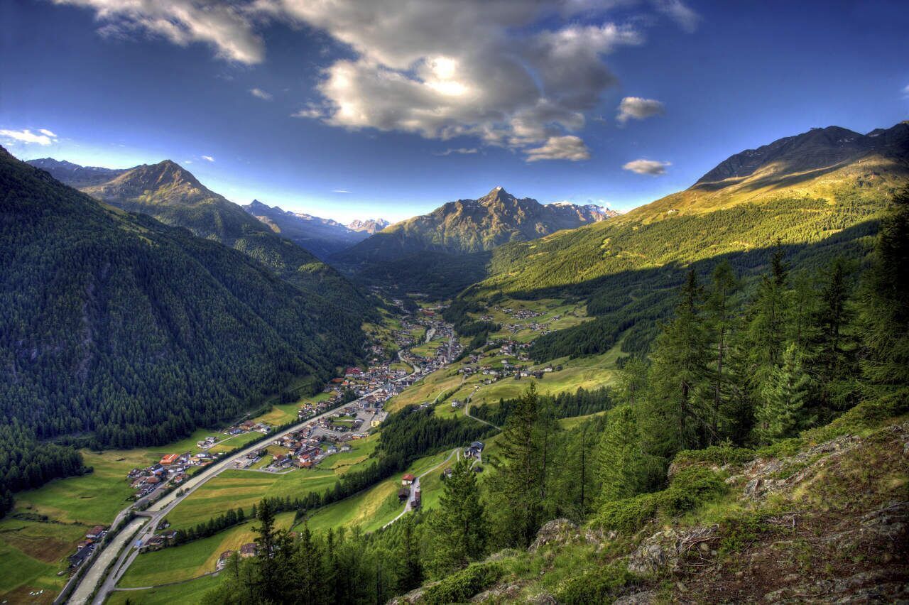
Sölden
:
Restaurant
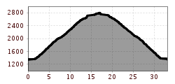
The right ‘mountain bike training’: Not so many kilometres but a lot of altitude metres characterise this tour.


Please note that there may be an increased risk of accidents and injuries in road cycling. Despite careful tour planning, there is always a basic risk. Tour preparation through endurance sports, appropriate training and further education as well as personal prudence minimise the risk of accidents and risks.
Personal equipment must be safe and fit for purpose and meet the relevant technical standards. Every road cyclist is recommended to inform themselves about the planned tours in specialised literature or on site. Complete road bike equipment is highly recommended, even for experienced cyclists!Tip: Lighting is advisable for the tunnels, some of which are poorly lit.
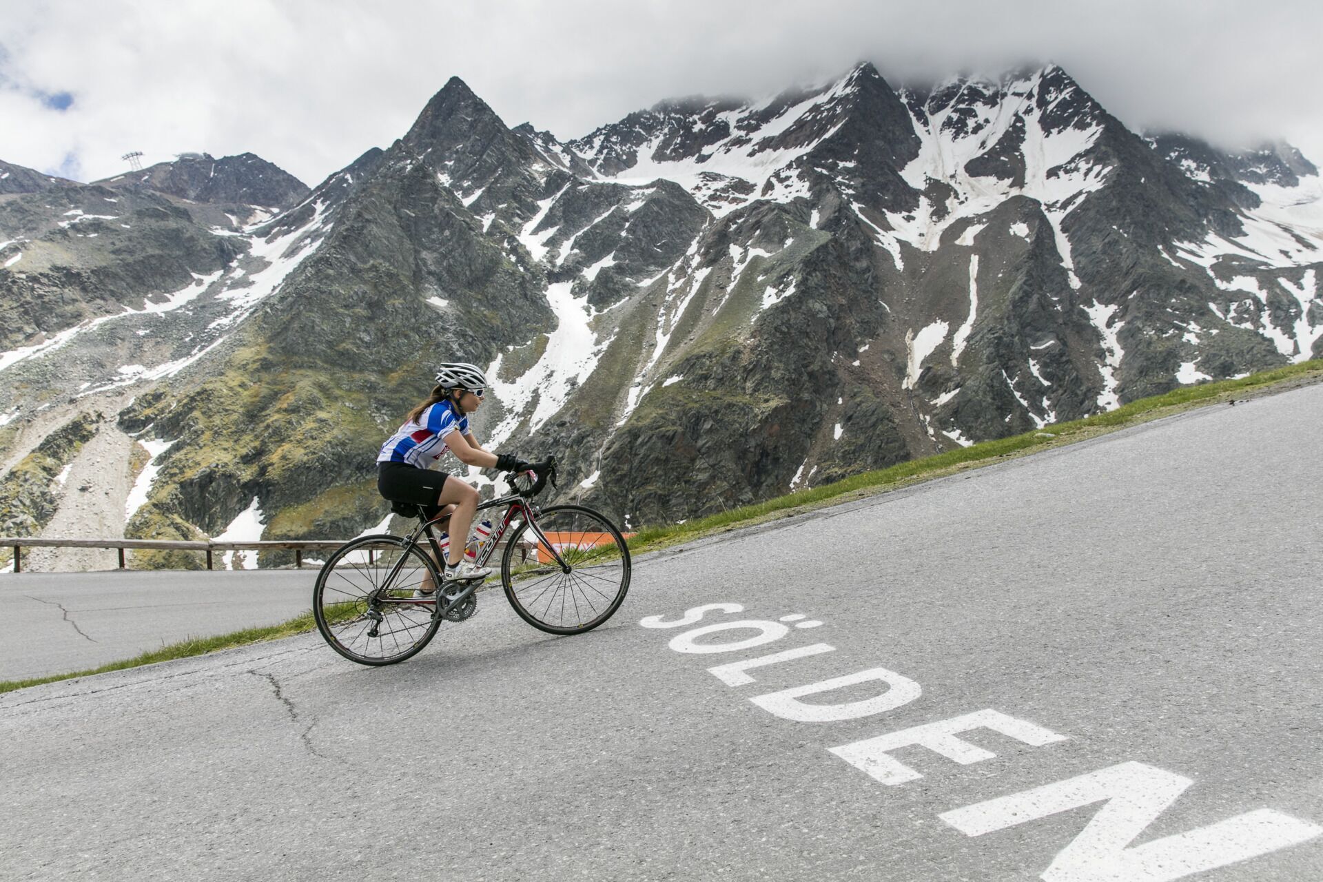
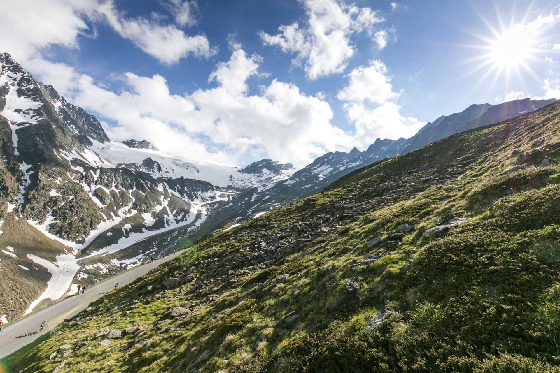
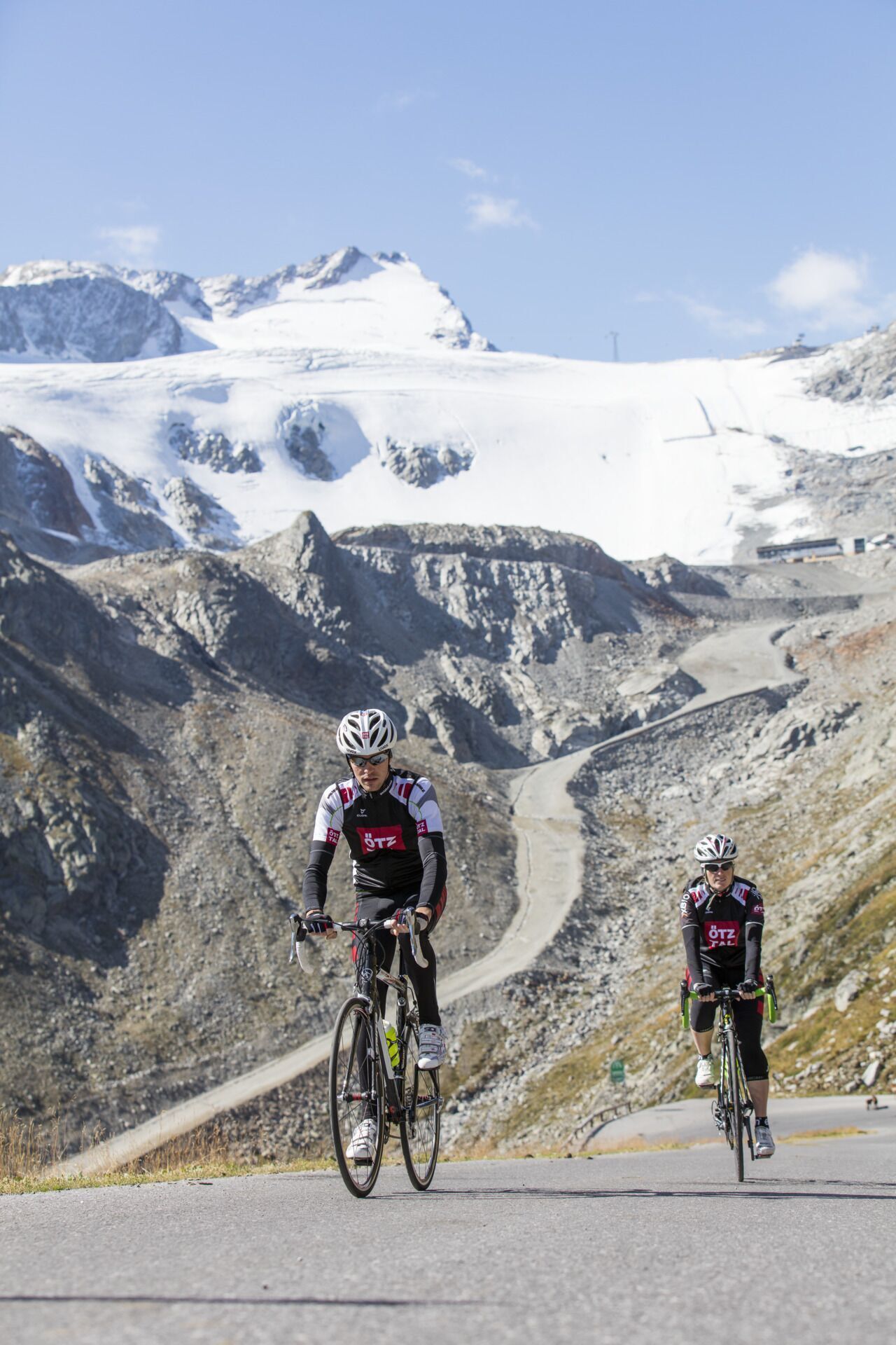
At the southern end of Sölden, the road to the two glacier ski areas Rettenbachferner (known from the start of the Alpine Ski World Cup season) and Tiefenbachferner as well as to Hochsölden branches off to the right. With an average gradient of 10.5%, the Ötztal Glacier Road is no easy task. This difficult stretch along the road, built in 1972, leads from Sölden through the spectacular Rettenbach Valley up to the glacier ski areas in the Ötztal. The wild beauty of the high alpine terrain is just as breathtaking as the increasingly thin mountain air. The Rettenbach glacier is reached after 13.6 kilometres.
The connection through the Rosi-Mittermaier tunnel to the Tiefenbach glacier is the highest road tunnel in Europe. Lighting is advisable for the tunnel to the Tiefenbach Glacier. This may be incentive enough for record hunters to take the glacier road, which was given a wonderfully smooth tar surface in 2004, but the trip into the eternal ice is also worthwhile for those who are mainly interested in scenic beauty.
In 2005 and 2007, the glacier road was conquered by the professional cyclists of the Tour of Germany. From 2015 to 2017, the Rettenbach Glacier was the destination of the royal stage of the Tour de Suisse.
P.S.: "The red-white-red highlight at 2830 metres. Jan Ulrich described the climb as “animal cruelty” and Jens Voigt wanted to “call the mountain rescue service and issue an avalanche warning”. Any questions?"
Anreise mit der Bahn
Reisen Sie mit der Bahn komfortabel und sicher zur Bahnhof-Station Ötztal. Direkt am Bahnhofsvorplatz startet ein Linienbus in Richtung Obergurgl. Die Busfahrt bis nach Sölden dauert ca. 1 - 1,5 Stunden.
Alle wichtigen Informationen zu Busfahrplänen, Verbindungen und Taxiunternehmen finden Sie hier.
An der Talstation der Gaislachkoglbahn und der Giggijochbahn sind ausreichend kostenfreie Parkplätze verfügbar, es stehen auch kostenlose Parkhäuser zur Verfügung. In der Zeit von 8.00 - 19.00 Uhr ist das Pakren kostenfrei.
Kostenpflichtiges Abstellen des PKWs über Nacht im Parkhaus Gaislachkogl möglich:
mehr Informationen zum Parken über Nacht


")

")


