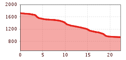
Open interactive mapOpen this POI on the interactive mapElevation profileFishing zone no. 9170 river Tauerbach.gpx
wallfahrtskirche-maria-schnee-obermauern-nilbach-hoch-c-bernhard-assmair.jpg © Bernhard Aßmair Theme path "Virgen crossroads"Difficulty:easyLength:3.2 kmDuration:1:00 hElevation uphill:104 mSee trailSee trail: Theme path "Virgen crossroads"
wanderung-grosser-zunig-wokenmeer-c-bernhard-assmair.jpg © Bernhard Aßmair Lasörling altitude trailDifficulty:mediumLength:57.0 kmDuration:25:00 hElevation uphill:3,740 mSee trailSee trail: Lasörling altitude trail
wandern2-neuepragerhuette-c-dezordo-desiree.jpg © Desirèe De Zordo Venediger altitude trailDifficulty:difficultLength:55.5 kmDuration:27:00 hElevation uphill:3,915 mSee trailSee trail: Venediger altitude trail
Figerhorn - Goßglockner_TVB Osttirol_Elias Bachmann_Kals am Großglockner (1) © TVB Osttirol | Elias Bachmann FigerhornDifficulty:difficultLength:6.5 kmDuration:6:00 hElevation uphill:807 mSee trailSee trail: Figerhorn
muhs-pyramide-panoramaweg-herbst23-c-anna-ladstaetter.jpeg © Anna Ladstätter Muhs panorama trailDifficulty:mediumLength:15.2 kmDuration:6:00 hElevation uphill:1,090 mSee trailSee trail: Muhs panorama trail
Mit dem Nationalpark Ranger unterwegs © NPHT/Martin Lugger Hiking tour to Lucknerhütte 2.241mDifficulty:mediumLength:5.2 kmDuration:2:20 hElevation uphill:320 mSee trailSee trail: Hiking tour to Lucknerhütte 2.241m
nikolauskirche-virgental-matrei-in-osttirol-c-bernhard-assmair.jpg © Bernhard Aßmair Circular walk church St. NikolausDifficulty:easyLength:5.4 kmDuration:1:39 hElevation uphill:150 mSee trailSee trail: Circular walk church St. Nikolaus
wandern-wolken-sonnenaufgang-bergtour-lasoerling-2010-c-bernhard-assmair.jpg © Bernhard Aßmair Lasörling 3.098mDifficulty:difficultLength:21.9 kmDuration:12:00 hElevation uphill:1,940 mSee trailSee trail: Lasörling 3.098m
Glacier trail Innergschlöss/SchlatenkeesDifficulty:mediumLength:9.4 kmDuration:5:00 hElevation uphill:680 mSee trailSee trail: Glacier trail Innergschlöss/Schlatenkees
Hängebrücke_Glocknerkrone_Etappe_6-373_c-Peter-Maier.jpg © Peter Maier Trail Talrundweg Kals am GroßglocknerDifficulty:easyLength:19.5 kmDuration:7:00 hElevation uphill:623 mSee trailSee trail: Trail Talrundweg Kals am Großglockner
wanderung-umbalfaelle-wasserfall-c-bernhard-assmair.jpg © Bernhard Aßmair Umbal waterfalls nature force trailDifficulty:easyLength:6.0 kmDuration:2:30 hElevation uphill:257 mSee trailSee trail: Umbal waterfalls nature force trail
Böses WeiblDifficulty:difficultLength:14.1 kmDuration:8:00 hElevation uphill:1,193 mSee trailSee trail: Böses Weibl
Gschlöss mit Venedigermassiv_TVB Osttirol_Kurzthaler Martin_Keine Ortsangabe.jpg © Kurzthaler Martin Hike to the Venedigerhaus InnergschlößDifficulty:easyLength:8.6 kmDuration:2:30 hElevation uphill:184 mSee trailSee trail: Hike to the Venedigerhaus Innergschlöß
prosseggklamm-matrei-2024-c-peter-maier72_TVB Osttirol_Peter Maier_Matrei in Osttirol.jpg © Peter Maier Circular Hike Proßeggklamm - Hinteregg - Matrei i. O.Difficulty:mediumLength:12.2 kmDuration:5:15 hElevation uphill:730 mSee trailSee trail: Circular Hike Proßeggklamm - Hinteregg - Matrei i. O.
Badener Huette © Fabian Pimminger Badener HütteDifficulty:difficultLength:23.2 kmDuration:11:30 hElevation uphill:1,754 mSee trailSee trail: Badener Hütte
Herbstwanderung_TVB Osttirol_Nationalpark Hohe Tauern Alexander Tempel_Matrei in Osttirol.jpg © www.alexander-tempel.de Hiking tour to St. Pöltner Hütte and 3 lakesDifficulty:difficultLength:14.8 kmDuration:7:45 hElevation uphill:1,119 mSee trailSee trail: Hiking tour to St. Pöltner Hütte and 3 lakes
Stüdlhütte-Kals-Sommer2019-Matteo Bachmann.JPG © Matteo Bachmann Lucknerhaus - StüdlhütteDifficulty:mediumLength:9.3 kmDuration:5:30 hElevation uphill:862 mSee trailSee trail: Lucknerhaus - Stüdlhütte
wandern-sudetendeutschehuette2-c-desiree-dezordo.jpg © Desirèe De Zordo Hiking tour to Sudetendeutschen Hütte 2.650mDifficulty:mediumLength:15.5 kmDuration:7:00 hElevation uphill:1,203 mSee trailSee trail: Hiking tour to Sudetendeutschen Hütte 2.650m
aussergschloess_06-19_(c)www.bergpixel.de © Bergpixel Hike to the Berghaus AußergschlössDifficulty:easyLength:5.2 kmDuration:1:45 hElevation uphill:169 mSee trailSee trail: Hike to the Berghaus Außergschlöss
Kalser Tauernhaus im Nationalpark Hohe Tauern © NPHT Hannah Assil und Michael Kastl Hike to Kalser TauernhausDifficulty:mediumLength:12.2 kmDuration:4:00 hElevation uphill:244 mSee trailSee trail: Hike to Kalser Tauernhaus
Hiking tour to Bergersee Hütte 2.181mDifficulty:mediumLength:10.7 kmDuration:4:30 hElevation uphill:899 mSee trailSee trail: Hiking tour to Bergersee Hütte 2.181m
wanderung-neue-sajathuette-ausblick-c-bernhard-assmair.jpg © Bernhard Aßmair Hiking tour to Neue Sajathütte 2.600mDifficulty:mediumLength:10.3 kmDuration:6:50 hElevation uphill:1,086 mSee trailSee trail: Hiking tour to Neue Sajathütte 2.600m
zupalsee-zupalseehütte-sommer24-c-anna-ladstaetter.jpeg © Anna Ladstätter Hiking tour to Zupalsee Hütte 2.350mDifficulty:mediumLength:14.9 kmDuration:8:40 hElevation uphill:1,261 mSee trailSee trail: Hiking tour to Zupalsee Hütte 2.350m
Neue Reichenbergerhütte_TVB Osttirol_Geyer Johannes_No location given © TVB Osttirol | Johannes Geyer Hike to Neuen Reichenberger HütteDifficulty:mediumLength:18.2 kmDuration:9:00 hElevation uphill:1,252 mSee trailSee trail: Hike to Neuen Reichenberger Hütte
Hoch und Heilig Etappe 7 Virgen Lasörlinghütte_TVB Osttirol_Peter Maier_Virgen in Osttirol.jpg © Peter Maier Hiking tour to Lasörlinghütte 2.350mDifficulty:mediumLength:14.6 kmDuration:7:10 hElevation uphill:1,080 mSee trailSee trail: Hiking tour to Lasörlinghütte 2.350m
Give feedback for a chance to win a special holiday experience!Click here for the surveyClick here for the survey


")


")


www.bergpixel.de")


