
Opening hours:Open today
Place:Leutasch
:Restaurant
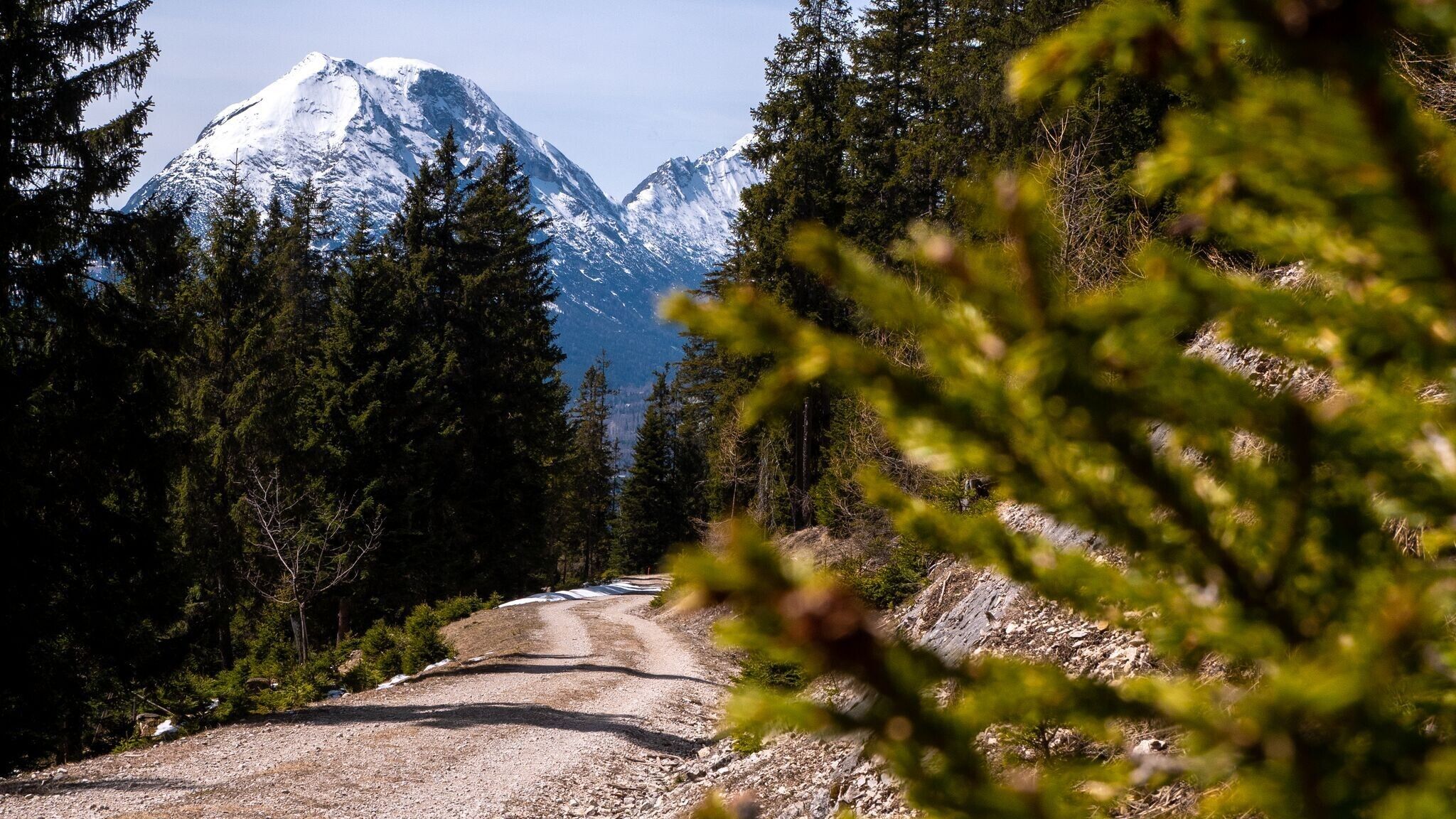
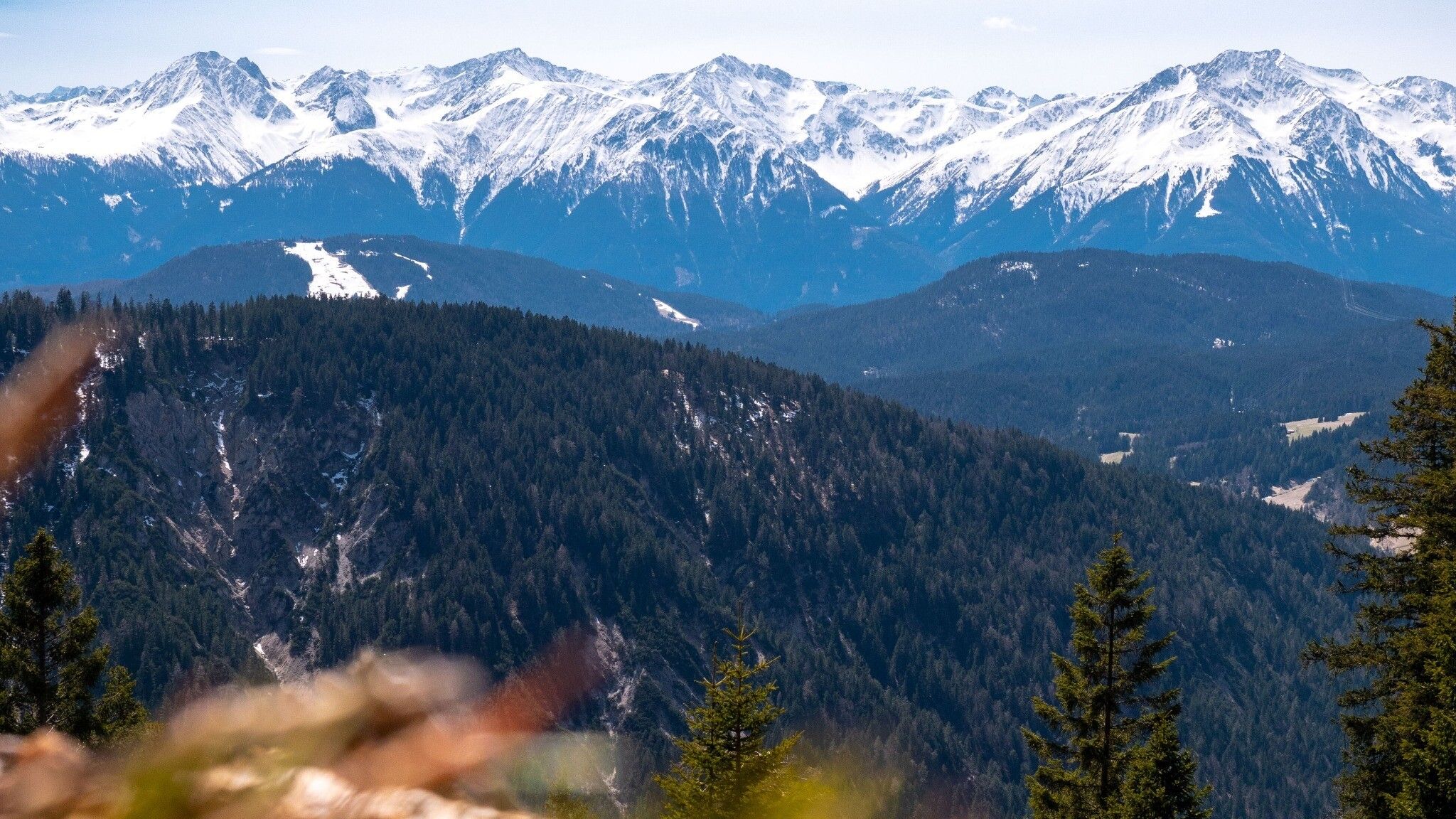
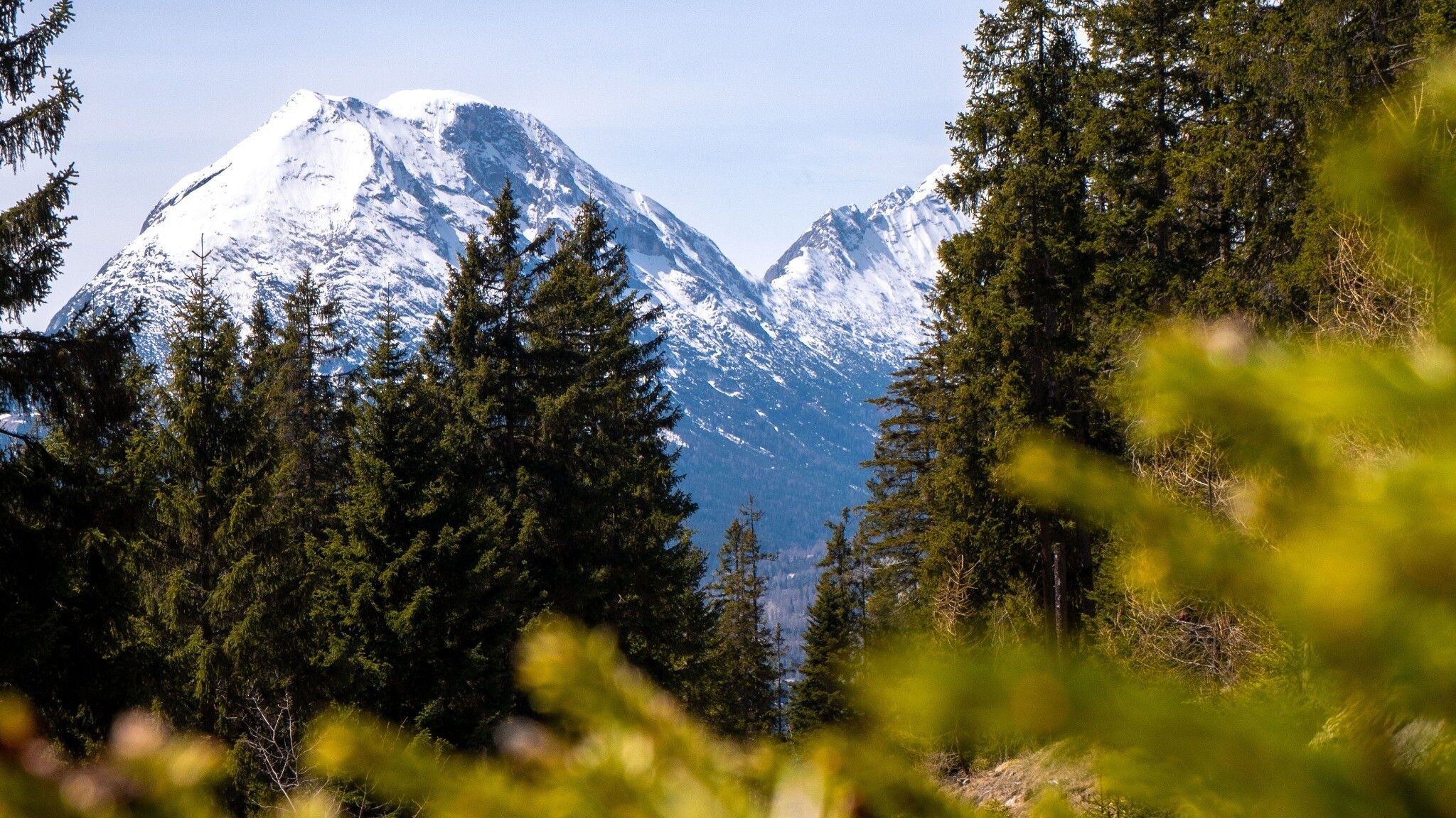
Moderate circular hike from Leutasch to Hoher Sattel, offering panoramic views of Hohe Munde and the surrounding mountain ranges.
Forest roads, woodland paths, aspahlt road and gravel trails.
All current information about the trail closures in the Region Seefeld can be found here.
Have you been out and about in the Region and discovered a spot that we should rework or repair? Fill out the form "Report a danger zone" and let us know where work is needed.
Sturdy hiking shoes, functional clothing, a backpack, water, snacks, basic fitness, and sure-footedness are recommended for this hike!
Additionally, a hiking map or GPS, a first aid kit, sun protection, and hiking poles are advisable.
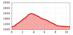
The hike starts in Ahrn and follows a well-maintained trail steadily uphill to the Hoher Sattel. The ascent winds through the forest, with occasional clearings that offer beautiful views of the surrounding landscape.
At the Hoher Sattel, a narrow path leads to the right, continuing to the Hohe Fluder, the highest point of the tour. After a short break, the trail gently descends towards Weidach, passing by the Kreithkapelle.
From the chapel, the route follows the road through Weidach until reaching the Weidach Bridge. There, the path turns right onto the Achweg, which runs peacefully along the Leutascher Ache, leading back to Ahrn.
Take the bus to Leutasch and get off at the "Leutasch Ahrn" bus stop. From there, it’s a 5-minute walk to the starting point at the P6 Hoher Sattel parking lot.
All real-time connections can be found in the route planner.


.jpg")
