Hut hike Hut hike: Brandberg municipal office - Kotahornalm

Mayrhofen, Zillertal / Zillertaler Alpen
Difficulty ratings: medium
Route length: 15.1 km
Duration: 6:00 h

The hike starts at Brandberg and leads past Gasthaus Steinerkogl and Karlalm to Kotahornalm. The return follows the same path, offering stunning mountain views and cozy rest areas along the way.

Tour information

  • Requirement: medium
  • Length: 15.1 km
  • Duration: 6:00 h
  • Elevation uphill:860 hm
  • Elevation downhill:860 hm
Highest point1,750 m

Starting point

Municipal office, Brandberg 13, 6290 Brandberg

Finishing point

Municipal office, Brandberg 13, 6290 Brandberg
  • Fitness level 3 / 6
  • Technique 3 / 6

Best time of year

  • January
  • February
  • March
  • April
  • May
  • June
  • July
  • August
  • September
  • October
  • November
  • December

Trail condition

  • Well-marked hiking trail
  • Easy to moderate ascent
  • Gravel paths and alpine meadows
  • Some narrow trails
  • Shaded sections through the forest
  • Panoramic views of the mountain landscape

Equipment

-
Source: Zillertal

Description

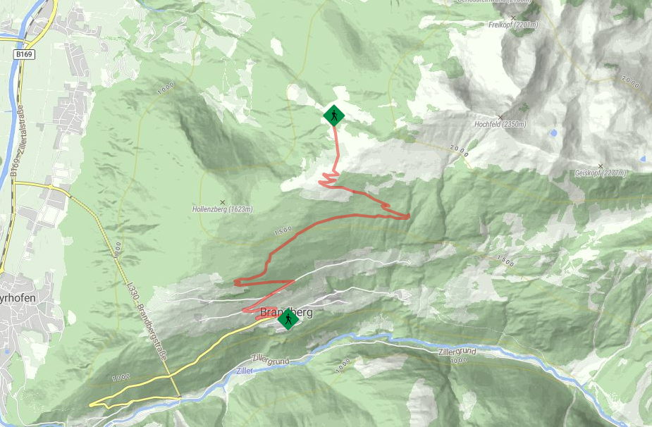
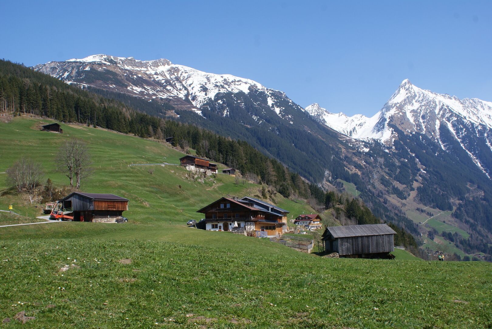
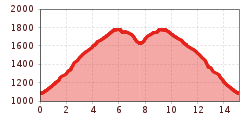
The hike starts at the municipal office in Brandberg and takes you to the Kotahornalm, 1.630 m on Ramsberg. Initially, trail No. 50 ascends gently towards Gasthaus Steinerkogl,1.263 m and then continues over alpine meadows to the idyllic Karlalm, 1.750 m, eventually reaching the Kotahornalm, 1.630 m. For the return to Brandberg, you take the same path. The hike rewards you with an impressive view of the mountain landscape and offers rest areas along the way to enjoy nature.

Nearby huts and mountain restaurants

Getting here

More tours in the surrounding area

Newsletter

The mountain is calling? So does our newsletter!

In our monthly newsletter we reveal the best holiday tips for Tyrol.