Mountain hikes Mödlingweg

closed
Difficulty ratings: easy
Route length: 2.3 km
Duration: 0:50 h

Leisurely hike with a view of the centre of Hopfgarten.  

Tour information

  • Requirement: easy
  • Length: 2.3 km
  • Duration: 0:50 h
  • Elevation uphill:84 hm
  • Elevation downhill:77 hm
Highest point701 m

Starting point

Infobüro Hopfgarten

Finishing point

Infobüro Hopfgarten
  • Fitness level 1 / 6
  • Technique 1 / 6

Features

  • Circular route
  • Suitable for families

Best time of year

  • January
  • February
  • March
  • April
  • May
  • June
  • July
  • August
  • September
  • October
  • November
  • December

Trail condition

Asphalt, forest road, walking path

Equipment

outdoor clothing Sturdy shoes sufficient food and drinks first aid equipment cell phone with full battery & charger hiking map & guide literature possibly GPS device or download the GPS data to the cell phone sun protection (sunglasses, sunscreen & cap) rain protection cash
Source: Kitzbüheler Alpen Management GmbH

Description

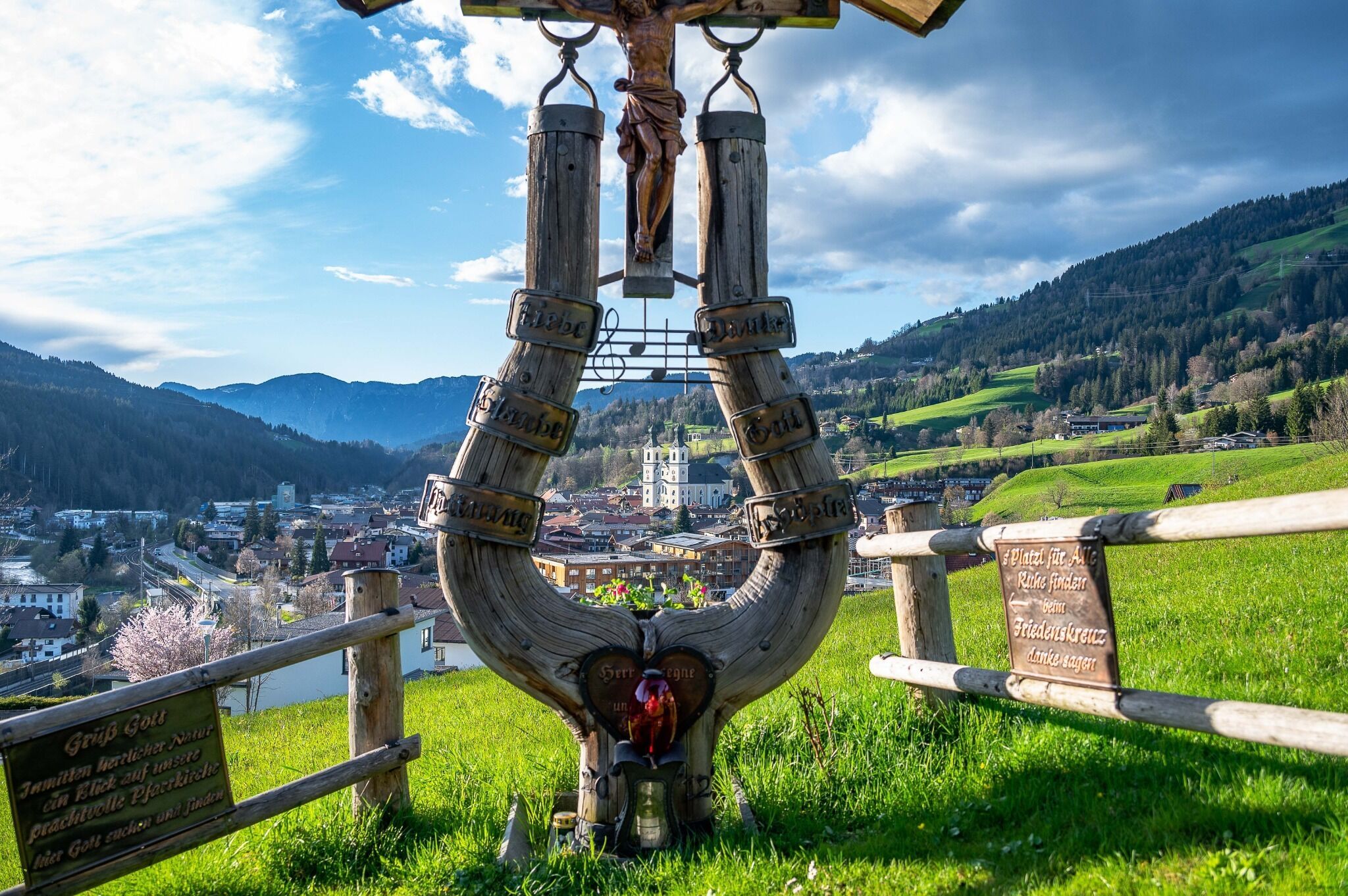
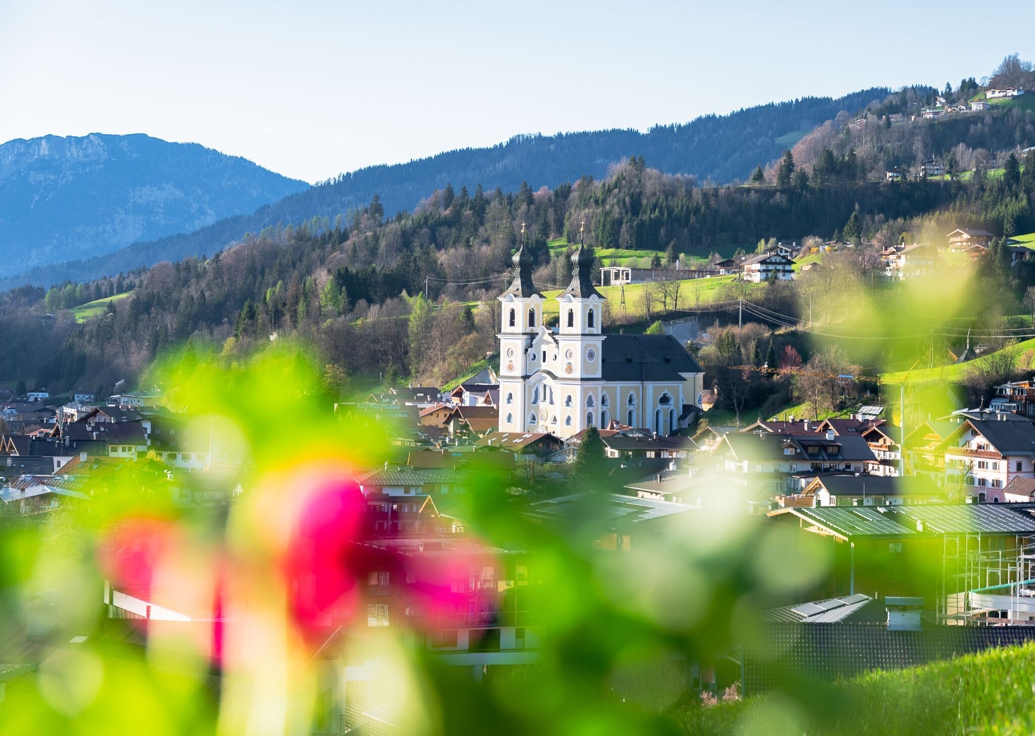
The starting point of this hike is the information office in Hopfgarten. Past the Familotel, follow the signs for no. 5 Mödlingweg. Passing the viewing platform Mödling you continue straight on to the Lindrainweg. From there you walk along the road back to the starting point.

Nearby huts and mountain restaurants

Getting here

  • Arrival by public transport

    bus: Hopfgarten Berglift Bahnhof
    train: Hopfgarten Berglift Bahnhof

    Guest card of the region = train ticket from Kirchbichl to Hochfilzen + bus ticket from Mariastein to Kitzbühel included

    More detailed information: www.hohe-salve.com/mobility
     

  • Parking

    Wasserfeld parking lot (free of charge)
    Lift parking lot - free of charge when using the gondola

More tours in the surrounding area

  • Lechtaler Höhenweg

    Difficulty: difficult
    Length: 84.5 km Duration: 45:00 h Elevation uphill: 6,773 m
  • Bärenkopf

    Difficulty: medium
    Length: 16.3 km Duration: 6:15 h Elevation uphill: 1,065 m
  • Guffert

    Difficulty: difficult
    Length: 10.3 km Duration: 6:30 h Elevation uphill: 1,195 m
  • Pertisau - Falzthurnalm - Gramai Alm - Pertisau

    Difficulty: easy
    Length: 14.1 km Duration: 4:30 h Elevation uphill: 280 m
  • Steinberg - Panoramarunde

    Difficulty: easy
    Length: 6.1 km Duration: 2:00 h Elevation uphill: 200 m
  • Bärenwald circuit

    Difficulty: easy
    Length: 4.8 km Duration: 1:30 h Elevation uphill: 180 m
  • Carnic altitude trail

    Difficulty: medium
    Length: 150.0 km Duration: 26:50 h Elevation uphill: 9,100 m
  • Dalfazer Falls

    Difficulty: medium
    Length: 9.2 km Duration: 4:00 h Elevation uphill: 760 m
  • Rosengartenschlucht

    Opening hours: closed
    Difficulty: easy
    Length: 4.4 km Duration: 2:30 h Elevation uphill: 282 m
  • Arzl - Benni-Raich-Bridge - Wald

    Difficulty: easy
    Length: 1.8 km Duration: 0:40 h Elevation uphill: 120 m
  • Breitegg tour

    Difficulty: medium
    Length: 11.0 km Duration: 5:00 h Elevation uphill: 680 m
Newsletter

The mountain is calling? So does our newsletter!

In our monthly newsletter we reveal the best holiday tips for Tyrol.