Description
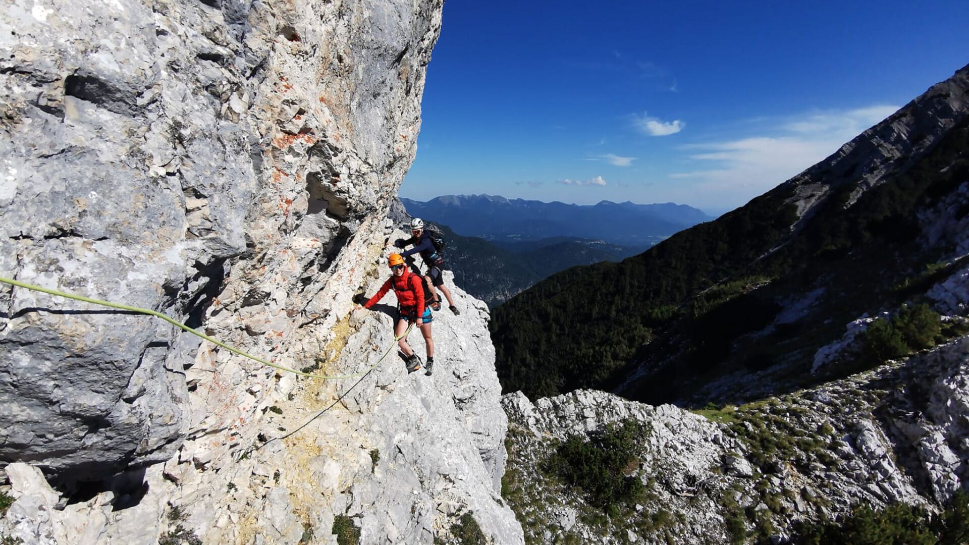
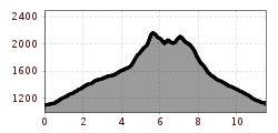
Long, difficult alpine tour with climbing passages in grade 3-, which requires excellent physical condition.
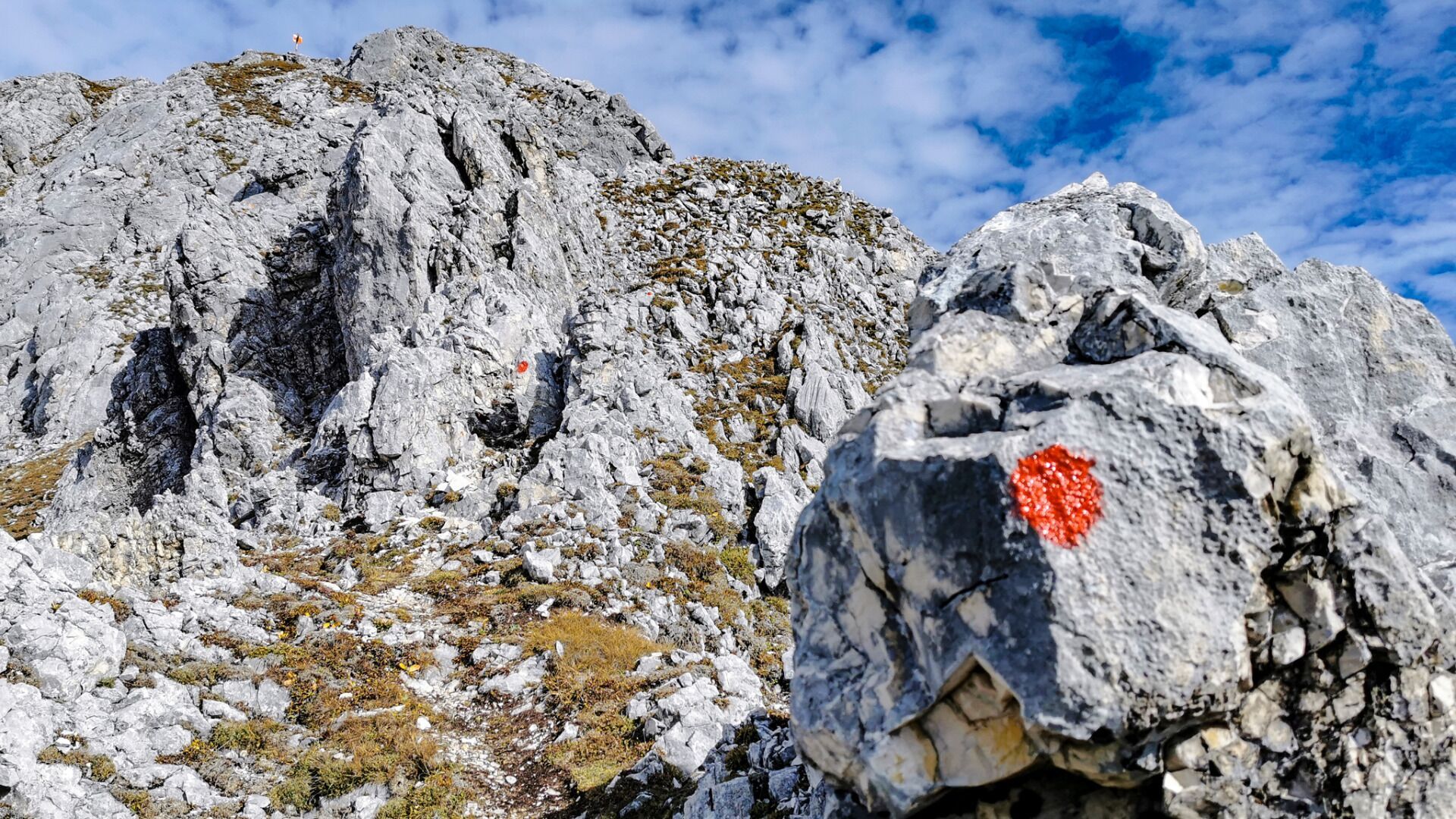
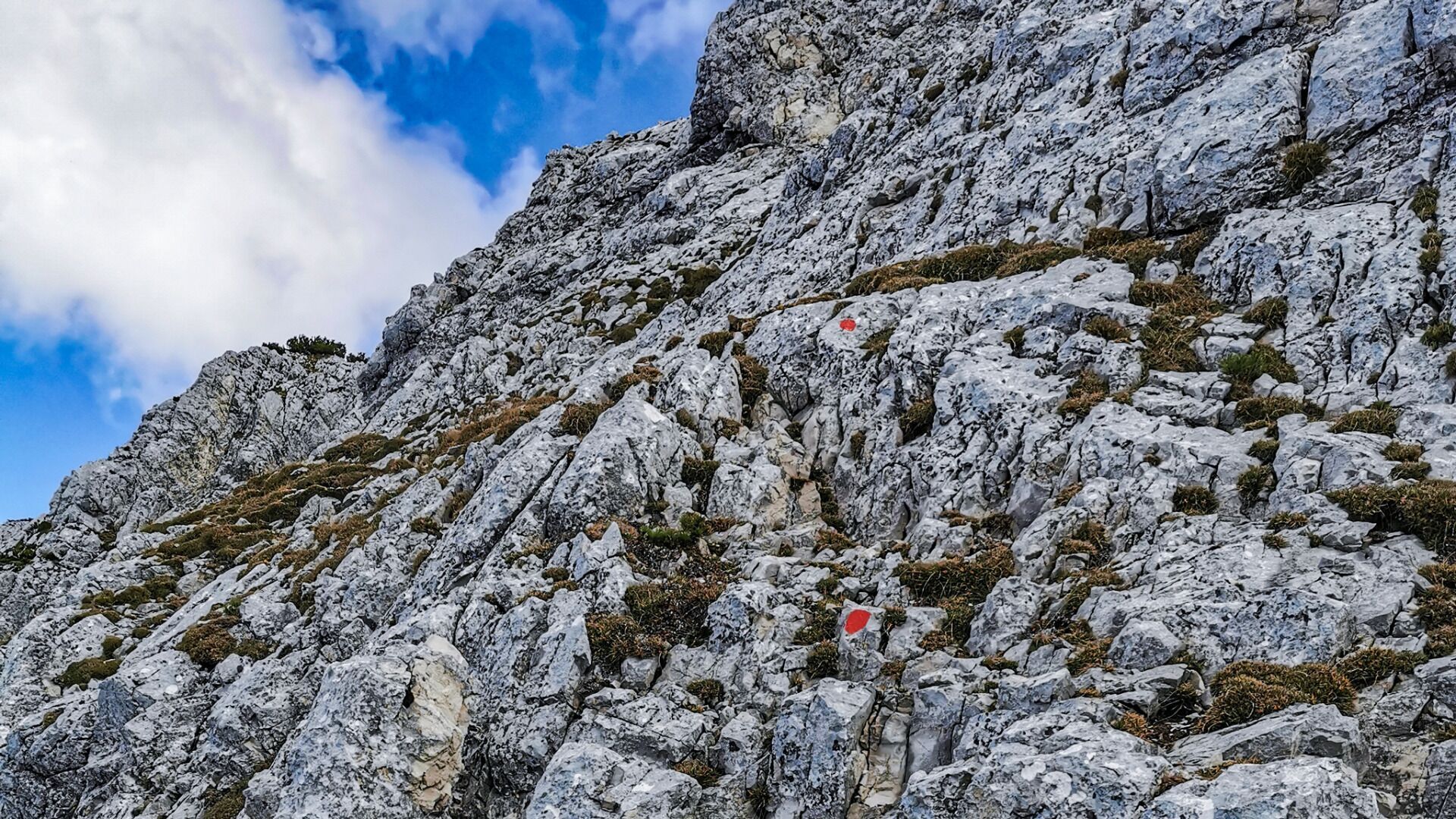
Only recommended for very experienced climbers, because the route is marked (red dots) but not secured. There are some climbing passages in grade 3- to overcome. Climbing harness, rope and helmet are necessary for self-securing.
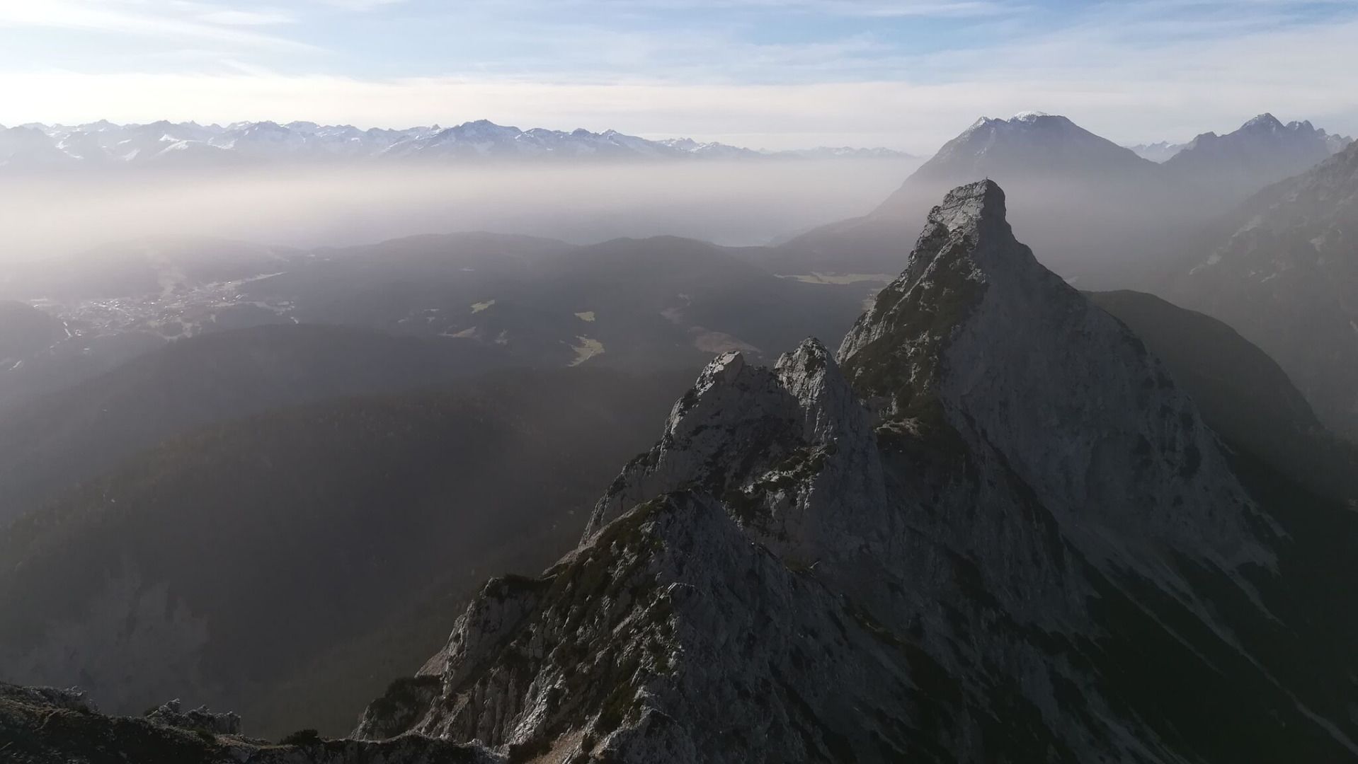
From the parking lot (P6) in the Ahrn district, follow the forest road to the Hohe Sattel. It is recommended to ride your bike up there. From the Hohen Sattel continue by foot, always following the signs in the direction of Große Arnspitze. The path quickly turns into a steep climb through gravelly terrain. From the unserviced hut it takes about 50 minutes to reach the summit of the Große Arnspitze. From the summit descend again a few meters, then to the right the route leads through rocky terrain, partly interspersed with mountain pines, to the Mittlere Arnspitze (no climb, but route marked with red dots).
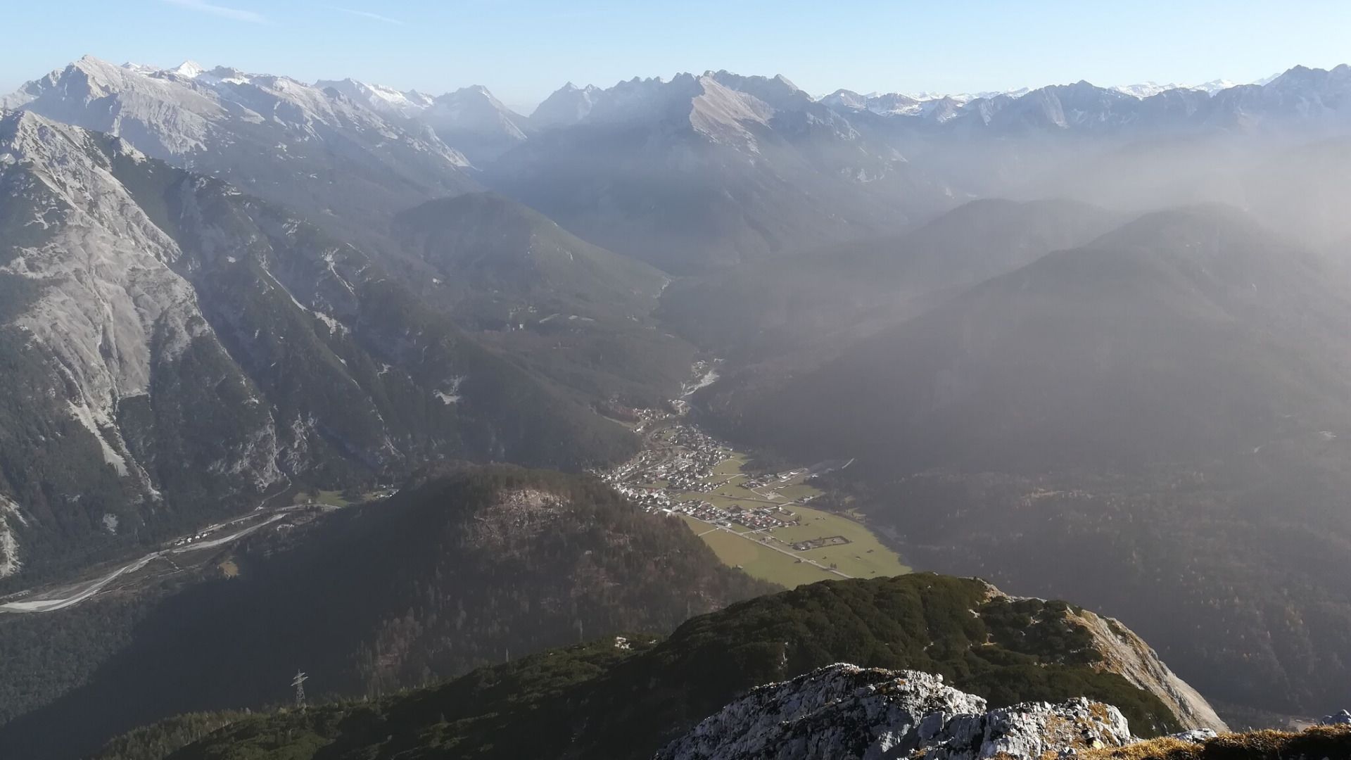
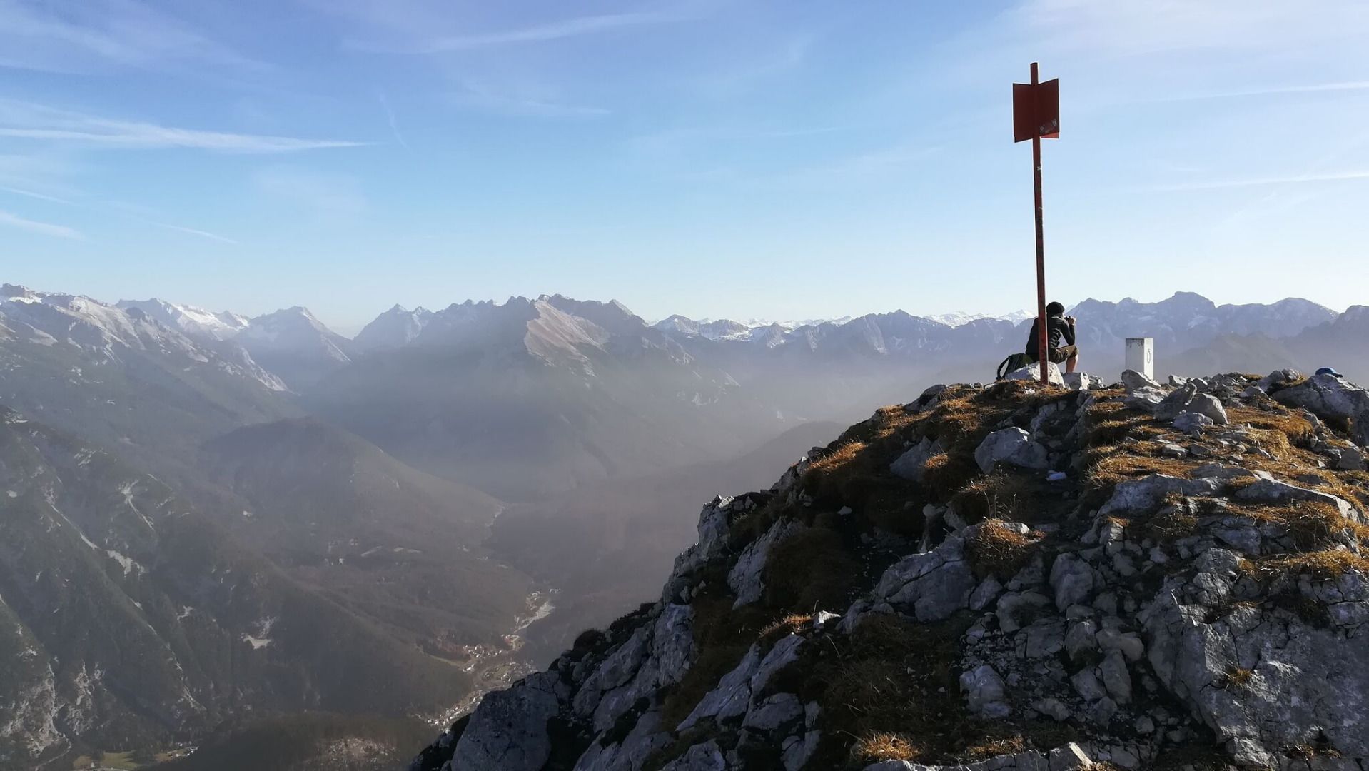
Always along the ridge, following the markings, go to the Mittlere Arnspitze. This can also be bypassed without difficulty. The Arnplattenspitze offers a short climb in the last part to the summit cross. Here, at the latest, you should enjoy the breathtaking view of the surrounding mountain world that lies at your feet.
The descent from the summit is secured by ropes. Follow the path to the junction and descend steeply to the Hohe Sattel and from there return to Ahrn by bike.
Hint:
Perfect as a bike & hike tour. Ride up to the Hohen Sattel with the (e-)mountain bike and park it there. After the crossing you descend again to the Hoher Sattel and can comfortably cycle back to the parking lot. An early start is recommended, as the tour is very sunny & hot. Take enough water with you, as there are no possibilities to refill it on the way.
More hikes around Arnspitze:
- Hike Hoher Sattel - Große Arnspitze Summit, 2,196 m
- Hike Arnplattenspitze
- Hike to the Große Arnspitze Summit, 2,196 m


.jpg")


.jpg")


.jpg")


