Mountain hikes Panorama-Restaurant Kanzelkehre - Wiesing - Panorama-Restaurant Kanzelkehre

Wiesing / Brandenberger Alpen (Rofan)
Difficulty ratings: easy
Route length: 6.6 km
Duration: 2:45 h

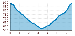
Hike from the Kanzelkehre viewpoint (overlooking the Inntal) down to Wiesing (6.6km, 325m elevation loss, ca. 2 hours 45 minutes). The return route is uphill on the same route, or you can take the bus.

Tour information

  • Requirement: easy
  • Length: 6.6 km
  • Duration: 2:45 h
  • Elevation uphill:325 hm
  • Elevation downhill:325 hm
Highest point896 m

Starting point

Wiesing, car park Panorama-Restaurants Kanzelkehre

Finishing point

Wiesing, care park Panorama-Restaurants Kanzelkehre
  • Fitness level 2 / 6
  • Technique 1 / 6

Best time of year

  • January
  • February
  • March
  • April
  • May
  • June
  • July
  • August
  • September
  • October
  • November
  • December

Trail condition

forest road, forest path

Equipment

Sturdy boots (ankle-high hiking boots), weather appropriate clothing. Telescopic hiking poles are recommended.
Source: Achensee

Description

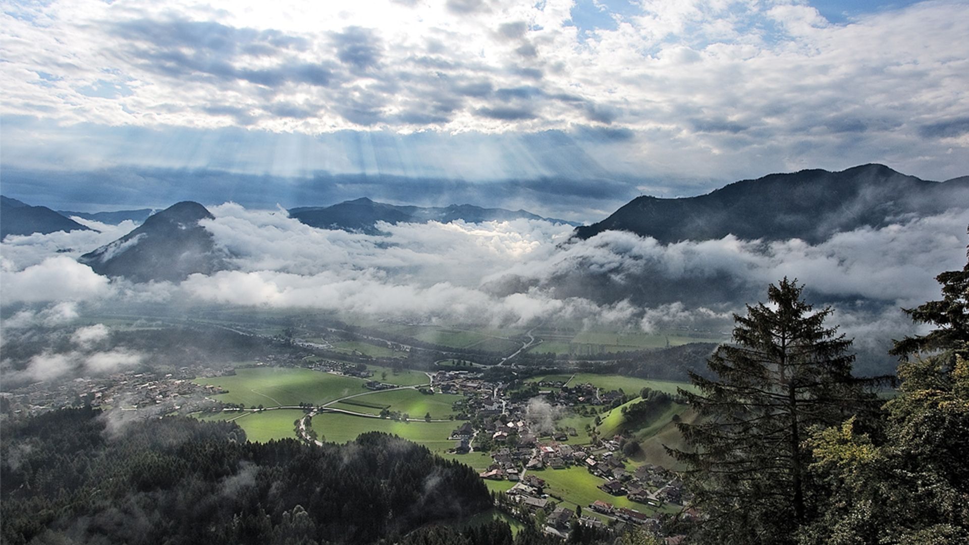
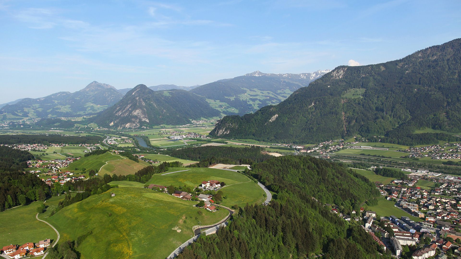
From the car park of the Panorama-Restaurant Kanzelkehre, walk along the main road for a few metres until you reach the signpost “Wiesing/Erlach”. Follow the forest path which affords splendid views of the Inn- and Zillertal until you come to an asphalt road. Turn right and walk past house number 227. Walk through the underpass of the Achensee main road and continue along the village road until you arrive at the parish church Wiesing. The return is via the same route, or by bus. 

Nearby huts and mountain restaurants

Getting here

  • Arrival by public transport

    Take the regional bus (line 4080 or 8332) to Wiesing and get off at the "Wiesing (Tirol) Kanzelkehre" stop. 

  • Parking

    Car park Panorama-Restaurant Kanzelkehre

More tours in the surrounding area

Newsletter

The mountain is calling? So does our newsletter!

In our monthly newsletter we reveal the best holiday tips for Tyrol.