Arrival by public transport
By train to Steinach am Brenner, from there with bus line 4144 to Schmirn-Kasern.
Information on the timetable at www.vvt.at
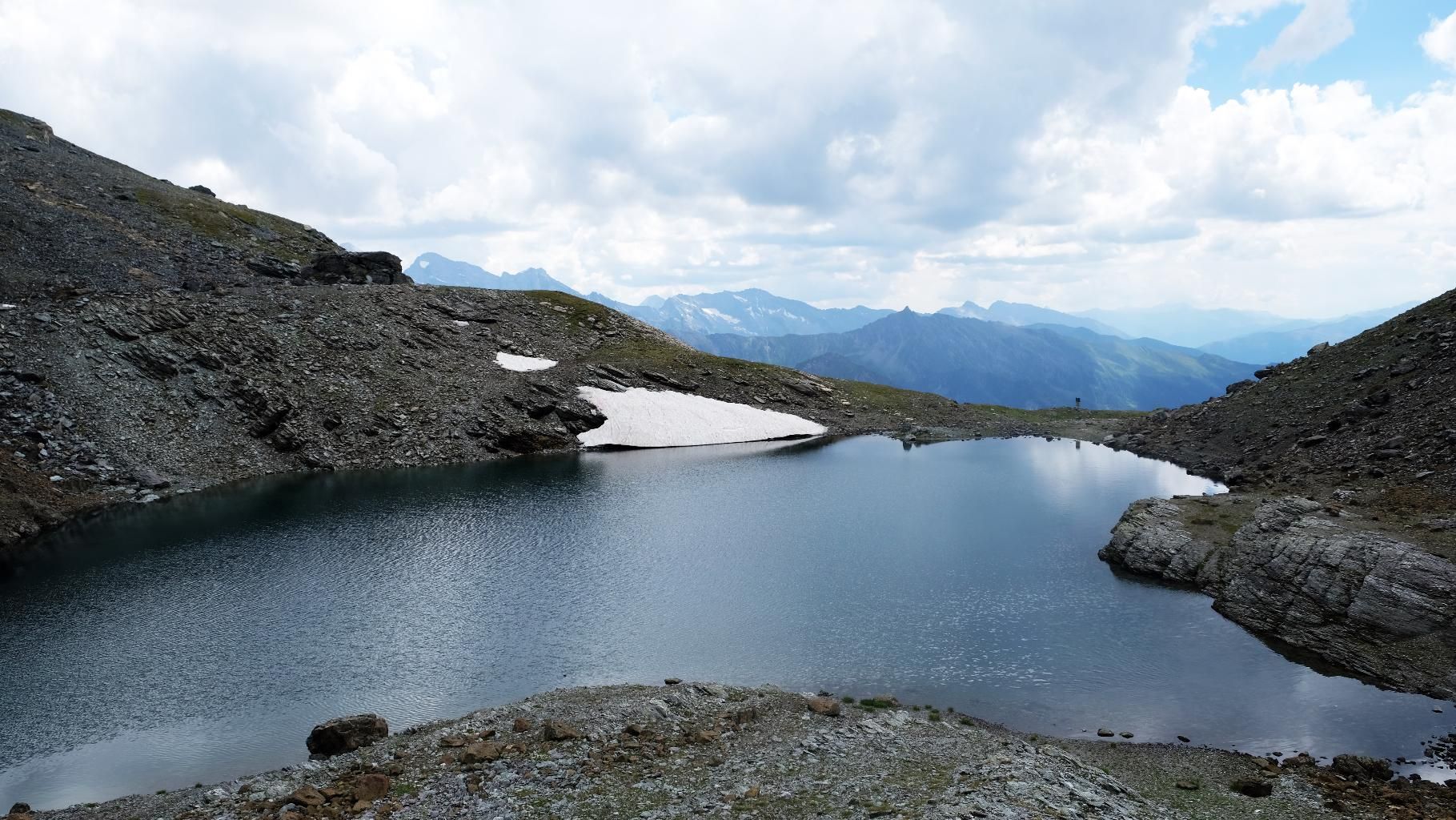
A scenically very rewarding mountain tour along the common valley head of the Schmirn and Navistal valleys, past the Staffelsee lake to the majestically enthroned Lixumer Reckner.
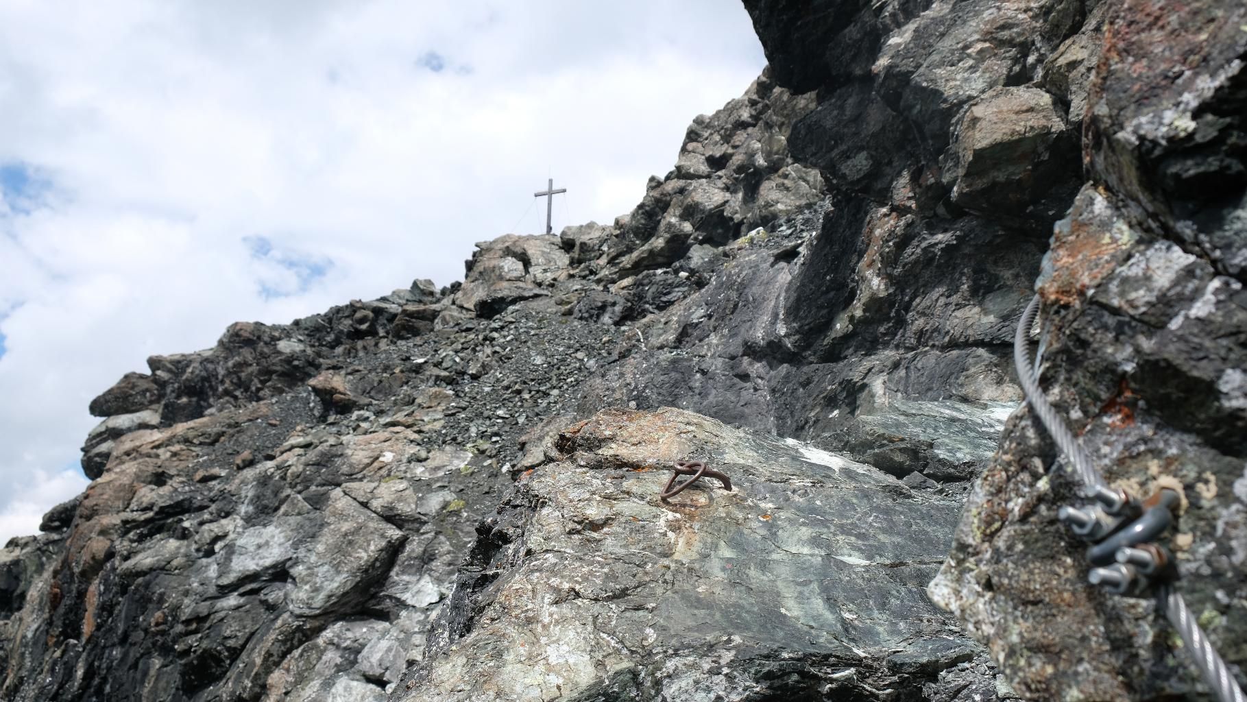
Starting from the small hamlet of Obern, the trail first leads across the imposing Kluppental valley to the alpine pasture of the same name and then to the beautifully situated, opening valley end. After a steep step up the southern slope, the trail then continues over the ridge to the crystal-clear Staffelsee, which lies directly below the summit. Due to the sheltered location and the impressive surroundings, this is the first place to stop for a short while before heading first through geologically interesting rock to a small saddle, then later over secured climbing passages (2) along the ridge to the summit. The Lizumer Reckner is the highest mountain in the Tux Alps, so you have a wonderful view of the limestone walls of the Karwendel and Rofan mountains as well as the mighty three-thousand-metre peaks of the main Alpine ridge.
ROUTE DESCRIPTION
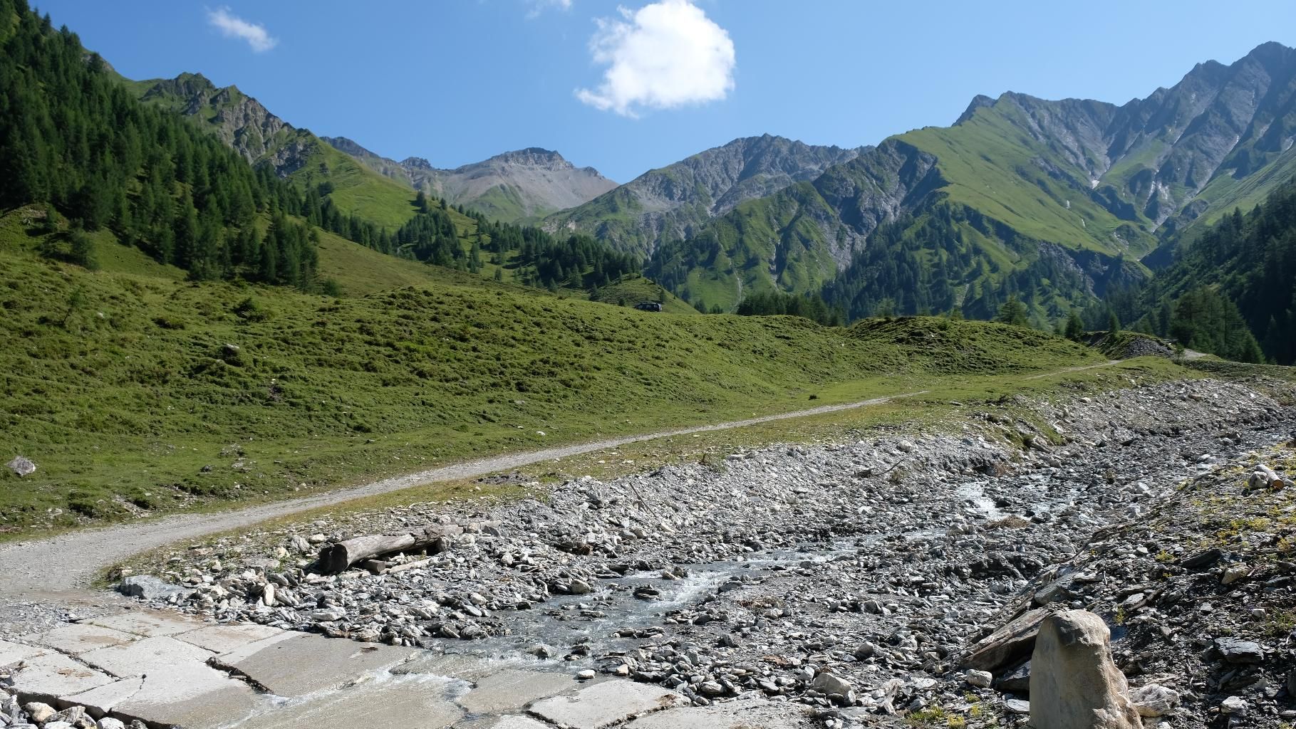
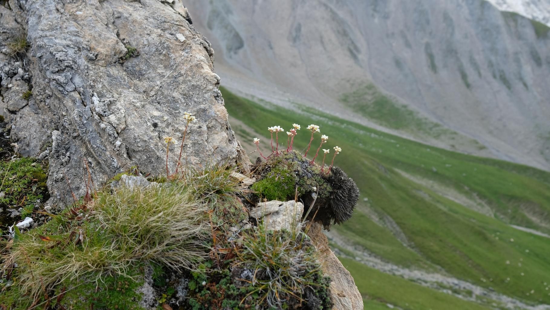
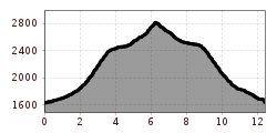
The starting point of the tour is the small hamlet of Toldern, sleepily situated at the far end of the Schmirntal valley. The route begins with a gentle ascent along a forest path through the wild and steep Kluppental valley to the alpine pasture of the same name, which you reach after a good half hour. When you reach the alpine pastures, the valley opens up and suddenly you find yourself in a wide basin after crossing a small stream without any problems. A little later, a small alpine village comes into view, where the path splits and you have to turn left. Now follows what is probably the most strenuous part of the tour, with around 600 metres of altitude to conquer, first in the sparse forest and later through steep pastureland on the south side. After reaching the ridge, you are rewarded with a beautiful view of the rugged walls of the Tux Alps and the white glow of the Hintertux Glacier and Olperer. If you still feel like it, you can take the summit of the Naviser Kreuzjöchl, which is 10 minutes out of the valley - otherwise continue along the ridge in a north-easterly direction, always towards the clearly visible Lizumer Reckner. This section of the tour is particularly beautiful, as on the one hand the pleasant incline allows you to progress quite quickly, and on the other hand the ridge hike gives you great impressions of the back of the Navis and Schmirn valleys. Don't be alarmed by the military warning signs - the region around the summit is indeed in a military training area, but it is precisely in this area that actual rehearsals are quite rare. After some time on the ridge, you finally reach a connecting path coming from Navis (unfortunately not signposted), now the path climbs a little steeper again and a little later you reach the eagerly awaited Staffelsee, which lies beautifully below the Reckner. The area around the crystal-clear lake is perfect for a short rest, the brave can also take a dip. From the Staffelsee, first follow the valley up about 200 metres in altitude to a small saddle and from there head north along the ridge over climbing passages secured with steel ropes (level 2) to the summit. The descent is the same as the ascent; an alternative is to return via the Navistal.
TIP OF THE AUTHOR
If the sun is shining, we recommend packing your swimming trunks and taking a brief dip in the crystal-clear Staffelsee - but beware, the water is very, very cold.
By train to Steinach am Brenner, from there with bus line 4144 to Schmirn-Kasern.
Information on the timetable at www.vvt.at


.jpg")
")


 (1).jpg")


.JPG")

