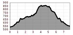
Kapellenweg Hart im Zillertal

Fügen, Zillertal / Tuxer Alpen
Route length: 8.4 km

Medium length course with a challenging climb admidst a tranquil landscape

Tour information

  • Length: 8.4 km
  • Elevation uphill:391 hm
  • Elevation downhill:391 hm
Highest point857 m

Starting point

Fügen / Ziller

Finishing point

Fügen / Ziller
Source: Zillertal Tourismus GmbH

Description

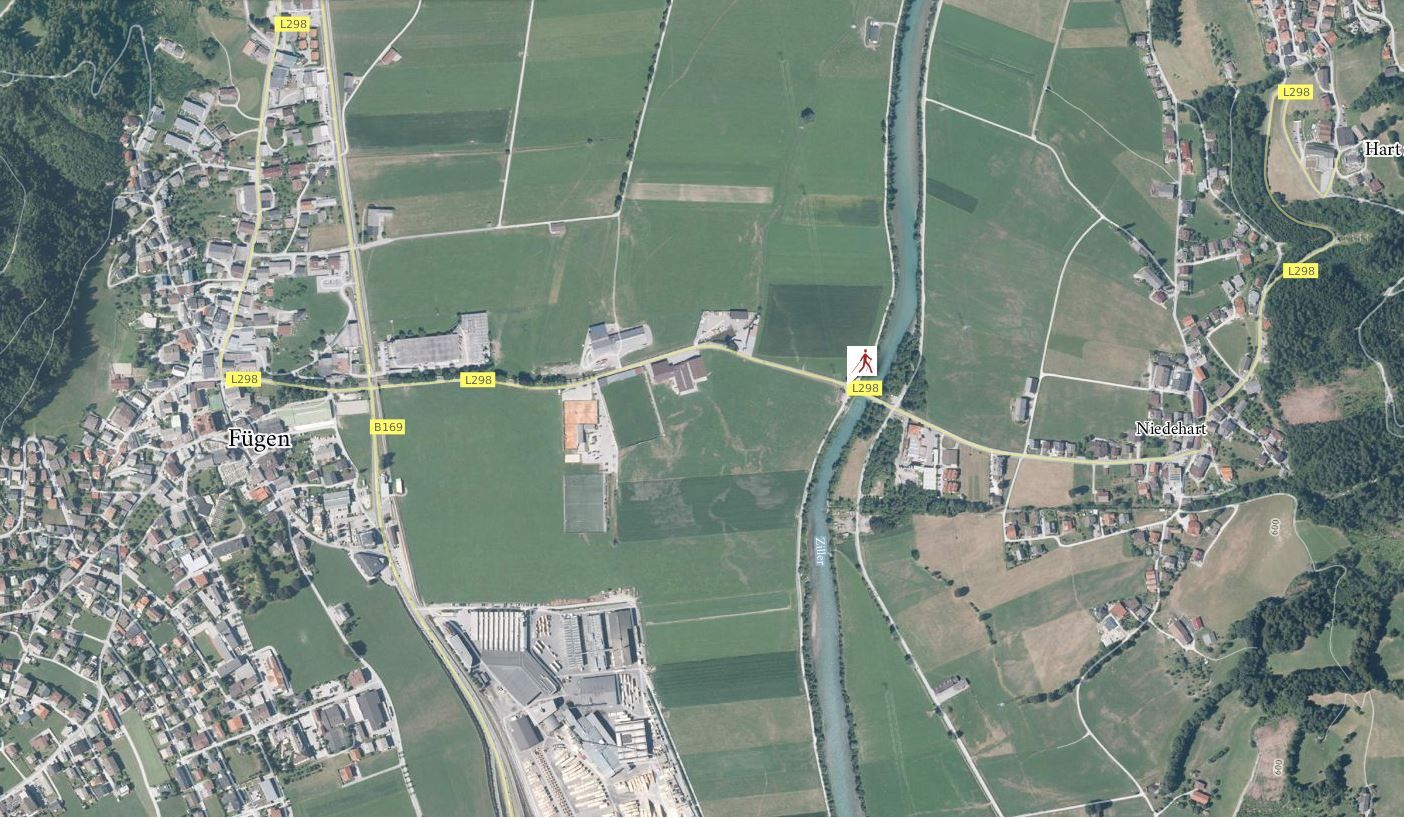
The chapel trail runs parallel to the Bird Trail up toward Oberhart. The trail then goes from the church along the public road toward the north. The course goes a slightly uphill gradient past residential homes and farmyards  along a wonderfully tranquil part of the Ziller Valley. After following steeply climbing forest trails, the course then heads toward the south, past several chapels, down toward Oberhart and back to the starting point.
 

More tours in the surrounding area

  • Hochfügen - Kleiner Gilfert (2388m) Walk no. 27

    Difficulty: medium
    Length: 14.4 km Duration: 6:00 h Elevation uphill: 925 m
  • Hamberg (2095m) from the Gasthof Almluft (Trail No. 37)

    Difficulty: medium
    Length: 9.4 km Duration: 4:45 h Elevation uphill: 865 m
  • Nature Trail and Bird Nature Trail

    Difficulty: medium
    Length: 6.5 km Duration: 2:00 h Elevation uphill: 250 m
  • 471 Kaltenbach - Wedelhütte

    Difficulty: medium
    Length: 36.9 km Duration: 5:00 h Elevation uphill: 1,759 m
  • 401 | Zillertaler Höhenstraße

    Difficulty: difficult
    Length: 52.6 km Duration: 7:40 h Elevation uphill: 1,890 m
Newsletter

The mountain is calling? So does our newsletter!

In our monthly newsletter we reveal the best holiday tips for Tyrol.