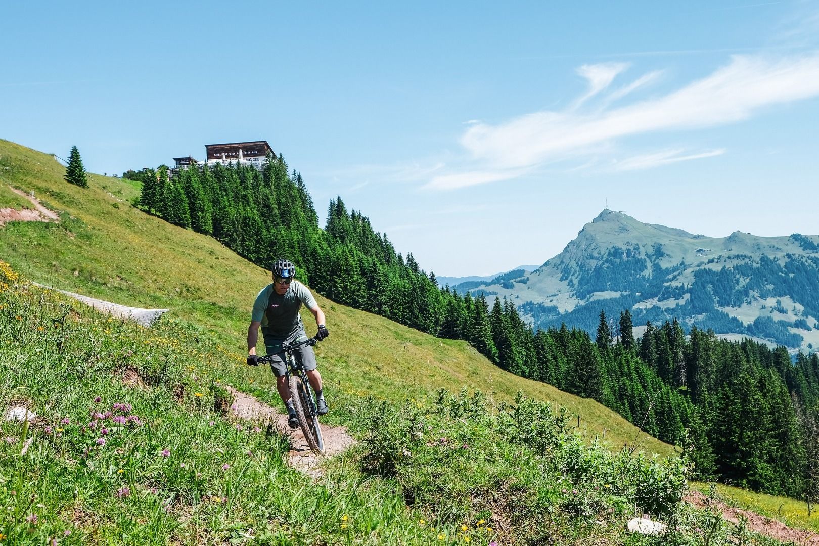
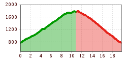
Open interactive mapOpen this POI on the interactive mapElevation profileOn Tour with Benni Raich - Gravel Bike.gpx
Lämmerbichl_Tirol Werbung_Sürth Paul_Tux-Hintertux.jpg © Sürth Paul Spring with late crocus blossom in Tux ValleyDifficulty:mediumLength:10.0 kmDuration:4:00 hElevation uphill:640 mSee trailSee trail: Spring with late crocus blossom in Tux Valley
valentinkapelle-1.jpg © Archiv TVB Mayrhofen Mountain hike: Zillergrund - Valentins KapelleDifficulty:mediumLength:3.2 kmDuration:2:30 hElevation uphill:390 mSee trailSee trail: Mountain hike: Zillergrund - Valentins Kapelle
Round hike to Padauner KogelDifficulty:mediumLength:12.0 kmDuration:5:00 hElevation uphill:936 mSee trailSee trail: Round hike to Padauner Kogel
Barrierefreier Themenweg am Schlosskopf © Inn-Frame Fotografie www.inn-frame.at Barrier-free theme trail at the castle headDifficulty:easyLength:1.0 kmDuration:0:20 hElevation uphill:26 mSee trailSee trail: Barrier-free theme trail at the castle head
ski_tour_breiteggspitz_wildschoenau_csilberberger_44 © TVB Wildschönau | Christine Silberberger BreiteggspitzeDifficulty:easyLength:3.4 kmDuration:2:00 hElevation uphill:700 mGo to skitourGo to skitour: Breiteggspitze
2023_TVB-Ischgl-Paznaun_Sommer_Cross-Trail_Gruebele-See_WEST_3267.jpg © TVB Paznaun-Ischgl 01 Premium long-distance hiking trail - High route PaznaunDifficulty:mediumLength:138.6 kmDuration:60:00 hElevation uphill:10,316 mSee trailSee trail: 01 Premium long-distance hiking trail - High route Paznaun
Radstrecke Bike Everest Tirol © © Serfaus-Fiss-Ladis Marketing GmbH Bike Everest TirolDifficulty:difficultLength:285.0 kmElevation uphill:8,848 mGo to biketourGo to biketour: Bike Everest Tirol
iseltrail-etappe2-feldner-katarakte-c-ramona-walder.jpg © TVB Osttirol/Waldner Ramona Iseltrail Stage 2More InformationMore Information: Iseltrail Stage 2
Bank bei Gratlspitze Alpbach, CCE Wanderdörfer © Nadine Probst Gratlspitze 1.899 m - starting point: Berggasthof HolzalmDifficulty:mediumLength:4.6 kmDuration:2:30 hElevation uphill:479 mSee trailSee trail: Gratlspitze 1.899 m - starting point: Berggasthof Holzalm
Geraerhütte_JohannesBitter_TVB-Wipptal_170623_105.jpg © JOHANNES BITTER Hike to the Geraer Hütte | Austrian TyrolDifficulty:mediumLength:7.0 kmDuration:5:30 hElevation uphill:1,000 mSee trailSee trail: Hike to the Geraer Hütte | Austrian Tyrol
1. Etappe KAT Bike Sport+Difficulty:mediumLength:25.0 kmDuration:3:30 hElevation uphill:1,108 mGo to biketourGo to biketour: 1. Etappe KAT Bike Sport+
Etappe_6 (1).jpg © Tourismusverband Paznaun - Ischgl Stage 6: Through the VerwallDifficulty:mediumLength:15.0 kmDuration:8:00 hElevation uphill:1,481 mSee trailSee trail: Stage 6: Through the Verwall
Scenic nature site: GletscherblickMore InformationMore Information: Scenic nature site: Gletscherblick
Suspension bridge to Maria Locherboden pilgrimage churchDifficulty:mediumLength:8.5 kmDuration:3:00 hElevation uphill:370 mSee trailSee trail: Suspension bridge to Maria Locherboden pilgrimage church
Sonnenaufgang_Kleiner_Gilfert_©FranzKupfner.jpg © (c) Ferienregion Fügen-Kaltenbach im Zillertal, Franz Kupfner Hochfügen - Kleiner Gilfert (2388m) Walk no. 27Difficulty:mediumLength:14.4 kmDuration:6:00 hElevation uphill:925 mSee trailSee trail: Hochfügen - Kleiner Gilfert (2388m) Walk no. 27
Sillianer Hütte © Peter Leiter Carnic altitude trail. Stage 1: Arnbach - Sillianer HütteDifficulty:easyLength:9.5 kmElevation uphill:1,350 mSee trailSee trail: Carnic altitude trail. Stage 1: Arnbach - Sillianer Hütte
Europakreuz auf der Gr. Kinigat © A. Goller Carnic altitude trail. Stage 3: Obstansersee Hütte – PorzehütteDifficulty:mediumLength:11.3 kmDuration:6:00 hElevation uphill:650 mSee trailSee trail: Carnic altitude trail. Stage 3: Obstansersee Hütte – Porzehütte
wanderung-grosser-zunig-wokenmeer-c-bernhard-assmair.jpg © Bernhard Aßmair Lasörling altitude trailDifficulty:mediumLength:55.4 kmDuration:25:00 hElevation uphill:3,718 mSee trailSee trail: Lasörling altitude trail
loebbentoerl-schlatenkees-sommer-2024-c-bernhard-assmair.JPG © Bernhard Aßmair Venediger altitude trailDifficulty:difficultLength:55.5 kmDuration:27:00 hElevation uphill:3,975 mSee trailSee trail: Venediger altitude trail
Figerhorn - Goßglockner_TVB Osttirol_Elias Bachmann_Kals am Großglockner (1) © TVB Osttirol | Elias Bachmann FigerhornDifficulty:difficultLength:6.5 kmDuration:6:00 hElevation uphill:807 mSee trailSee trail: Figerhorn
The sunny plateau circuitDifficulty:easyLength:38.0 kmDuration:8:00 hElevation uphill:740 mSee trailSee trail: The sunny plateau circuit
Bergdoktor-Winter Hiking TrailDifficulty:easyLength:2.1 kmDuration:0:45 hElevation uphill:40 mGo to winter hikeGo to winter hike: Bergdoktor-Winter Hiking Trail
Along the Goetheweg trail to thePfeishütte mountain hutDifficulty:difficultLength:5.2 kmDuration:5:00 hElevation uphill:769 mSee trailSee trail: Along the Goetheweg trail to thePfeishütte mountain hut
wallfahrtskirche-maria-schnee-obermauern-nilbach-hoch-c-bernhard-assmair.jpg © Bernhard Aßmair Theme path "Virgen crossroads"Difficulty:easyLength:3.2 kmDuration:1:00 hElevation uphill:104 mSee trailSee trail: Theme path "Virgen crossroads"
Württemberger Haus 2.220m © Roman Huber Zams - Württemberger HausDifficulty:mediumLength:10.1 kmDuration:11:20 hElevation uphill:1,554 mSee trailSee trail: Zams - Württemberger Haus
Give feedback for a chance to win a special holiday experience!Click here for the surveyClick here for the survey


.jpg")


")


")


