Langlaufen in Seefeld - Langläufer auf der A1 beim Seekirchl in Seefeld - Tirols Hochplateau (1).jpg © Region Seefeld, Moritz Klee A1 - Seekirchl LoipeOpening hours:closedDifficulty:easyLength:3.0 kmElevation uphill:19 m:Style: Skating, ClassicGo to Cross-country skiing trailGo to Cross-country skiing trail: A1 - Seekirchl Loipe
Leutascher Geisterklamm - Wasserfallsteig (2).jpg © Region Seefeld Hike through the Leutasch Spirit Gorge and to the Waterfall TrailOpening hours:closedDifficulty:mediumLength:5.0 kmDuration:2:30 hElevation uphill:255 mSee trailSee trail: Hike through the Leutasch Spirit Gorge and to the Waterfall Trail
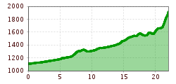
Falkenhütte neu © Falkenhütte Karwendelmarsch 52 kmDifficulty:difficultLength:52.0 kmDuration:19:00 hElevation uphill:2,281 mSee trailSee trail: Karwendelmarsch 52 km
Nördlinger Hütte - Wanderer kurz vor der Hütte (2).jpg © Region Seefeld, newcreatings Hike via Nördlinger Hütte to Reither SpitzeDifficulty:difficultLength:9.9 kmDuration:7:30 hElevation uphill:1,190 mSee trailSee trail: Hike via Nördlinger Hütte to Reither Spitze
Weitwandern Etappe 3 Winterlandschaft (1).jpg © Region Seefeld, Johannes Geyer Complete Route for the Tyrol’s 1. Winter Multi-day HikeOpening hours:openDifficulty:mediumLength:48.0 kmDuration:4 daysElevation uphill:1,000 mGo to winter hikeGo to winter hike: Complete Route for the Tyrol’s 1. Winter Multi-day Hike
Leutasch Farm Shop Circular HikeDifficulty:easyLength:11.5 kmDuration:3:10 hElevation uphill:111 mSee trailSee trail: Leutasch Farm Shop Circular Hike
Weitwandern Etappe 1 Teilnehmer bei Bach (1).jpg © Region Seefeld, Johannes Geyer Stage 1: From Schanz to Weidach – Tyrol’s 1. Winter Multi-day HikeOpening hours:closedDifficulty:mediumLength:14.2 kmDuration:3:30 hElevation uphill:140 mGo to winter hikeGo to winter hike: Stage 1: From Schanz to Weidach – Tyrol’s 1. Winter Multi-day Hike
Weitwandern Etappe 2 Teilnehmer am Weg bei Huette © Region Seefeld, Johannes Geyer Stage 2: From Leutasch to Mösern – Tyrol’s 1. Winter Multi-day HikeOpening hours:closedDifficulty:mediumLength:16.9 kmDuration:5:00 hElevation uphill:402 mGo to winter hikeGo to winter hike: Stage 2: From Leutasch to Mösern – Tyrol’s 1. Winter Multi-day Hike
Urlaub mit Rollstuhl in der Region Seefeld (67).jpg © JACKSCORNER Wheelchair Circular Hike around the WildseeDifficulty:easyLength:3.4 kmDuration:1:00 hSee trailSee trail: Wheelchair Circular Hike around the Wildsee
Seekirchl mit Neuschnee - 29.11.2023 - Querformat.jpg © Region Seefeld Complete Route for the Seefeld High Plateau Winter Multi-day HikeOpening hours:openDifficulty:mediumLength:65.2 kmDuration:5 daysElevation uphill:1,157 mGo to winter hikeGo to winter hike: Complete Route for the Seefeld High Plateau Winter Multi-day Hike
Katzenkopfhuette Leutasch © Region Seefeld Katzenkopf circuit (classic & skating)Opening hours:closedDifficulty:difficultLength:20.5 kmElevation uphill:175 m:Style: Skating, ClassicGo to Cross-country skiing trailGo to Cross-country skiing trail: Katzenkopf circuit (classic & skating)
Bikepark Katzenkopf - Green Trail © Jenny Haimerl Photography Bikepark Katzenkopf - Green Pangea TrailDifficulty:easyLength:600 mGo to biketourGo to biketour: Bikepark Katzenkopf - Green Pangea Trail
Oberer Wiesenweg im Frühwinter_Paar läuft auf Wanderweg_Blick auf Stadl und Hohe Munde.jpg © Region Seefeld W17: Winter circular hike on the WiesenwegOpening hours:closedDifficulty:easyLength:6.2 kmDuration:1:45 hElevation uphill:61 mGo to winter hikeGo to winter hike: W17: Winter circular hike on the Wiesenweg
Leutascher Ache im Sommer - Drohnenaufnahme Kurve im Fluss (1).jpg © Region Seefeld Biketour - Adventure RideDifficulty:mediumLength:48.5 kmDuration:5:00 hElevation uphill:1,071 mGo to biketourGo to biketour: Biketour - Adventure Ride
KatzenkopfLeutasch - Blauer Trail © Jenny Haimerl Photography Bikepark Katzenkopf - Kitty Twister TrailDifficulty:easyLength:2.1 kmDuration:0:15 hGo to biketourGo to biketour: Bikepark Katzenkopf - Kitty Twister Trail
Familie in der Region Seefeld - Spielen am Fluss - Leutascher Ache.jpg © Region Seefeld, David Hennerbichler Hike to UnterleutaschDifficulty:easyLength:9.5 kmDuration:2:30 hSee trailSee trail: Hike to Unterleutasch
Bikepark Katzenkopf - Roter Trail © Jenny Haimerl Photography Bikepark Katzenkopf - Dirty Dancer TrailDifficulty:mediumLength:2.1 kmGo to biketourGo to biketour: Bikepark Katzenkopf - Dirty Dancer Trail
Langlaufen in der Region Seefeld_zwei Langläufer auf C9 Plaik Loipe in Leutasch_Weitwinkelaufnahme mit Hohe Munde.jpg © Region Seefeld, Moritz Klee Plaik-Loipe C9Opening hours:closedDifficulty:difficultLength:8.7 kmElevation uphill:169 m:Style: Skating, ClassicGo to Cross-country skiing trailGo to Cross-country skiing trail: Plaik-Loipe C9
Loipe A5 Obern in Leutasch - Luftaufnahme (2).jpg © Region Seefeld, Moritz Klee Obern trail: adaptive cross-country skiing in Leutasch (A5)Opening hours:closedDifficulty:easyLength:5.3 kmElevation uphill:29 m:Style: Skating, ClassicGo to Cross-country skiing trailGo to Cross-country skiing trail: Obern trail: adaptive cross-country skiing in Leutasch (A5)
Langlaufloipe A11 © Region Seefeld Barrier-free trail Bodenalm | A11Opening hours:closedDifficulty:easyLength:10.7 kmElevation uphill:60 m:Style: Skating, ClassicGo to Cross-country skiing trailGo to Cross-country skiing trail: Barrier-free trail Bodenalm | A11
Schlossbachklamm mit Bahnstrecke - Reith.jpg © Region Seefeld Hike through the SchlossbachklammDifficulty:mediumLength:12.4 kmDuration:4:30 hElevation uphill:470 mSee trailSee trail: Hike through the Schlossbachklamm
Snowfarming Loipe Leutasch © Region Seefeld A2 - Snowfarming track LeutaschOpening hours:closedDifficulty:easyLength:2.8 kmElevation uphill:20 m:Style: Skating, ClassicGo to Cross-country skiing trailGo to Cross-country skiing trail: A2 - Snowfarming track Leutasch
weg-zum-karwendelhaus.jpg © Region Seefeld | Stefan Wolf Bikepacking Tour Tirol - Etappe 3 Variante B Difficulty:difficultLength:80.0 kmDuration:7:19 hElevation uphill:1,730 mGo to biketourGo to biketour: Bikepacking Tour Tirol - Etappe 3 Variante B
Radfahrt durch das Karwendeltal zum Karwendelhaus.jpg © GREGOR KUNTSCHER Bikepacking Tour Tirol - Etappe 3 Variante ADifficulty:mediumLength:77.0 kmDuration:6:18 hElevation uphill:800 mGo to biketourGo to biketour: Bikepacking Tour Tirol - Etappe 3 Variante A
winterwandern_paar_oberer_wiesenweg_paar_von_vorne_mit_huette.jpg © Region Seefeld Stage 3: From Burggraben through the Leutasch valley to Weidach - Seefeld High Plateau Winter Multi-day HikeOpening hours:closedDifficulty:easyLength:14.2 kmDuration:4:00 hElevation uphill:144 mGo to winter hikeGo to winter hike: Stage 3: From Burggraben through the Leutasch valley to Weidach - Seefeld High Plateau Winter Multi-day Hike
Give feedback for a chance to win a special holiday experience!Click here for the surveyClick here for the survey
.jpg")
.jpg")

.jpg")
.jpg")

.jpg")

.jpg")


.jpg")


.jpg")


