Arrival by public transport
From Innsbruck main station take the bus directly to the Kampl bus stop.
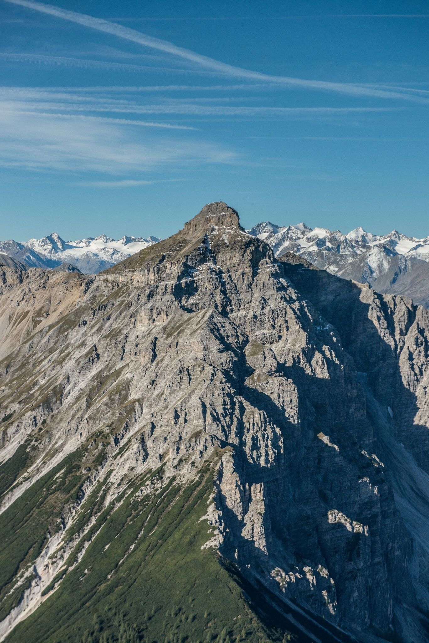
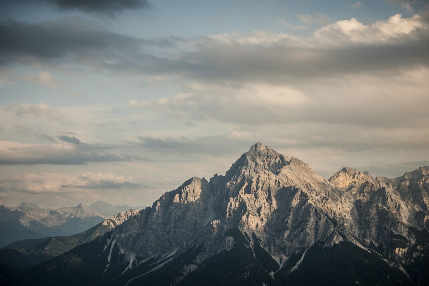
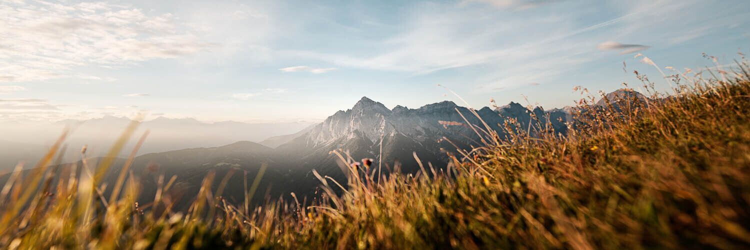
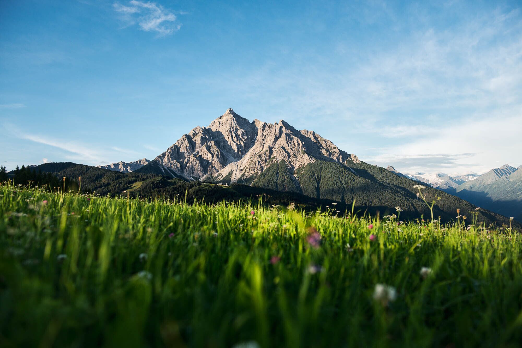
If there is a perfect mountain, then the Serles between the Stubai and Wipptal valleys is pretty close. Its mighty north face rises above Innsbruck in an almost perfect pyramid.
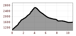
Impressive mountain tour to the "altar of Tyrol", the Serles. Across alpine meadows and a steep ascent to the wonderful Wildeben snack station. Shortly above this, another highlight awaits along the way in the form of the Wildeben natural site. From here, the trail becomes more challenging, with rocky passages and exposed sections that require surefootedness and a head for heights. At Serlesjöchl, there is a short ladder and a few meters of secured passages to overcome before you reach the summit. Then you stand on one of Tyrol's absolute character peaks and can proudly enjoy the panoramic view over the Stubai and Tux Alps, Karwendel and down to Innsbruck. If you don't want to descend the same way again, you can head for the Maria Waldrast pilgrimage site from the Serlesjoch and from there to the Serlesbahnen mountain station. From here you can descend into the valley and return to the starting point by bus.
From the Stubai Valley, the Serles can be reached as usual via Kampl/Wildeben.
THE GOVERNOR
A king is enthroned above all mountains. However, the mountain regent of Tyrol is actually a "she" and leads the summit world from the Stubai Alps to Innsbruck with her dominant face. The Serles stands as a seemingly completely isolated rock pyramid where, according to a folk tale, a wild knight and his two sons were cursed by a farmer because of his irascibility, hardness and cruelty. Petrified, King Serles and his sons must now endure as a secondary summit where his castle once stood. The striking, three-part summit structure, which may form the basis of this story, also impressed Goethe on his trip to Italy. He gave the Serles the nickname "High Altar of Tyrol".
Unrestricted views
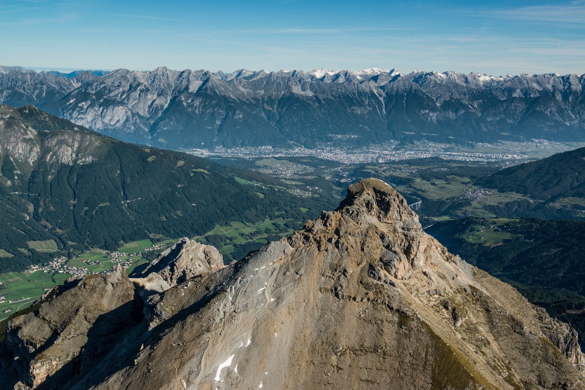
Not only can you see the Serles from Innsbruck, you can see at least as far from its summit. Its exposed location enables amazing mountain views and opens up an incomparable panorama from the Zuckerhütl to the Tux glacier mountains and from the Dolomites to the Karwendel. The view from the Serles also encompasses the Inn Valley, the Stubai Alps and the Zillertal Alps.
Clear origins
When the Innsbruck mountaineer Georg Ernstinger first climbed the Serlesspitze from Schönberg via the Gleinserberg and Maria Waldrast in 1579, he noticed the special water of Maria Waldrast. However, he was not the first to appreciate the quality of the Waldrast water. The place at the foot of the Serles was already sacred to the Celts. The Roman pilgrims also used the route via Maria Waldrast to drink the Waldrast water, which is one of the highest quality waters in Tyrol. Its journey through limestone and mineral-enriched primary rock is said to be almost 100 years long. The remote place at the foot of the Serles is home to a monastery with a church, fountain of grace and original chapel on the edge of the forest and is Austria's highest place of pilgrimage.
TOUR DESCRIPTION
ASCENT:
From the Kampler dam wall, on the edge of the forest of Kampl, the steep forest path begins, which leads in hairpin bends to the Wildeben snack station in approx. 2 hours. From there, the trail continues directly behind the snack station on a steep path to the Serlesjöchl (2384 m). There you have to climb a small rock face using a short ladder. This is followed by a short passage secured with steel cables, then the path winds uphill over the widening south-west ridge covered in scree. Finally, you reach the large summit cross via a somewhat exposed rocky ledge.
DESCENT:
Descent as ascent. Alternatively, you can hike via the Maria Waldrast monastery to the mountain station of the Serles cable car. To do this, turn left at Serlesjöchl in a south-easterly direction and follow the path first over gravel, then through a mountain pine zone and later through a forest to the Maria Waldrast monastery (approx. 3 hours). From there, a relatively flat path leads to the Serlesbahnen mountain station in 45 minutes. From there, you can either use the cable car to descend or walk down to Mieders in 1 ½ hours.
From Innsbruck main station take the bus directly to the Kampl bus stop.
Limited parking facilities at the Kampler dam.


.jpg")


