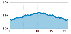
Zillerpromenade-HM Fügen

Fügen, Zillertal / Tuxer Alpen
Route length: 21.1 km

Level-running, half marathon course or training course to suit individual preferences regarding distance

Tour information

  • Length: 21.1 km
  • Elevation uphill:58 hm
  • Elevation downhill:58 hm
Highest point565 m

Starting point

Fügen / Ziller

Finishing point

Fügen / Ziller
Source: Zillertal Tourismus GmbH

Description

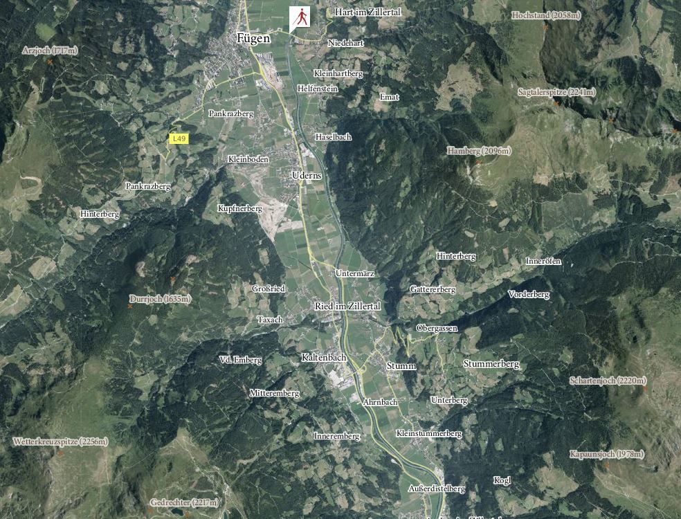
The course runs from the starting point Fügen / Ziller in a continuous upstream direction along the west bank of the Ziller until one reaches the outskirts of Aschau, where a U-Turn sign indicates the half of the half marathon after exactly 10.548 km. Runners can access the course at anytime and from anywhere along the route. Beginners or runners not used to such long distances are provided with the possibility of choosing only individual  sections of the course, along which one can easily determine distances by means of kilometre markers along the course.
 

More tours in the surrounding area

  • Hochfügen - Kleiner Gilfert (2388m) Walk no. 27

    Difficulty: medium
    Length: 14.4 km Duration: 6:00 h Elevation uphill: 925 m
  • Hamberg (2095m) from the Gasthof Almluft (Trail No. 37)

    Difficulty: medium
    Length: 9.4 km Duration: 4:45 h Elevation uphill: 865 m
  • Nature Trail and Bird Nature Trail

    Difficulty: medium
    Length: 6.5 km Duration: 2:00 h Elevation uphill: 250 m
  • 471 Kaltenbach - Wedelhütte

    Difficulty: medium
    Length: 36.9 km Duration: 5:00 h Elevation uphill: 1,759 m
  • 401 | Zillertaler Höhenstraße

    Difficulty: difficult
    Length: 52.6 km Duration: 7:40 h Elevation uphill: 1,890 m
Newsletter

The mountain is calling? So does our newsletter!

In our monthly newsletter we reveal the best holiday tips for Tyrol.