Hikes in Fügen, Zillertal Valley
Map

Show
on mapHochfügen – Rastkogel Hut
on mapHochfügen – Rastkogel Hut
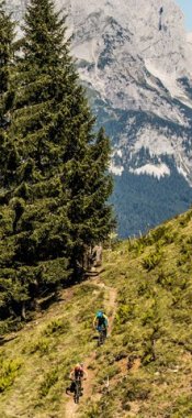
Mountain hikes
Starting point: Hochfügen
Length: 25km
Elevation uphill: 1,972m
Total hiking time: 13 h 30 min
Difficulty rating: intermediate (red mountain trails)

Show
on mapSpieljochbahn - Hochfügen
on mapSpieljochbahn - Hochfügen
Mountain hikes
Starting point: Top of Spieljochbahn cable car
Length: 13km
Elevation uphill: 357m
Total hiking time: 4 h 30 min
Difficulty rating: intermediate (red mountain trails)

Show
on mapThe Trans-Alpine Crossing
on mapThe Trans-Alpine Crossing
Long Distance Path
Starting point: Gmund at Tegernsee lake, Germany: Blaubergalm (Achenkirch)
Length: 110km
Elevation uphill: 3,300m
Duration: 7 day(s)
Difficulty rating: intermediate (red mountain trails)
Fügen, Zillertal Valley: Hikes in the region

Finkenberg, Zillertal
The challenging Berlin High Trail is a must-do high Alpine hike starting in…

Fügenberg / Hochfügen im Zillertal
Plenty of wide open meadows and a few ski pistes are the terrain awaiting…

Stummerberg, Zillertal
The Hamberg mountain towers above the village of Stumm in the Zillertal…