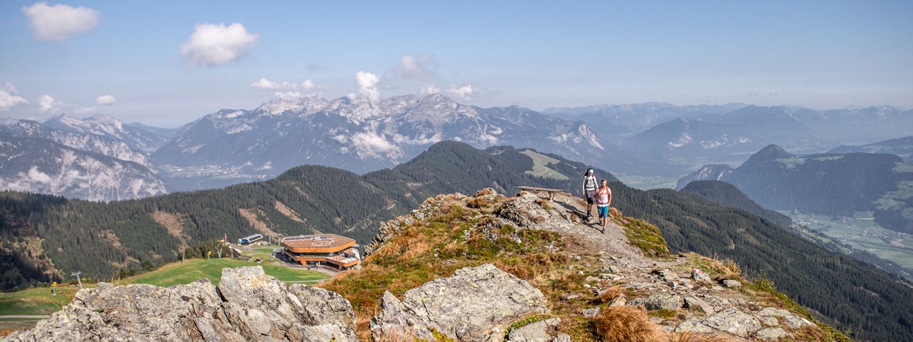
This enjoyable hike of intermediate difficulty begins at the top of the Spieljochbahn cable car at 1,862 metres above sea level and leads all the way to Hochfügen (1,474 metres), passing through lush meadows offering fabulous views of the Zillertal Valley and the Inn Valley as far as the Karwendel Mountains the the mighty Kellerjoch peak. There are six huts along the way (some closed to the public, others open to the public and serving food). One, the Gartalm, even has its own museum. The trail is gentle and therefore suitable for families with children.

Mountain Hike
Starting point
Top of Spieljochbahn cable car
Hike to
Geolsalm, Gartalm-Hochleger, Gamssteinhaus, Alpengasthof Loas, Maschentalalm, Lamarkalm-Niederleger
Finishing point
Hochfügen
Mountain chain
Tux Alps
Length
12.7 km
Total hiking time
4 h 30 min
Features
- Wheelchair-accessible Hiking Route
- Circular hike
Difficulty rating
intermediate (red mountain trails)
Altitude
Elevation uphill 357m
Vertical metres downhill 766m
Fitness level
Technique
Best time of year
* These are approximate values and recommendations. Please take your personal fitness level, technical ability and the current weather conditions into account. Tirol Werbung cannot guarantee that the information provided is correct and accepts no liability.
Public transport
- Accessible using public transport
Bus route 633, get off at stop Fügen Mittelschule
Parking
Bottom of Spieljochbahn cable car, Fügen
Places serving food and drink
- Geolsalm (May until October)
- Gartalm Hochleger (June until October)
- Gamssteinhaus (currently closed)
- Alpengasthof Loas (May until October)
- Maschentalalm (no information available)
- Gasthof Aigner Dornauer, Restaurant Kohlerhof and other locations in Fügen
Downloads
Trail description
In Fügen (545 metres), take the Spieljochbahn cable car up to 1,862 metres above sea level. Walk along the trail to the Spieljoch mountain (1,865 metres), the Geolsalm (1,733 metres) and the Gartalm-Hochleger (1,860 metres). The trees disappear as hikers continue to the Gamssteinhaus (1,675 metres), with the option of walking down to the nearby Alpengasthof Loas (1,645 metres). From the Gamssteinhaus, head south to the Maschentalalm (1,717 metres) and the Lamarkalm-Niederleger (1,613 metres) before desending in an easterly direction to Hochfügen.
In Hochfügen, take the bus to Fügen (30 mins).


